

• Whistler Springs is a public rockhounding site in the Ochoco National Forest
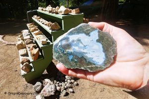
• The area produces agate-filled thundereggs
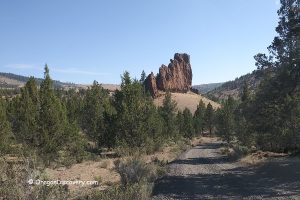
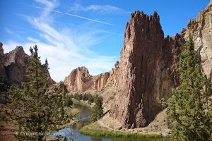
Whistler Springs Rockhounding Site is hidden deep in the beautiful ponderosa pine forest of the Ochoco Mountain, 50 miles away from Prineville. The area is featured on the Central Oregon Rockhounding Map which is available for purchase.
The collecting site is bounded from the southern end by Mill Creek Wilderness where digging is not allowed. Watch boundary fence and signs.
There are two digging sites. Both sites produce agate-filled thundereggs, typically, ranging in size from apricots to large apples. Also, jasper, agate, and petrified wood can be found. Look where other rockhounds have been digging for possible leads. You can find a lot of material left behind by other rockhounds. For the best materials, dig through rhyolite matrix with a shovel, gad, chisel, and hammer. This might be challenging but definitely will yield decent t-eggs.
Site 1 and site 2 are situated 0.1 miles of each other and 0.5 miles away from Whistler Springs Campground. There are many standing dead trees in the area. Be careful where you walk or set your camp.
Wildcat Trail (#833) running through the eastern portion of Mill Creek Wilderness starts from the Wildcat North Trailhead (parking area) near Site 1.
Check a map of Mill Creek Wilderness and trails.
The road to Whistler Springs is rough, bumpy, and muddy when wet. Four-Wheel Drive is recommended. Recreational vehicles and trailers are not recommended.


Whistler Springs: Camping, Lodging & Vacation Rentals
Dispersed camping is allowed in the Ochoco National Forest.
Whistler Springs Campground operates on a first-come, first-served basis and is situated within walking distance of both the collecting area.
It's essential to exercise caution due to the presence of numerous standing dead trees in the vicinity. Pay careful attention to where you wander and choose your camping spot wisely.
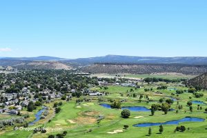
For those seeking alternative accommodation options, Prineville, located 37 miles to the southwest, presents a variety of affordable lodging choices and vacation rentals, catering to visitors with budget-friendly preferences.
Affordable vacation rentals for short and long term stay at Prineville
Whistler Springs | Facts
Open: Best time: May-October
Managed by: US Forest Service
Location: Ochoco National Forest
Rocks & Minerals: Thundereggs, agate, jasper, and petrified wood
Tools: Shovel, gad, chisel, geology pick, and hammer
Activities: Rockhounding, camping, and hiking
Distance from the parking: Vary
Road access: A high-clearance 4WD vehicle is suggested
Day-use fees: None
Elevation: 5,600 ft (1,707 m)
Whistler Springs is located:
- 37 miles northeast of Prineville
- 73 miles northeast of Bend
- 186 miles southeast of Portland.

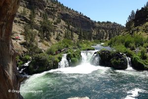
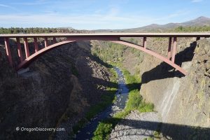
Adventures Nearby


Directions to Whistler Springs
Shorter Route by Prineville Chamber of Commerce
From Prineville,
- Drive east via Highway 26 to milepost 49 and then 0.4 miles after milepost 49 to Forest Road 27
- Turn left and go for about 6 miles to Forest Road 2700
- Turn left onto Forest Road 2700, then take NF 50 to Whistler Springs Campground.
Do not use this route in wet weather, some sections are narrow and winding.
Longer But Gentler Route
From Prineville,
- Drive east via Highway 26 to milepost 49 and then drive 0.4 miles after milepost 49 to Forest Road 27
- Turn left onto Forest Road 27 and go 1.3 miles to Forest Roar 2730
- Turn right onto NF 2730 and continue 9.5 miles (on the fork after 6 miles bear left) to Forest Road 200
- Turn left onto NF 200 and follow for about 6 miles to Whistler Springs Campground
- As the road goes left, take a primitive road to the right and go down 0.3 miles
- As you cross a cattle guard, park your car on the right.
You will find a pit near the parking area if you hike west along the trail from a fire pit. Other digging spots are 0.1 miles south on the road that goes on the left.