Skip to content
Oregon Discovery
Oregon Discovery
Secondary Navigation Menu
Menu
  • Outdoor Adventures
    • Beachcombing
      • Rockhounding & Beachcombing
      • Agate Hunting
      • Tide Pool Exploring
    • Hot Spring Soaking
    • Rockhounding
      • Oregon Coast Agate Hunting
      • Central Oregon Rockhounding
      • Southern Oregon Rockhounding
      • Lake County Rockhounding Sites
      • Harney County Rockhounding Sites
      • Malheur & Owyhee Rockhounding Sites
    • Swimming
      • Swimming Holes at Portland
      • Swimming Holes at Salem
      • Swimming Holes at Eugene
      • Oregon Coast Swimming
      • Swimming Holes at Bend
      • Southern Oregon Swimming
    • Wild Edible Mushroom Harvesting
    • Fishing
    • Hiking
  • Places
    • Oregon Discovery – Mapped
    • Oregon Rockhounding – Mapped
    • Cities & Towns
    • Recreation Areas & Parks
    • Oregon Coast Beaches
      • Northern Oregon Coast Beaches & Landmarks
      • Central Oregon Coast Beaches & Landmarks
      • Southern Oregon Coast Beaches & Landmarks
    • Lighthouses
    • Waterfalls
    • Lakes & Reservoirs
    • Covered Bridges
  • Events
  • History & Legends
    • Historical Landmarks
    • Historic Covered Bridges
  • Outdoor Gear
    • Top Outdoor Adventure Gear
    • Affordable Survival Gear 101
    • Best Rockhounding & Beachcombing Gear
      • Best UV Lights for Rockhounding
      • Sand Dipper Beach Scoop
      • Hazlewolke Metal Detector
    • Desert Survival Gear
    • The Best Trekking Poles
    • The Best GPS Navigators
      • The Best Value GPS Navigator
      • The Best Hiking GPS Satellite Phone
      • Best GPS Smartwatches
    • The Best Fat Tire Bike

Southern Oregon

Myrtle Creek Rockhounding in Oregon: The picture "Myrtle Creek Rockhounding in Oregon – riverbank with parked car and tree-lined hillside" shows a tranquil bend of the river with a stony shore in the foreground, a white car parked near the water's edge, and lush, forested hills forming a green backdrop beneath a blue sky.

Myrtle Creek Rockhounding – South Umpqua River Gravel Bars

2026-02-06

• Myrtle Creek offers the most convenient access to South Umpqua River gravel bars justContinue Reading

Ash Flat Campground in Oregon: The picture "Ash Flat Campground in Oregon – rocky shore with gear and floating tubes" depicts a rocky riverbank lined with green bushes, where a blue sleeping bag and various personal items are scattered near the water's edge, along with black inflatable tubes ready for floating.

Ash Flat Campground – Year-Round Escape to the South Umpqua River

2026-02-03

• Ash Flat Campground offers peaceful river access and crystal-clear swimming holeContinue Reading

Boulder Creek Campground in Oregon: The picture "Boulder Creek Campground in Oregon – picnic table and fire ring in the forest" shows a wooden picnic table and benches sitting on bare earth surrounded by large mossy boulders, with a metal fire ring and wooden seats nearby, all set in a dense, green forest.

Boulder Creek Campground – Quiet Retreat along the South Umpqua River

2026-02-02

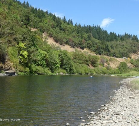
• Boulder Creek Campground is one of the few primitive campgrounds along the South UmpquaContinue Reading

Dumont Creek Campground in Oregon: The picture "Dumont Creek Campground in Oregon – river with mossy rocks and dense forest backdrop" shows a flowing river bordered by moss-covered boulders and thick vegetation, with evergreen trees rising up steep hillsides and a blue inner tube floating in the water.

Dumont Creek Campground – Secluded Retreat on the South Umpqua River

2026-02-01

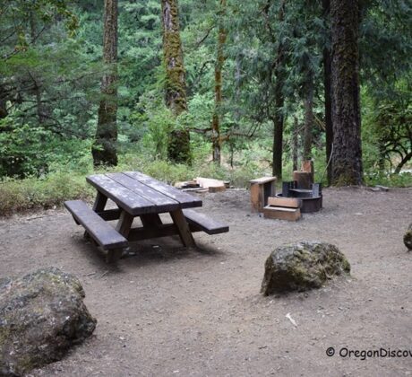
• Dumont Creek Campground is a quiet spot with easy river accessContinue Reading

White Creek Campground in Oregon: The picture "White Creek Campground in Oregon – forested creek with reflections" features a peaceful, slow-moving creek bordered by dense green forest, with tall trees and bushes reflected in the water on a sunny day.

White Creek Campground – Secluded Forest Retreat on the Little River

2026-01-30

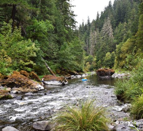
• White Creek Campground is a small camp spot with easy access to a tonContinue Reading

Wolf Creek Falls Recreation Area in Oregon: The picture "Wolf Creek Falls Recreation Area in Oregon – footbridge over creek and forest" displays a footbridge arching over a flowing creek, surrounded by green forest and rocky banks, with a large rock formation in the background.

Wolf Creek Falls Recreation Area – Forest Trails, Waterfall, and River Access

2026-01-23

• Wolf Creek Falls and Trailhead are a part of Wolf Creek Falls Recreation AreaContinue Reading

Dry Creek Rockhounding in Oregon: The picture "Dry Creek Rockhounding in Oregon close-up of dry hillside" shows a close-up view of a rocky, dry hillside covered in tufts of yellow grass and scattered sagebrush, with pine trees visible in the background.

Dry Creek Rockhounding – Hunt Red Jasper on Oregon’s Volcanic Ridge

2025-10-29

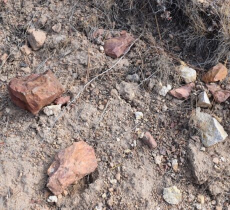
Dry Creek Rockhounding Site lies in the volcanic uplands of the Fremont National Forest, aboutContinue Reading

Cedar Creek Campground - Brice Creek, Oregon

Cedar Creek Campground – Gateway to Brice Creek Adventures

2025-10-01

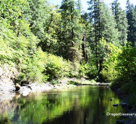
Cedar Creek Campground Bridge Cedar Creek Campground is tucked into the forest along Brice Creek,Continue Reading

Brice Creek - Lund Park

Lund Park Campground – Brice Creek Camping in the Umpqua National Forest

2025-09-30

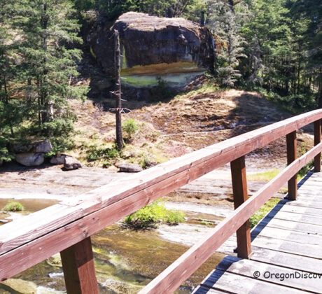
Lund Park Campground sits along Brice Creek in the Umpqua National Forest, about 26 milesContinue Reading

Coquille River Falls Oregon Hiking: Close-up view of multiple streams of Coquille River Falls flowing over large rocks with greenery along the cliffside.

Coquille River Falls – Remote Waterfall Hike in the Rogue River-Siskiyou Forest

2025-07-16

• Coquille River Falls drops a total of 115 feet through a lush, old-growth forestContinue Reading

Myrtle Creek Rockhounding in Oregon: The picture "Myrtle Creek Rockhounding in Oregon – historic arched bridge over the river" shows a classic concrete arch bridge crossing the green river, surrounded by wildflowers and shrubs in the foreground, with tree-covered hills and partly cloudy skies in the background.

Myrtle Creek Charm with Covered Bridges & River Adventures

2025-03-28

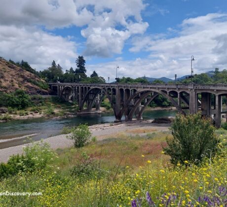
• Myrtle Creek is a cozy town with historic bridges, river fun, and local flavorsContinue Reading

Toketee Falls - Oregon Must Visit Waterfall

Toketee Falls – A Stunning Oregon Waterfall with Columnar Basalt Formations

2025-03-12

• The Toketee Falls pool is a one of the most picturesque and reliable waterfallsContinue Reading

Posts pagination

1 2 … 7 Next

Recent Posts

Myrtle Creek Rockhounding in Oregon: The picture "Myrtle Creek Rockhounding in Oregon – riverbank with parked car and tree-lined hillside" shows a tranquil bend of the river with a stony shore in the foreground, a white car parked near the water's edge, and lush, forested hills forming a green backdrop beneath a blue sky.

Myrtle Creek Rockhounding – South Umpqua River Gravel Bars

South Umpqua River Rockhounding in Oregon: The picture "South Umpqua River Rockhounding in Oregon – gray rock outcrops along riverside trail" shows smooth, light and dark gray rock formations covered in patches of grass and wildflowers, with a person walking along a sandy trail beside the river in the background.

South Umpqua River Rockhounding – 30 Miles of Gravel Bars

Ash Flat Campground in Oregon: The picture "Ash Flat Campground in Oregon – rocky shore with gear and floating tubes" depicts a rocky riverbank lined with green bushes, where a blue sleeping bag and various personal items are scattered near the water's edge, along with black inflatable tubes ready for floating.

Ash Flat Campground – Year-Round Escape to the South Umpqua River

Boulder Creek Campground in Oregon: The picture "Boulder Creek Campground in Oregon – picnic table and fire ring in the forest" shows a wooden picnic table and benches sitting on bare earth surrounded by large mossy boulders, with a metal fire ring and wooden seats nearby, all set in a dense, green forest.

Boulder Creek Campground – Quiet Retreat along the South Umpqua River

Oregon Places

  • Oregon Coast
  • Cascade Mountains
  • Great Portland
  • Willamette Valley
  • Central Oregon
  • Southern Oregon
  • Eastern Oregon


Rocks & Minerals

  • Oregon Rockhounding Map
  • Agate
  • Jasper
  • Petrified Wood
  • Sunstone
  • Thunderegg
  • Fossils, Rocks & Minerals
  • Public Land Rockhounding Regulations in Oregon
  • Mineral Clubs | Events | Local Agencies
Rockhounding Oregon
  
Hot Springs Washington and Oregon

Oregon Coast Beaches

  • Northern Oregon Coast Beaches & Landmarks
  • Central Oregon Coast Beaches & Landmarks
  • Southern Oregon Coast Beaches & Landmarks
Mushroom Identification
  
Central Oregon Rockhounding Map

Swimming Oregon

  • Best Swimming Holes
  • Best Swimming Holes near Eugene
  • Best Swimming Holes near Portland
  • Top Swimming Holes near Salem: Discover Local Hidden Gems
  • Best Swimming Holes near Bend
  • Best Swimming Oregon Coast & Range


GPS Truck Navigator and app-based driving directions may not always be accurate. In addition, in certain remote locations, cell services may not be available at all. For that reason, we recommend saving a copy of the directions we provide before you embark on your journey.

If any of the information on the website is incorrect, contact us and suggest an update.

About Us | Disclaimer | Contact Us

Travel
Oregon Coast
Portland Metro Area
Willamette Valley
Cascade Mountains
Columbia River Gorge
Central Oregon
Southern Oregon
Eastern Oregon

This website (oregondiscovery.com) may be compensated for linking to other sites or for sales of products we link to. We are disclosing this in accordance with the Federal Trade Commission™ 16 CFR, Part 255: “Guides Concerning the Use of Endorsements and Testimonials in Advertising.”

Oregon Discovery Team & Contributors

Follow Us

Oregon Discovery ©2026 All rights reserved