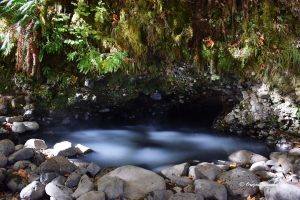
Delintment Lake
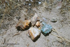
 Mud Ridge, located near Hines, yields primarily black obsidian, with green, greenish-blue, snowflake, and occasionally rare red pieces mixed in.
Delintment Lake Rockhounding: Where to Find Ammonite Fossils
Mud Ridge
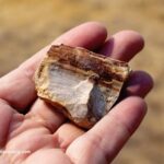
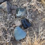 Mud Ridge, located near Hines, yields primarily black obsidian, with green, greenish-blue, snowflake, and occasionally rare red pieces mixed in.
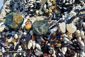
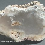
Harney Lake

Harney Lake, located in Oregon's Harney Basin, is a remote high desert area about 25 miles south of Burns. Once part of a massive prehistoric lake system, this unique landscape is now a dry, mineral-rich basin.
This area is perfect for collecting oolitic agate, agate, jasper, and petrified wood.
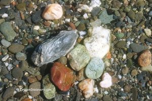
North Beede Reservoir

The area north of the North Beede Reservoir is an excellent location to collect various minerals, such as agate, jasper, and petrified wood.
Warm Springs Reservoir
The area is rich in fascinating geological treasures waiting to be discovered. Various materials, ranging in size, are scattered across the surface, making it easy to start collecting.
In addition to excellent rockhounding opportunities, the reservoir offers breathtaking scenery and a variety of recreational activities, including fishing, boating, and hiking.
Warm Springs Reservoir Rockhounding: Explore, Discover, Collect
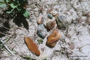
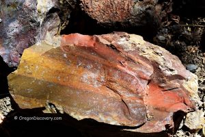
Stinkingwater Petrified Wood
 The Stinkingwater area is known for yellow and cream-colored petrified “golden oak.” Many pieces also show shades of red, brown, gray, and black, often with strong contrast between growth rings and clear wood grain.
Stinkingwater Petrified Wood – Clear Creek Rockhounding in Eastern Oregon
Pike Creek Canyon

Pike Creek Canyon is a scenic site on the eastern side of Steens Mountain. The site provides opportunities for hiking, rockhounding, and camping.
Pike Creek Canyon - Hiking & Rockhounding at Steens Mountain