Eastern Oregon and western Idaho, in Malheur and Owyhee Counties, share a similar geological environment. Ancient lava flows and long periods of erosion have shaped their rugged terrain. These regions feature fossil-rich formations and abundant deposits of collectible materials: chalcedony, jasper, agate, petrified wood, thundereggs, and opals.
Before heading out, rockhounds should research land ownership, collecting limits, and any seasonal restrictions. Many sites are on BLM land, where casual collecting is allowed, but some locations may have private claims or protected areas. Always respect the land, follow ethical collecting practices, and leave no trace to preserve these remarkable geological sites for future generations.
Below is a list of notable rockhounding locations in the region.
Graveyard Point: Oregon-Idaho Border
 Graveyard Point is a vast Eastern Oregon area in Owyhee Canyon along the Oregon-Idaho border.
The area is known for excellent plum agates with pink, yellow, and red inclusions. Moss, dendritic, angel wing, and other varieties of agate can also be found here. Beware of private claims.
Succor Creek Canyon
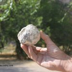
 The scenic rocky Succor Creek Canyon is known as a rockhound's paradise. The official state rock of Oregon, thunder eggs, filled with agates and other minerals, can be found in the Succor Creek State Natural Area.
Cross the bridge and search the hillside and gravel deposits along the creek. This deposit is very large, and typically, thunder eggs are averagely sized up to apples.
Haystack Butte
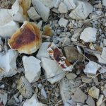
 Haystack Butte Rockhounding site is a remote high desert destination of the Owyhee area, known for its distinctive colorful brecciated jasper. The jasper is prized for its ability to take on a great polish.
Besides jasper, white, or gray mossy agate, petrified wood, chalcedony, and sometimes common opal can be found.
Beulah Reservoir
 Beulah Reservoir Fossil sites is a remote destination north of Juntura, known for its well-preserved leaf impressions in fine-grained sedimentary rock.
Some rocks naturally break apart, revealing prehistoric imprints, while others may need careful splitting with a rock hammer and chisel.
Beulah Reservoir Fossil Sites: A Window into the Miocene Era
DISCLAIMER
The Oregon Rockhounding Map provides information about some of the many rockhounding sites of the state of Oregon. Information is subject to change at any time, and the Oregon Discovery team cannot guarantee that is either current or correct. Be aware that there are some mine claims and private lands near the public collecting areas. Determining the land status and minerals' collection rules at the site is your responsibility.
Currently, this map is incomplete but new rockhounding sites and related details will be added in the future.
Marli B. Miller. Roadside Geology of Oregon. 2014. Mountain Press Publishing Company Missoula, Montana.
Lars Johnson. Rockhounding Oregon: A Guide to the State's Best Rockhounding Sites (Rockhounding Series). 2014. A Falcon Guide.
Dan R. Lynch, Bob Lynch. Rocks & Minerals of Washington and Oregon: A Field Guide to the Evergreen and Beaver States (Rocks & Minerals Identification Guides). 2012.


Gold Prospecting Adventure
Get Your Gold at a Gold Mining Au Indulge!
YES! People do still go out and prospect for Gold! Want some GOLD? We dig it…. You Process it….and YOU split the gold between the participants.
Be part of a Gold Mining Common Dig Experience where the group will process up to 125 yards in 2.5 days! Than on Sunday afternoon the GOLD will be split between the participants.
This event is OPEN to EVERYONE!
The event will officially kick off at 8am, Friday, August 5th 2022 and end at noon Sunday August 7th 2022.
The Processing Site will be available from 8am-8pm Friday & Saturday and 8am -1130am Sunday then it will be time for GOLD Clean Up and Split the gold.
This adventure is perfect for prospector that’s willing to work hard, 8 hours a day. No Gold Miner goes home empty handed, and no two piles of gold bearing Paydirt are alike. Participants will bucket up gold bearing material and feed it to the AU Draggin Trommel.
Fee structure:
LDMA Members: $400.00 per participant
Non LDMA Members: $500.00 per participant
Camping sites are available for an additional fee.
Call and make your reservation ASAP (541)869-2455