

• Cape Arago State Park is a part of the Oregon Islands National Wildlife Refuge
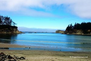
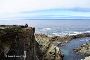
Located at the end of Cape Arago Highway, about 14 miles southwest of Coos Bay and 5 miles south of Charleston, Cape Arago is part of the Oregon Islands National Wildlife Refuge. The cape offers stunning views of the Pacific Ocean, reefs, and offshore islands, home to large colonies of marine mammals.
Bordered to the south by Shore Acres State Park, this land was once part of the estate of Louis J. and Lela Simpson. In 1932, the Simpson family donated it to the State of Oregon.
In 1778, the headland was named Cape Gregory in honor of Saint Gregory. Later, in 1850, it was renamed Cape Arago after French physicist and politician François Arago. Some theories suggest that Sir Francis Drake sheltered his ship in the south cove of Cape Arago in 1579. During World War II, the area served as a Coast Guard and U.S. Army lookout site and radio station.
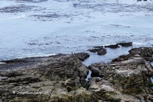
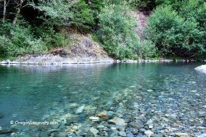
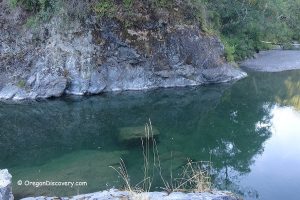
The park offers an opportunity for fishing, hiking, and watching seabirds, offshore colonies of seals, and sea lions at Simpson Reef and Shell Island.

Cape Arago Hiking
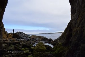
A section of the Oregon Coast Trail, this four-mile coastal route offers scenic views and connects to Sunset Bay State Park via the Shore Acres State Park. Additionally, the 2.25-mile Pack Trail provides another route to Shore Acres.
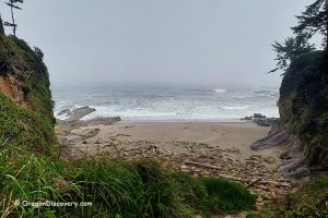
The South Cove trail leads to a sandy beach and excellent tide pools. (Please do not touch or remove tide pool habitats!)
The North Cove trail runs down to a beach with tide pools, fishing spots, and views of Shell Island's off-shore colonies of seals and sea lions. The North Cove is closed from March 1st to June 30th to protect seal pups.

Cape Arago Camping, Lodging & Vacation Rentals
No camping is available at the park. The closest campgrounds are found at Sunset Bay State Park and Bastendorff Beach County Park.
The nearest lodging and vacation rentals can be found in Charleston, North Bend, and Coos Bay.
Affordable vacation rentals for short and long term stay at Charleston and North Bend

Cape Arago | Facts
Open: Year-round dawn to dusk
Managed by: Oregon State Parks
Amenities: Picnic tables, restrooms, and gazebo shelter
Activities: Hiking, scenic viewpoints
Day-use: Free
Dogs: Must be on a leash
Cape Arago is located:
- 14 miles southwest of Coos Bay
- 94 miles west of Roseburg
- 128 miles southwest of Eugene.
Adventures Nearby

Directions to Cape Arago South
From Highway-101 in North Bend,
- Turn west onto Virginia Avenue and follow 0.6 miles to Broadway Avenue
- Turn left onto Broadway Avenue and go 0.9 miles to Newmark Avenue
- Bear right onto Newmark Avenue and drive 1.8 miles to Cape Arago Highway
- Turn left onto Cape Arago Highway and continue for 10.3 miles to Cape Arago Highway Loop and bear right.
Phone: 800-551-6949
oregonstateparks.org