

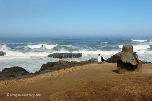
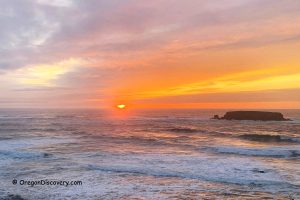
• Cook's Chasm is the stage for the Pacific Ocean's performance
• At high tide, you can see ocean geysers, foaming cisterns, and the magic sinkhole Thor's Well
![]()
![]()
![]()
![]()
![]()
![]()
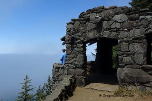
During millions of years, powerful waves sculpted the rocks, carving and widening fractures that eventually formed a sea cave.
When the cave’s roof collapsed, Cook's Chasm was created, setting the stage for the captivating spouting horn phenomenon.
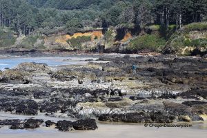
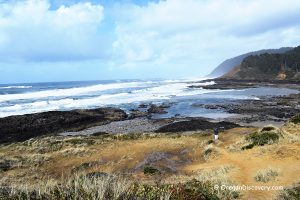
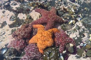
At high tide, the ocean comes alive with dramatic displays—crashing waves, saltwater bursts, foaming cisterns, and the enchanting sinkhole known as Thor's Well, which seems to swallow seawater in a mystical embrace. During low tide, the area transforms into acres of tide pools filled with anemones, starfish, urchins, and saltwater algae.
For a closer look, hike down the Cook’s Chasm Trail.
Spouting Horn
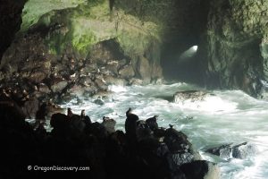
Spouting Horn is a fun coastal feature—a natural 'ocean geyser' created by strong waves.
When waves push water and air into a deep hole in the rocks, pressure builds and shoots out a tall spray. It looks like a whale blowing water and brings extra excitement to the rugged shoreline.
Along the 0.75-mile round-trip Cook’s Chasm Trail, you can discover vibrant tide pools, the spectacular Spouting Horn, remnants of mussel shell middens left by the Alsea Native Americans centuries ago, and traces of a 1930s Civilian Conservation Corps camp.

Devil's Churn
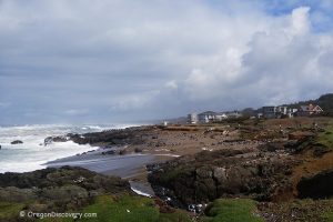
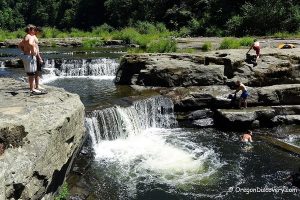
Located just south of Yachats, Devil's Churn is a narrow channel carved into ancient volcanic rock. Over time, tides and powerful waves deepened a fissure in the basalt shoreline. Each incoming wave surges into the channel, sometimes erupting in dramatic water explosions.
Trail of the Restless Waters, the 0.5-mile loop of a moderate hike to Devils Churn.
Thor's Well
Thor's Well, often called "Gate to Hell" is a 20-foot deep hole in the basalt rocks at Cook's Chasm. Under the right conditions, upward-moving water can shoot as high as 20 feet.
The best time to see these spectacular sites is during high tides and winter storms—roughly from one hour before high tide to one hour after.
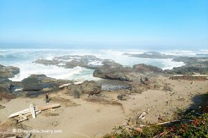
Good Fortune Cove and Cape Cove lie between Cook's Chasm and Devil's Churn.

Spectacular geological features draw hundreds of photographers and visitors each year. However, this coastline can be extremely dangerous, especially during high tides and storms, when large and powerful waves are common.
Sneaker waves can occur at any time, and while there are no official statistics on fatalities, news reports occasionally describe visitors being swept into the ocean near Thor’s Well.
Cautions: Use care when exploring the rocky coast, chasm, and spouting horns. Beware of sneaker waves and slippery rocks. Never turn your back on the ocean. Stay behind railings and away from undercut edges.
Video
Camping, Lodging & Vacation Rentals at Cook's Chasm
Open from March to September, Cape Perpetua Campground offers 37 tent sites along the banks of Cape Creek. Each site has a picnic table and campfire ring. There are flush toilets and drinking water. Reservation is available through recreation.gov or phone 877-444-6777.
The nearest lodging is available in Yachats or Florence.
Affordable vacation rentals for short and long term stay in Yachats
Affordable vacation rentals for short and long term stay in Florence
Cook’s Chasm – Spouting Horn & Thor’s Well | Facts
Open: Year-round
Managed by: U.S. Forest Service
Amenities & Service: Cape Perpetua Visitor Center, cafe, guided hikes, picnicking areas, and restrooms
Activities: Hiking & nature viewing
Day-use fees (Devils Churn Site, Shelter): Yes or Interagency Senior/Access/Military Passes
Day-use fees (Cook's Chasm Site): Free
Cook's Chasm is located:
- 3 miles south of Yachats
- 80 miles west of Eugene
- 100 miles southwest of Salem.
Adventures Nearby
Directions to Cook's Chasm
From Highway 101,
- Follow 3 miles south of Yachats to the destination on the right.
You May Also Like


Attention Fellow Beachgoers
Unfortunately, our beautiful Pacific North West beaches are stained with trash, especially plastic. We, at Oregon Discovery, as well as other unaffiliated groups of nature lovers made a commitment to do our part in keeping our beaches clean, but we need your help too!
Every time you go out to enjoy nature at your favorite spot, please bring a garbage bag or two and help us pick up garbage. Even picking up a little bit here and there will make a huge difference long term.
Please, help us save our beautiful nature for the generations to come!
1 Comment