

![]()
![]()
![]()
![]()
![]()
![]()


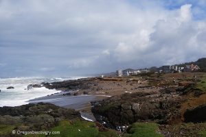
Cape Perpetua Trails
There are 26 miles of hiking trails through the pristine coastal forest, Native American shell middens, tidepools, and breathtaking scenic views.
Saint Perpetua Trail
The 2.2-mile trail of moderate difficulty, gaining 700 feet in elevation, from the visitor center to the West Shelter, offers thrilling ocean views.
 Whispering Spruce Trail
The 0.3-mile loop, from the summit point. On a clear day, you can see up to 70 miles of the Oregon Coast. The West Shelter is a great viewpoint to watch for whales.
Giant Spruce Trail
The 2.1-mile trail of easy difficulty, from the visitor center and back, leads to the Oregon second-largest Sitka spruce, known as the "Giant Spruce". The tree is nearly 600 years old and more than 185 feet tall, 40 feet in circumference.
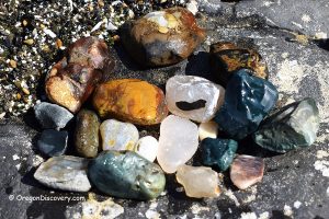
Cook’s Chasm Trail
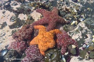
The 0.75-mile trail, easy hike to the Spouting Horn. While hiking, at low tide you can find fascinating sea creatures in tide pools, mountains of mussel shells left by generations of Alsea tribes who harvested them hundreds of years ago, remnants of a 1930s Civilian Conservation Corps camp, and the spectacular Spouting Horn.
 Cape Cove Trail
The 0.3-mile easy walk to a quiet sandy beach.
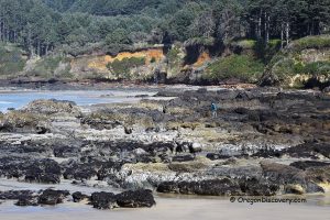
Trail of the Restless Waters
The 0.5-mile loop of moderate difficulty to Devils Churn. The trail runs along the coastline, tide pools at low tide, and the spouting horns at high tide.
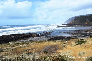
Oregon Coast Trail
The 2.5-mile round trip of moderate difficulty. There are volcanic fascinated natural wonders below Cape Perpetua along the coastline.


Please send me information on when Cape Perpetua Trails will re-open
You should ask US Forest Service or Cape Perpetua Visitor Center – 541-547-3289