• Pike Creek Canyon is a scenic site on the eastern side of Steens Mountain
• The site provides opportunities for hiking, rockhounding, and camping
Pike Creek Canyon is a dramatic rugged location tucked away on the eastern side of Steens Mountain. This area offers the perfect escape from the hustle and bustle of your daily routine providing great opportunities to enjoy the breathtaking landscape and amazing geology. Spend your time hiking, sightseeing, rock collecting, and camping.
Pike Creek runs year-round, merges into the Alvord Desert, dries up and, finally, disappears. Camping is allowed at Pike Creek. There are multiple sites with big boulders and cottonwoods along the creek that provide sheltered camping. Do not cut any trees for firewood. They are rare in the high desert and surrounding mountains.
Other primitive camping is also available at Mann Lake, Alvord Playa, and Alvord Hot Springs.
The parking area and some portions of the land at the creek are private property. Be sure to pack out all trash, do not abuse the privilege of accessing the area.

Pike Creek Hiking
Moderate to Difficult | 5.6 miles (9 km) out & back | 1,100 ft (335 m) elevation gain
The only developed trail on the eastern slope of Steens Mountain, Pike Creek is 5.6 miles out-and-back route running up the canyon along the creek.
The hike begins at a colorful huge boulder with a juniper sprouting from it and at the mouth of the canyon. The trail crosses the creek twice – a few yards and then 0.9 miles from the trailhead.
The first 1.4 miles is an established old mining track. On your way, you’ll see an abandoned uranium mine shaft and other remnants of the past. After the second creek crossing, the trail becomes narrow, rocky, and steep and runs another 1 mile to Pike Creek Basin. It is not safe to cross the creek during high water and spring runoff. So, the best time to visit is from May to October.
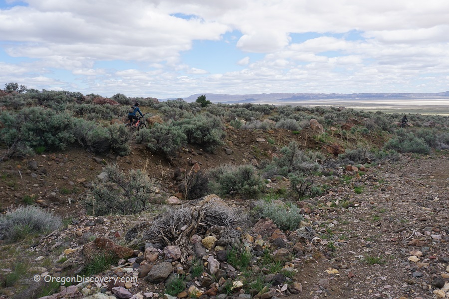
The trailhead is located 0.5 miles from Fields-Denio Road. There are free trail access and free parking near the road. Park your car and hike 0.5 miles to the point where the trail begins. If you have a high-clearance vehicle you can drive a portion of the road but do not drive all way to the trailhead.
The public BLM road has been washed out and is getting bumpy and rugged with huge boulders poking out the further you drive. There are lots of huge boulders at the endpoint and a chance for U-turn without scratching your car is minimal.
Another option to drive directly to the trailhead and camping area is accessing the private road nearby. You should pay a fee and check-in for a Wilderness Day Pass at Alvord Hot Springs that located 2 miles south.

Pike Creek Rockhounding
The area is known for an opportunity to find thundereggs filled with jasper and/or agate. You can explore mountain slopes, search the creek bed, and other dry washes around this area.
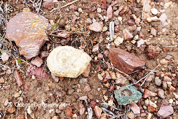
Besides thundereggs, you can find agate, jasper, obsidian, uranium, petrified wood, and sea fossils.
Know Before You Go
- There are long distances between gas stations, services, and food
- No cell phone services in the area
- Rattlesnakes are a possibility in the lower canyon, so caution is advised
- Steens Mountain is a popular hunting area from September through November; be cautious and wear bright clothing.
Pike Creek Camping & Lodging
A primitive campsite along the creek in managed by the Alvord Ranch owners. So, before heading to the campground and trailhead via a private road, check-in at the Alvord Hot Springs. Alvord Hot Springs offer other accommodation options including camp sites and bunkhouses at the hot springs.
Affordable vacation rentals for short and long term stay in Hines-Burns Area
Pike Creek Canyon | Facts
Open: Best time: May-October
Managed by: Bureau of Land Management (BLM), partially private
Rocks & Minerals: Thundereggs, jasper, agate, obsidian, fossils, and petrified wood
Tools: Geology pick
Amenities: None
Activities: Rockhounding, hiking, camping
Distance from the parking: Vary
Road access: A high-clearance 4WD vehicle is recommended
Day-use fees: None if park on BLM land
Elevation: 4,300 ft (1,310 m)
Pike Creek is located:
- 25 miles north of Fields
- 104 miles south of Burns
- 400 miles southeast of Portland.
Adventures Nearby
Directions to Pike Creek Canyon
From Burns,
- Travel 65 miles southeast on Highway OR-78 to Folly Farm Road
- Turn right onto Folly Farm Road and drive 2.5 miles
- Continue 37 miles on Fields-Denio Road towards Fields (the road is partially gravel).
Phone: 541-573-4400
E-mail: BLM_OR_BU_Mail@blm.gov
GPS (Parking at Fields-Denio Road): N 42°34.432' W 118°31.495' | 42.571006, -118.522187
GPS (Trailhead): N 42°34.557' W 118°31.832' | 42.575949, -118.530540

