
• The Waterfalls Loop Trail is a scenic waterfall hike along Oregon’s McKenzie River
The Waterfalls Loop Trail is one of the best short hikes in Oregon's Cascade Mountains, looping 2.6 miles past Sahalie Falls and Koosah Falls along the Wild and Scenic section of the McKenzie River.
Managed by the U.S. Forest Service, this easy family-friendly trail climbs just 380 feet and winds through old-growth forest, ice-blue cascades, and ancient lava flows.
Hiking the Waterfalls Loop Trail
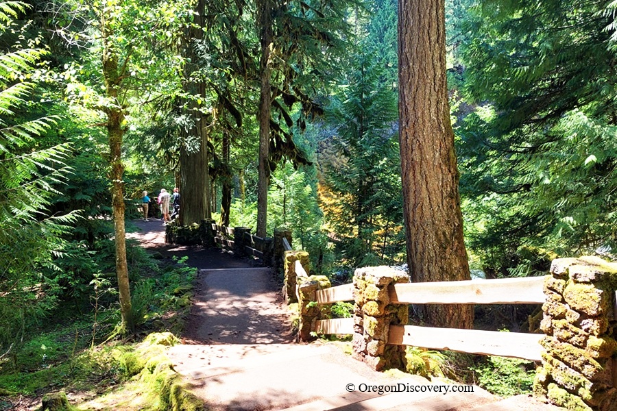
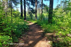
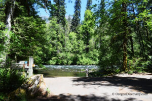
Start at the Sahalie Falls Trailhead and take the paved path descending from the parking lot. The full loop runs 2.6 miles with only 380 feet of gain, topping out at 2,995 feet.
You'll walk down one bank of the McKenzie, cross a one-lane bridge near Carmen Reservoir, and return on the quiet west side away from the crowds. The trail is rated easy and stays open mid-spring through fall.
Short on time? You can drive straight to the parking lots at both falls and still catch the views.
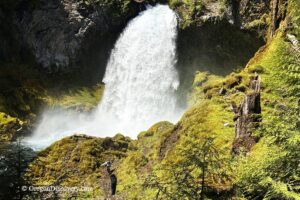
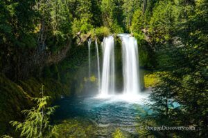
Sahalie and Koosah Falls
Here's the cool part. A basalt lava flow from the Sand Mountain area helped shape the valley and create the lava benches that form both falls.
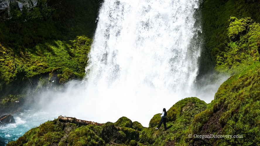
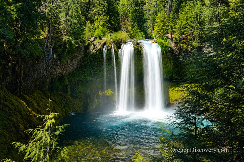
Sahalie Falls drops about 100 feet over a narrow lava ledge. The word sahalie means "high" in Chinook Jargon. During high water, a second stream spills from a lava bowl on the right.
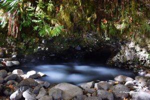
Just downstream, Koosah Falls plunges roughly 75 feet. The name koosah means "sky." In dry months, it splits into two streams; at full flow, it becomes one 70-foot-wide wall of water. Part of the river even slips under the lava and bubbles back up as springs at its base.
Photography & Viewpoints
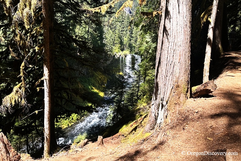
My favorite is the head-on vista of Koosah Falls down a set of narrow steps, where you can spot a rock pinnacle on the slope above the falls.
A tripod helps for silky water shots, and a rain cover is useful because Koosah Falls is very misty.
🔴 Warning: West-side viewpoints have no railings, so watch your step.
Part of the McKenzie River Trail System
The Waterfalls Loop connects directly to the McKenzie River National Recreation Trail, a famous 26-mile path through the Willamette National Forest.
On your return, you'll hop onto the river trail's west bank and cross a substantial footbridge spanning a wide section of river near a natural logjam, where the McKenzie turns calm and broad. The old single-log footbridge still rests nearby.
For a longer day, you can keep going and explore much more of this world-class trail.
Camping & Lodging near the Waterfalls Loop Trail
Several campgrounds are located along the McKenzie River corridor, with a few close to Waterfalls Loop Trail and others a short drive away.
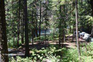
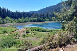
Ice Cap Campground is the closest to the upper McKenzie River waterfalls area, sitting near Carmen Reservoir at about 3,000 feet. It offers drinking water and vault toilets, making it a convenient base for exploring Sahalie and Koosah Falls.
Olallie Campground is also nearby along the McKenzie River, offering shaded forest sites in a quiet riverside setting.
Trail Bridge Campground sits a short drive downstream on Trail Bridge Reservoir and is popular for fishing access and a boat ramp.
Paradise Campground is farther downriver, near McKenzie Bridge, at about 1,600 feet, with riverside sites beneath large Douglas fir trees.
Prefer a roof over your head? You'll find accommodation options in Sisters or Bend.
Waterfalls Loop Trail | Facts
Open: Mid-spring through fall
Managed by: U.S. Forest Service (Willamette National Forest)
Amenities: Trailhead parking, vault toilets, viewpoints, nearby campgrounds
Activities: Hiking, photography, nature viewing, picnicking
Distance from the parking: Vary
Road access: Any passenger vehicle
Day-use fees: None
Elevation: 2,995 ft (913 m) at the high point
Waterfalls Loop Trail is located:
- 20 miles northeast of McKenzie Bridge
- 75 miles east of Eugene
- 105 miles southeast of Salem.
Adventures Nearby

Directions to Waterfalls Loop Trail
From I-5 in Eugene,
- Take OR-126 East toward McKenzie Bridge and continue for approximately 69 miles
- Look for the Sahalie Falls sign on the left side of the highway, turn left, and drive 0.2 miles to the parking area.