
The Willamette Valley has a fascinating geological history and produces a variety of rocks and minerals, but collecting opportunities within the valley itself are limited. Much of the valley floor is privately owned, developed, or preserved as county and city parks, which often restricts rockhounding. Some Oregon State Parks allow limited collecting, as long as it is not prohibited by the specific park’s rules.
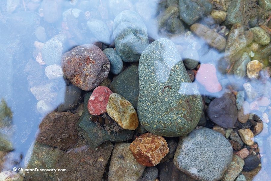
Most accessible sites are along rivers, where gravel bars sometimes yield agates, jasper, and other minerals. A few areas managed by federal agencies, such as the BLM or U.S. Forest Service, allow collecting for personal use. However, rivers designated as Wild and Scenic often prohibit or limit rock collection.
Despite these constraints, the nearby Coast Range to the west and the Western Cascades to the east offer a much wider range of possibilities.
These mountainous regions contain a diverse mix of volcanic, sedimentary, and river‑transported collectible stones just a short drive from the valley.
Willamette River Rockhounding
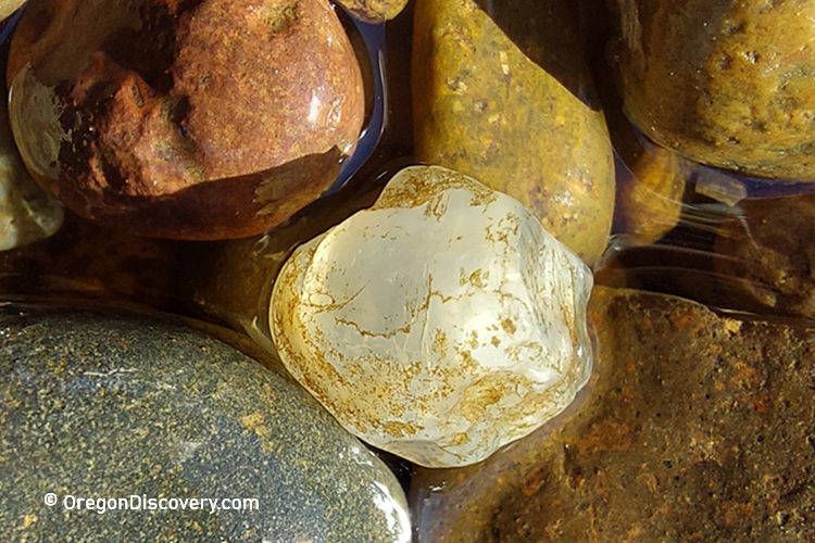
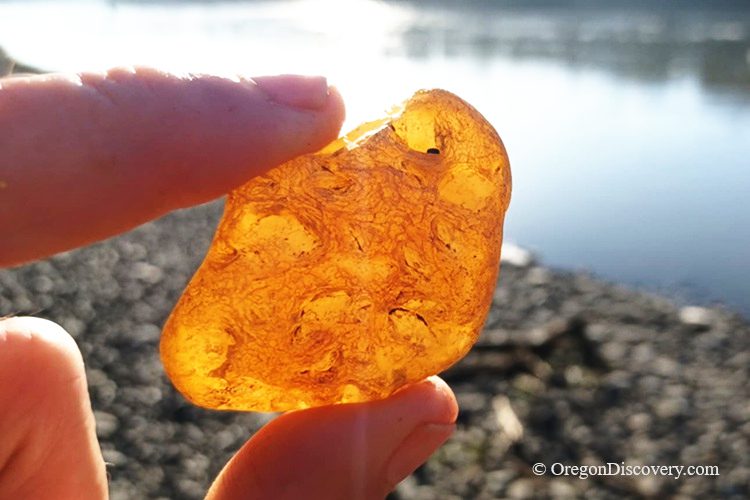
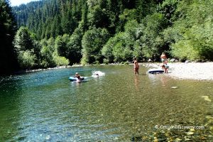
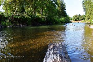
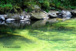
The Willamette River flows north through the Willamette Valley, carrying gravels from the Cascade Range and nearby volcanic regions. Rockhounds may find agate, jasper, chalcedony, quartz, and petrified wood along its gravel bars.
Because the river passes through a mix of public and private lands, collecting rules can vary. To find suitable places, focus on open gravel bars outside of developed parks and without posted restrictions. Even where access is allowed, collecting should be limited to small amounts and surface picking only.
Late summer and early fall, when water levels are lower, are the best times to explore exposed gravel bars and search for interesting stones.
Willamette River Rockhounding: Geology and What You Can Find
Clackamas River - No Many Legal Options for Rock Collecting
The restrictions along the Clackamas River are stricter because it is a federally protected Wild and Scenic River, a critical drinking water source, and a heavily used recreation area, so removing rocks could damage habitats, degrade scenic values, and impact public resources.
Collecting rocks along the Clackamas River in Oregon is generally not allowed. Most of the upper river is part of the Wild and Scenic River system, where removing natural materials from riverbeds or gravel bars is prohibited to protect the river’s scenic, recreational, and ecological values.
Downstream, areas like Milo McIver State Park and other city or county parks also ban taking rocks, as they are considered park property. So there are essentially no legal options for casual rock collecting along the main Clackamas River corridor.
Collecting Along the Santiam River
The North and South Forks of the Santiam River begin high in the central Cascade Range and flow west through heavily forested mountain terrain. Near Jefferson, the two rivers merge to form the Santiam River, which eventually joins the Willamette River south of Salem.
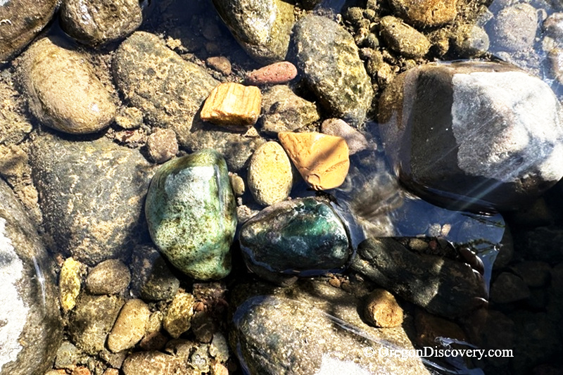
The Santiam River system is known for occasional finds of of agate, jasper, quartz, volcanic rocks, and petrified wood in its gravel bars and cobbles. These stones originate from volcanic formations in the Cascades and are typically river-tumbled and scattered rather than concentrated in a single deposit.
Good areas to search for exposed gravel bars include sections near Stayton, Detroit, and Mill City along the North Fork, as well as areas near Sweet Home on the South Fork. Late summer is often the best time to explore, when lower water levels expose additional gravel deposits.
Some collectors use access points near Jefferson, including areas around the Santiam Rest Area, to reach nearby river gravel bars more easily.
North Santiam River Rockhounding - What to Find and Where to Look
Calapooia River - Access is Limited
The Calapooia River in Oregon is known among rockhounds for carnelian, blue agate (including the rare “Holey Blue” or Calapooia agate), jasper, and petrified wood found in its gravel bars near Sweet Home in Linn County.
However, public access is currently very limited. There is no legal access from public roads to the river until reaching the National Forest boundary, and active logging operations along Upper Calapooia Road (before milepost 25) restrict stopping and parking, with enforcement in place.
Most of the river runs through private timber land posted against trespassing, including areas near the original Holley blue deposit. Rockhounding is also prohibited at McKercher County Park and Pioneer Park along the river.
Oregon Rockhounding Map
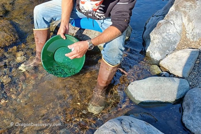
Quartzville Creek - Recreational Gold Panning
Quartzville Creek has a Wild and Scenic River designation stretches from the Green Peter Reservoir to the Willamette National Forest boundary. Along the Quartzville Back Country Byway, BLM lands are open for recreational gold panning under specific guidelines, and collectors must follow surface-only limits and any posted rules.
Several pullouts and recreation sites along the road provide easy access to the river. In summer, you can visit Yellowbottom Recreation Site, a popular swimming area, though gold panning is not allowed there.
While Quartzville Creek is best known for gold panning, visitors may also spot quartz, calcite, basalt, andesite, rhyolite, and breccia along the creek, , usually as small surface rocks or river-tumbled stones.
Exploring Quartz Creek: Volcanic Rocks, Quartz, and Gold Flakes
.
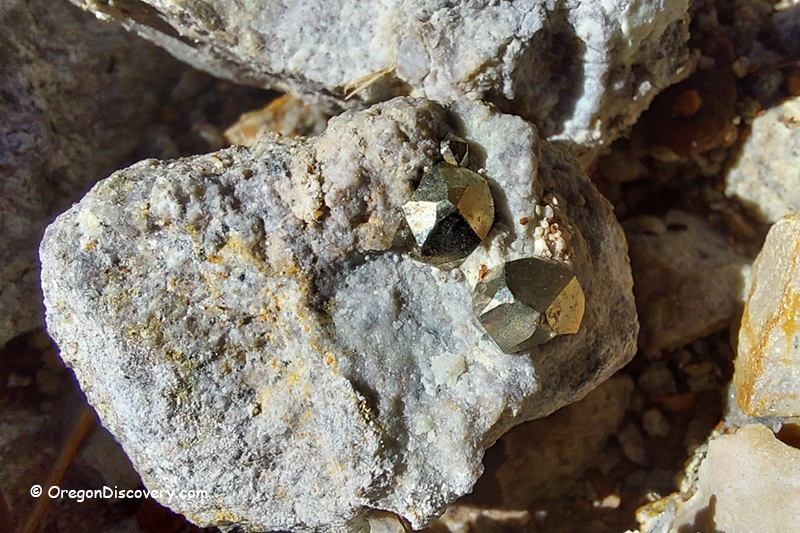
Bouder Creek Pyrite Collecting Site
Boulder Creek Pyrite Site is located about 30 miles east of Sweet Home in the Quartzville Creek recreation area.
The area is known for exposed pyrite crystals embedded in soft volcanic rocks. The best pieces are often found where erosion has loosened material and exposed fresh surfaces along the hillside.
Boulder Creek Pyrite Rockhounding Site near Quartzville Creek
Middle Fork Willamette River Rockhounding
The Middle Fork Willamette River starts in the Cascade foothills and flows toward Eugene, where it joins the main Willamette River.
You can sometimes find agate, jasper, and quartz in the gravel along its banks. Good places to look are bridges, boat launches, and river pullouts, such as near Jasper Bridge, where you can park and walk along the river.
Low water in late summer or early fall exposes more gravel bars, improving the chance of finding collectible stones.
Brice Creek Prospecting
Brice Creek is a scenic mountain stream in the Cascade foothills, known for its connection to the historic Bohemia Mining District and for its quiet setting popular with gold panners and rockhounds.
Flowing through dense forest within Umpqua National Forest, the creek contains gravel deposits, black sand concentrations, and occasional fine placer gold in a peaceful natural setting.
The creek gravels include smooth, water-worn stones such as greenstone, porphyritic basalt, and diorite. Small pieces of agate and jasper can also occasionally be found.
Most of the lower and middle sections of Brice Creek pass through public forest land managed for recreation, where recreational prospecting is generally allowed under Forest Service guidelines.
DISCLAIMER
The Oregon Rockhounding Map provides information about some of the many rockhounding sites of the state of Oregon. Information is subject to change at any time, and the Oregon Discovery team cannot guarantee that is either current or correct. Be aware that there are some mine claims and private lands near the public collecting areas. Determining the land status and minerals' collection rules at the site is your responsibility.
Currently, this map is incomplete but new rockhounding sites and related details will be added in the future.
You May Also Enjoy

Is there a place that you can purchase this map to view offline or is there a way to purchase a hard copy?
Just screenshot it on your phone lol
open full view and click 3dots click copy
Currently, Central Oregon Rockhounding Map only is available in paper. You can purchase it online on Amazon
https://amzn.to/31IFrOc
Love the idea of the map, but what do the different colors of icons mean? I don’t see a legend that explains the use of green, red, black and gold.
Fogarty beach is the best place ever for agates fossils and petrified wood. The trick is getting there when the tide is low. Rocks everywhere!
I like coastal Big Creek and Chine Creek between Florence and Yachats