
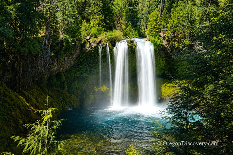
• Koosah Falls is a powerful 75-foot waterfall famous for its emerald pool and seasonal changes
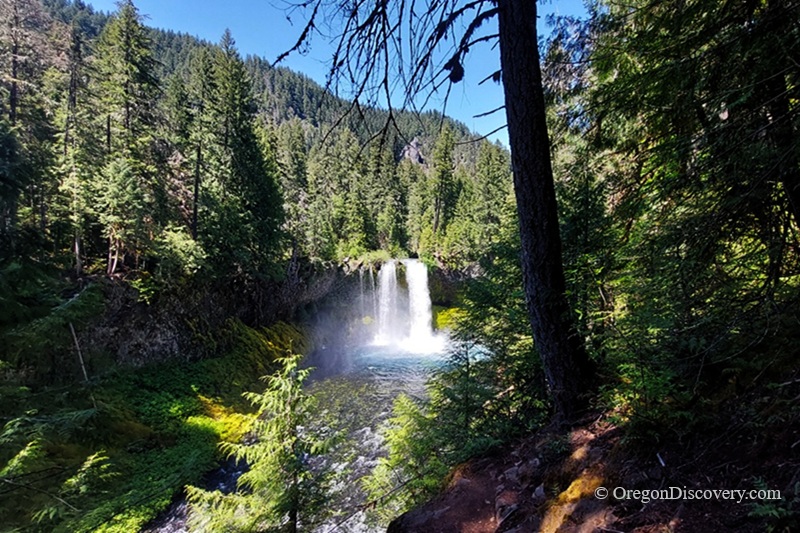
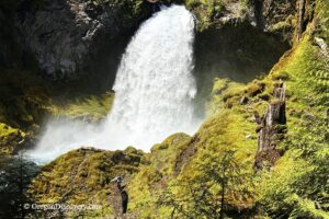
Koosah Falls is a roaring 75-foot waterfall on the McKenzie River, hidden in the Willamette National Forest in Linn County just off Highway 126.
The name "Koosah" comes from Chinook Jargon. It means "sky" or "shining," and trust me, that name fits when the mist catches the light.
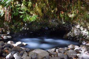
The falls plunge over a basalt shelf into a deep emerald pool below. The flow changes with the seasons. In spring, it crashes down as one solid wall of water. By late summer, it splits into two parallel streams. Want to see two different waterfalls in one year? Just visit Koosah twice.
This spot sits only 0.5 miles downstream from Sahalie Falls, its famous sister. Together, they make one of the best waterfall stops in the Oregon Cascades.
The waterfall runs strong all year, but it's most powerful from late fall through spring, when heavy rain and snowmelt feed the river. Summer brings lower, cleaner streams that are perfect for photos.
Here's one safety note you can't skip. Swimming is not allowed at Koosah Falls. The currents move fast, and the rocks are unstable. As pretty as that pool looks, please enjoy it from the trail.
This is also where old meets new. Across the river, the western Cascades began forming 40 million years ago, holding the oldest rocks in the entire Willamette National Forest. But the lava that falls over today?
It's only about 3,000 years old. Look closely, and you'll see the older rocks have fewer holes, while the newer stones look smooth and water-polished.
Koosah Falls Hike
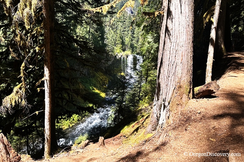
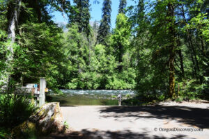
Just want to see the falls without a real hike? You can. The viewpoints sit a short walk from the parking lot at the Koosah Falls Day Use Area.
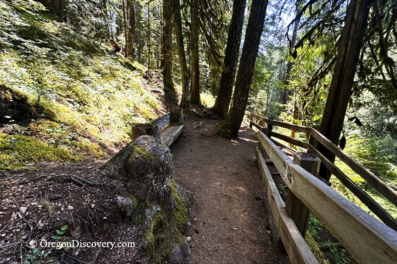
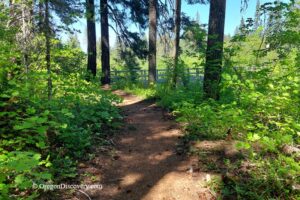
But if you've got an hour or two, hike the Waterfalls Loop Trail (#3503).
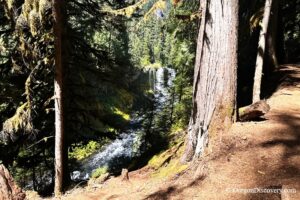
This loop connects Koosah and Sahalie Falls and crosses the river on a footbridge, so you see both falls from different angles.
The full loop runs about 2.4–2.6 miles with roughly 370 feet of elevation gain. It's rated easy to moderate and takes around 1–1.5 hours with photo stops.
The falls sit only 0.5 miles apart, and the trail follows the McKenzie River through rapids, smaller cascades, and mossy old-growth forest.
Honestly? Many visitors think that the stretch between the falls is just as pretty as the waterfalls themselves.
Love photography? Try this: park at Sahalie Falls, hit the main viewpoint, hike downstream to Koosah on the east side, then loop back over the footbridge for fresh views.
The Sahalie viewing deck is wheelchair accessible, but the full loop is not. This loop is also a small piece of the famous 26-mile McKenzie River Trail.
Camping & Lodging near Koosah Falls
Want to stay nearby? Several Forest Service campgrounds sit close to the falls along Highway 126, including Ice Cap Campground just minutes away near Carmen Reservoir.
Belknap Hot Springs Resort, 14 miles south, offers a stay and hot spring soaking in a beautiful setting of the Willamette National Forest.
Other accommodation is available in Sisters or Bend.
Koosah Falls | Facts
Open: Year-round
Managed by: U.S. Forest Service
Amenities: Parking, viewpoints, hiking trail, restrooms at day-use area
Activities: Hiking and photographing
Distance from the parking: Short walk to viewpoints
Road access: Any passenger vehicle
Day-use fees: None
Koosah Falls is located:
- 17 miles northeast of McKenzie Bridge
- 72 miles east of Eugene
- 85 miles east of Salem.
Adventures Nearby


Directions to Koosah Falls
From McKenzie Bridge,
- Drive about 17 miles northeast on Highway 126
- Watch for the brown "Koosah Falls" sign
- Turn off the highway into the Koosah Falls Day Use Area
- Park in the large lot near the trailhead.
The road is paved and easy for any vehicle. Once parked, follow the short signed path to the viewpoints, or join the Waterfalls Loop Trail to reach Sahalie Falls.