
• Wolf Creek Falls and Trailhead are a part of Wolf Creek Falls Recreation Area
Wolf Creek Falls Recreation Area is a peaceful forest destination, located about 27 miles east of Roseburg along Little River Road.
Managed by the Bureau of Land Management, the area is best known for Wolf Creek Falls, a scenic two-tier waterfall tucked into the lush Umpqua National Forest.
Wildlife viewing, hiking, swimming, and picnicking, as well as year-round access, make Wolf Creek Falls Recreation Area an easy and rewarding stop in Southern Oregon.
Things to Do at Wolf Creek Falls Recreation Area
Hiking
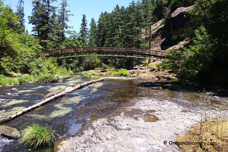
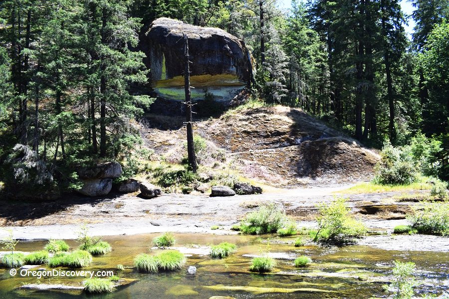
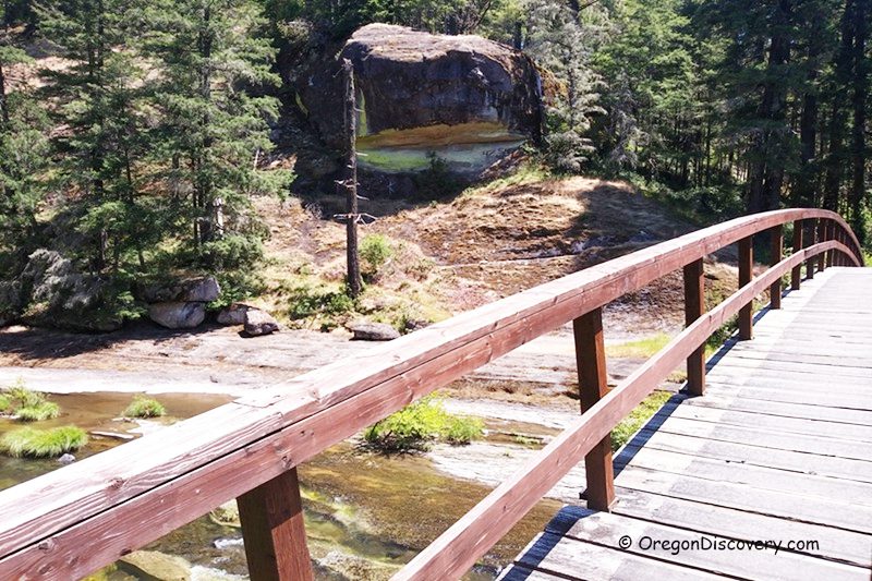
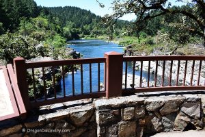
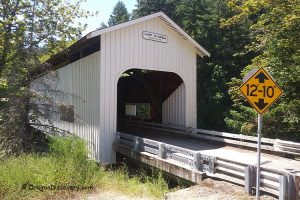
The 1.2-mile Wolf Creek Falls Trail begins at a 150-foot arched pedestrian bridge over Little River. Massive basalt formations line the riverbanks near the bridge and are often coated with bright gold dust lichen (Chrysothrix candelaris).
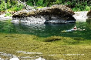
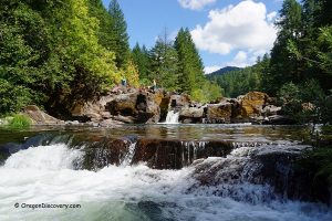
The trail follows Wolf Creek through shaded woodland to a cascading two-tier waterfall that drops approximately 75 and 50 feet into plunge pools below.
The first half mile of the trail is easy, while the second half becomes moderately difficult due to steeper slopes. Waterfall flow is strongest in winter and spring.

Picnicking
Vault toilet and picnic table sit at the trailhead, with another picnic area about half a mile up the trail.
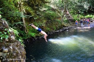
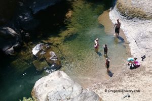
Swimming
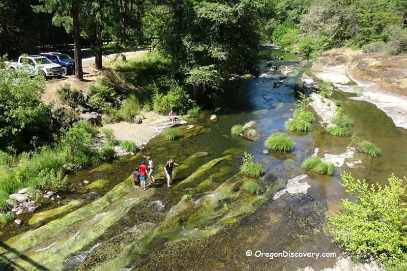
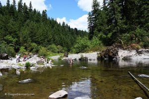
Little River near the trailhead is calm and warms quickly in summer, making it ideal for splashing. The river is shallow here, and children often use underwater ledges and gentle rapids as natural water slides.
Wolf Creek Recreation Area Camping, Lodging & Vacation Rentals
Just 1.25 miles up the road from Wolf Creek Recreation Area, you will find Wolf Creek Campground. The development here includes an adjacent group campground (for up to 150 people), a softball field, and facilities for volleyball and horseshoes. The campground also has flush toilets and drinking water.
There are 8 first-come, first-served campsites with picnic tables and fire rings. 5 spots are for tents or RVs up to 30 feet long, and 3 are for tents only. Reservations are required for the group camp (877-444-6777 or recreation.gov).
If you are looking for more comfortable accommodations, you can find plenty in Roseburg, 27 miles away.
Affordable vacation rentals for short and long-term stays in Roseburg
Wolf Creek Recreation Area | Facts
Open: Year-round
Managed by: Bureau of Land Management (BLM)
Amenities: Picnic tables, toilets, a softball field, volleyball and horseshoes courts
Activities: Hiking, nature viewing, picnicking, swimming
Distance from the parking: Vary
Road access: Any passenger vehicle
Day-use fees: None
Elevation: 1,100 ft (335 m)
Wolf Creek Falls Trailhead Recreation Area is located:
- 11 miles southeast of Glide
- 27 miles east of Roseburg
- 94 miles southeast of Eugene.
Adventures Nearby

Directions to Wolf Creek Falls Trailhead Recreation Area
- Take exit 124 for OR-138 toward City Center and Diamond Lake
- Turn right onto W Harvard Avenue (OR-138) and follow it 0.6 miles to SE Stephens Road (OR-138)
- Turn left onto SE Stephens Road and continue for 0.2 miles, then bear right onto OR-138
- Continue on OR-138 east for about 16 miles to Little River Road
- Turn right onto Little River Road and drive 10.8 miles to the destination on the right.