

• Colliding Rivers is the only place in the US where a rare colliding phenomenon occurs
• The best times to see the violent force of wild rivers smashing into each other are when runoff is high
Colliding Rivers is a unique natural wonder located along Highway 138 (also known as the Scenic Umpqua River Byway) in the town of Glide, about 12 miles northeast of Roseburg.
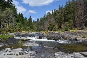
Little River flows from the south, and the North Umpqua River flows from the north, meeting head-on in a basalt pool. After the collision, both rivers change course and flow westward toward the Pacific Ocean.
This site is considered the only place in the United States where this rare river-colliding phenomenon occurs.
Interestingly, the area where the two rivers meet was once part of the Pacific Ocean millions of years ago. Ongoing erosion of the ancient seabed exposes seashells, shale, silica, coal, and conglomerate.
The viewpoint has experienced several major floods.
One occurred in 1955, when the North Umpqua River pushed the Little River back as much as 100 yards.
During the 1964 flood, the interpretive sign at the viewpoint was submerged under nearly five feet of water. This flood was caused by heavy snowfall followed by warm, intense rain, which sharply raised water levels in both rivers.

When is the Best Time to See Colliding Rivers
The best times to see the violent force of wild rivers smashing into each other are winter and spring, when runoff is high. The more powerful Umpqua can push the Little River a few yards back.
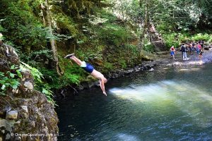
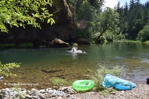
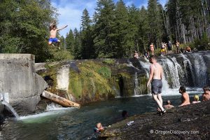
The summer months, when river flows are low, are the best time for swimming, diving, wading, fishing, and rock collecting. The water of the Little River is warmer and slower than the Umpqua.
Located west of the bridge and the viewpoint site, a pebble beach, underwater ledges, shallow and deep spots – all of those offer great opportunities to enjoy summer activities.

Things to Do at Colliding Rivers Viewpoint
Swimming
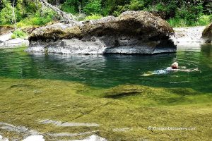
The swimming spot on the Little River upstream of the bridge features a low-water bedrock where you can walk and sit to cool off on a hot summer day. The bedrock abruptly ends, creating a deep enough pool to enjoy swimming.
This swimming spot is calm and safe only during summer when the water is warmer, and the rivers are calmer. During other seasons, river currents are very powerful and will easily drag you to the Umpqua River.
Rockhounding
The Colliding Rivers Site is also great for some riverbank rockhounding. The most common minerals you can find here for your collection are agate, jasper, and petrified wood.
To get there, take the trail to the left of the bridge if you are overlooking the Colliding Rivers Site.

Colliding Rivers Viewpoint: Camping, Lodging & Vacation Rentals
Camping is not allowed at the viewpoint. One of the nearest campgrounds is at Cavitt Creek Falls Recreation Site. This small, rustic campground is typically open seasonally on a first-come, first-served basis. Reservations are not available, and sites may fill quickly on summer weekends and holidays.
The campground has 10 individual campsites and basic amenities, including picnic tables, fire rings, and vault toilets, but there is no RV hookup service and no on-site drinking water.
If you are looking for more comfortable accommodations, you can find plenty in Roseburg, 17 miles away.
Affordable vacation rentals for short and long-term stays in Roseburg

Wolf Creek Falls | Facts
Open: Year-round
Managed by: Bureau of Land Management (BLM)
Amenities: None
Activities: Hiking, nature viewing, swimming, rockhounding
Distance from the parking: Short
Road access: Any passenger vehicle
Day-use fees: Free
Elevation: 530 ft (162 m)
Colliding Rivers Viewpoint is located:
- 17 miles northeast of Roseburg
- 83 miles south of Eugene
- 85 miles northeast of Grants Pass.
Adventures Nearby


Directions to Colliding Rivers Viewpoint
From I-5,
- Take exit 125 in Roseburg for Garden Valley Boulevard and travel 1.9 miles east to Wright Avenue
- Turn right and then left onto Winchester Street and continue 0.2 miles to Highway 138 (North Umpqua Highway)
- Turn left onto Highway 138 and head 16 miles east to the destination.
Can you tell me please when the salmon are leaping I have been there many years around my birthday July 25th and sometimes that’s a little too late?
I believe it happens at the beginning of December.