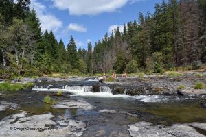
Colliding Rivers Viewpoint
 Colliding Rivers Park is a unique natural site along the Scenic Umpqua River Byway (Highway 138).
Here, Little River flows south, and the North Umpqua River flows north, and the two rivers collide head-on in a turquoise pool surrounded by dark basalt rock.
After joining, both rivers turn west and flow toward the Pacific Ocean.
Colliding Rivers – The Only Place in the U.S. Where Rivers Collide
Cavitt Creek Covered Bridge
 Built in 1943, Cavitt Creek Covered Bridge is also known as Little River Covered Bridge. It crosses Little River about 900 feet from the mouth of Cavitt Creek.
The bridge carries the Cavitt Creek Road, which leads to Cavitt Creek County Park and the popular Cavitt Creek Falls Recreation Area, a well-known summer destination..
Cavitt Creek Covered Bridge - Logging Bridge of Douglas County
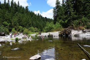
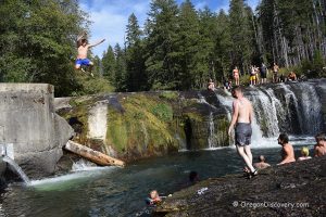
Wolf Creek Falls Recreation Area and Trailhead
 Wolf Creek Falls Recreation Area is located along a scenic stretch of Little River, about 27 miles east of Roseburg.
The 1.2-mile trail to Wolf Creek Falls begins at an arched pedestrian bridge and follows Wolf Creek through a lush forest to a beautiful two-tier waterfall.
Wolf Creek Falls Recreation Area: Forest Trails, Waterfall, and River Access
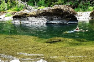
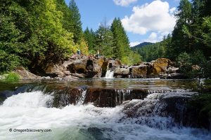
Wolf Creek Falls
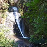 Wolf Creek Falls, an example of natural scenic beauty, is hidden in the Umpqua National Forest, 27 miles east of Roseburg.
The trail is easy for the first half mile and becomes moderately challenging near the falls, making this destination rewarding hikers with gorgeous views of the two-tier waterfall dropping from 75- and 50-foot rocky cliffs into a deep turquoise pool.
Wolf Creek Falls - Hiking to Hidden Beauty in the Umpqua Forest
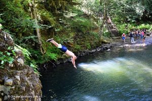
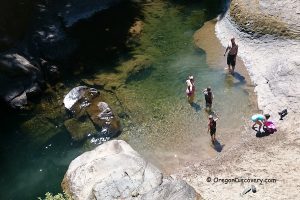
E-Mile Day-Use Site
 E‑mile Day‑Use Site is a quiet, secluded day-use area located about 31 miles east of Roseburg.
The site offers fishing, hiking, swimming, and picnicking.
A short trail begins near the vault toilet at the parking area.
Here, the river bends and forms a large, deep swimming hole. Picnic tables are located in the shade of tall trees.

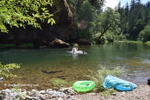
White Creek Campground
 White Creek Campground is tucked into the forest along the Little River, about 33 miles east of Roseburg.
Tall conifers surround this small campground, and the gentle sound of flowing water fills the air, creating a quiet, secluded atmosphere.
White Creek Campground - Secluded Forest Retreat on the Little River