
• Myrtle Creek offers the most convenient access to South Umpqua River gravel bars just off I-5
The small town of Myrtle Creek in Douglas County offers convenient access to the South Umpqua River just off the I-5 corridor in Southern Oregon.
Myrtle Creek makes an ideal stop for travelers driving between Portland and Ashland, combining a chance to stretch your legs with the opportunity to search for unique, river-polished stones. Several locations in the town lead directly to the river, where gravel bars stretch for hundreds of feet.
One access point is located at Exit 108, while additional sites lie farther south through town, where longer gravel bars line the river bend and provide a wider variety of material.

Myrtle Creek Rockhounding
The South Fork of the Umpqua River at Myrtle Creek features massive gravel bars with an impressive variety. The material ranges from common quartz cobbles to elusive agates with quartz crystal pockets.
Sugary quartz specimens with sparkling crystal surfaces dominate here, while clear or milky chalcedony occasionally appears.
Agate is less common, but you can still find quality specimens — some with clear to slightly reddish-tinted layers and quartz crystal centers that form beautiful geode-like structures.
Jasper appears everywhere along the gravel bars in an impressive variety. Colors range from deep red to brown to green, with some brecciated pieces showing interesting patterns.
Petrified wood scatters throughout the river deposits in brown and gray tones. While not as abundant as quartz or jasper, persistent searching typically rewards collectors with nice specimens.
Gold prospectors have found fine flour gold in pockets along the riverbed, and some areas have been dredged in the past.
Best season for collecting: Rockhounding is possible year-round, but late summer through early fall is the best. Water levels drop significantly by August and September, exposing the largest gravel accumulations and making wading safer.
📌 By late summer, algae and cyanobacteria blooms can coat rocks along the river and can harm humans and animals. Watch for warning signs posted on trees, and always wash your hands and treasures thoroughly after collecting.
Where to Rockhound at Myrtle Creek
Several access points provide easy routes to gravel bars. All are located just minutes from I-5, making short stops convenient.
Site 1 - N Main Street
A parking area sits above the river just before the bridge entering town from Interstate 5. Gravel bars are visible below, with a short trail of approximately 0.1 miles leading down to the riverbank. This is quick and convenient stop for travelers.
Site 2 - Western Avenue (Railroad Bridge)
Located about one mile south through downtown Myrtle Creek, this area features extensive gravel bars near the railroad bridge. It is also popular in summer for swimming and kayaking.
Site 3 - Lawson Bar
Lawson Bar is another destination is worth to explore. Here, Cow Creek joins the South Umpqua River, adding additional rock varieties. This area is also favored by gold prospectors.

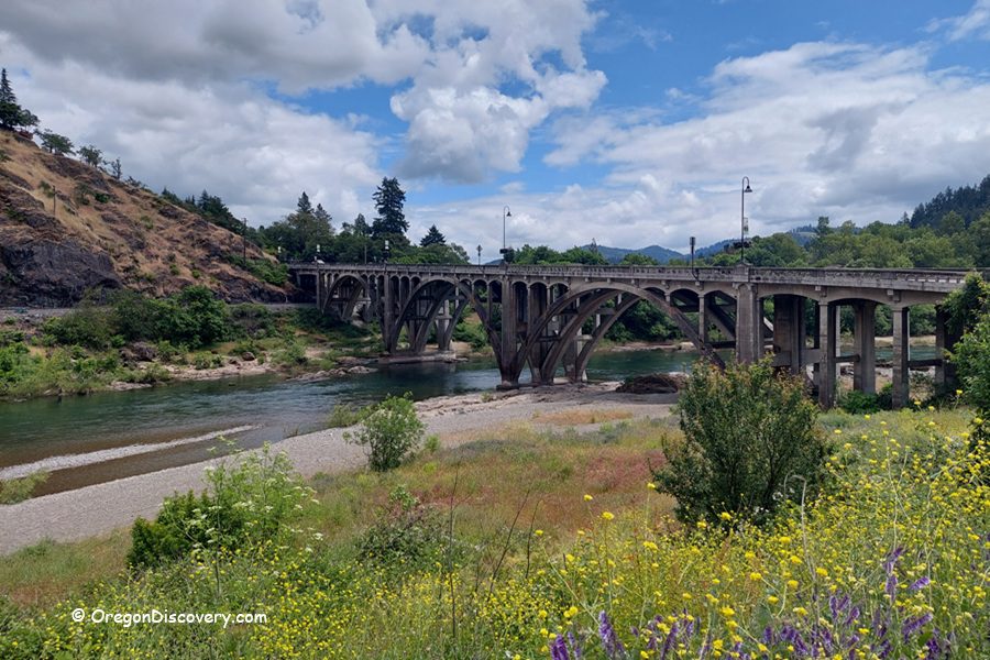
South Umpqua River Rockhounding
Myrtle Creek sits along a 30-mile stretch of productive rockhounding territory on the South Umpqua River. The river corridor upstream has even more extensive gravel bars, primitive campgrounds, and scenic beauty worth exploring.
Oregon Route 227 follows the river from Canyonville through Days Creek and Tiller, passing multiple collecting sites along the way. The upper river sections flow through U.S. National Forest land with legal access points and established campgrounds.
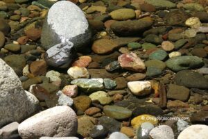
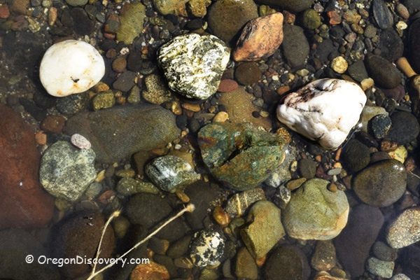
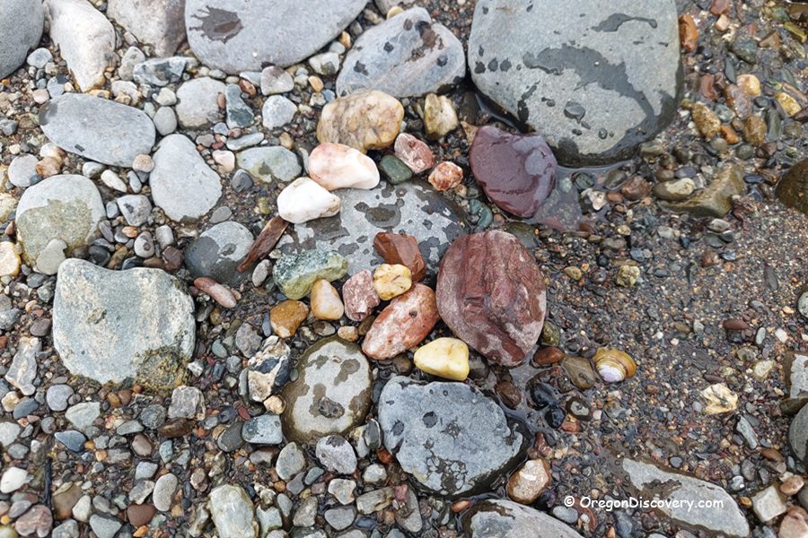
Material upstream includes sugary quartz, clear agate, jasper, carnelian, and petrified wood. Some collectors have found agate geodes measuring up to 5 inches in length. The elusive deep red carnelian that makes the South Umpqua famous among rock hunters appears more frequently in certain tributary creeks.
South Umpqua River Swimming
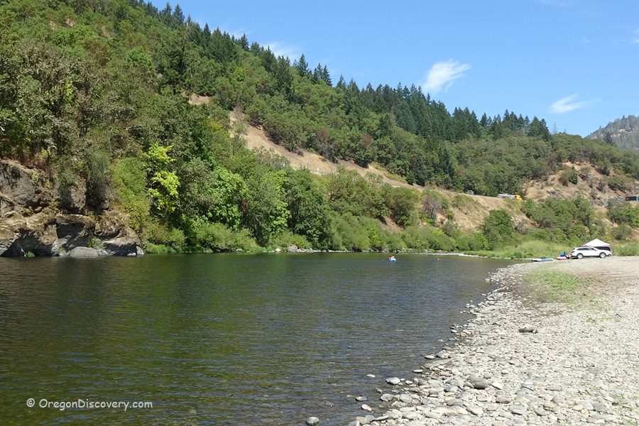
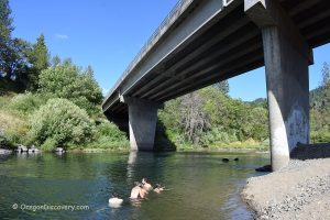
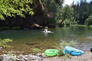
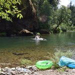
The South Umpqua River has a ton of spots to swim at during the warm summer months. There are plenty of shallow wading areas as well as deeper swimming spots.
Water temperature is cool early in the summer because forest shade and mountain origins, but it warms up to about 70°F at South Umpqua Falls by late August.
The best time to swim is from July through September when flows drop and the weather warms.

Myrtle Creek Camping, Lodging & Vacation Rentals
There is no camping nearby the Myrtle Creek gravel bars, but the town of Myrtle Creek has a few hotels to choose from.
Myrtle Creek Rockhounding | Facts
Best time: Late spring through early fall
Managed by: Bureau of Land Management (BLM)
Rocks & Minerals: Quartz, chalcedony, agate, jasper, petrified wood
Tools: Sand Dipper Square Scoop, collecting bag
Distance from the parking: Short
Road access: Any vehicle
Fees: None
Elevation: 600 ft (184 m)
Adventures Nearby
Directions to South Umpqua Access Points at Myrtle Creek
From Interstate 5 to Site 1 – Bridge Parking Area,
- Take Exit 108 at Myrtle Creek and turn east toward Main Street.
The parking area appears immediately on your right just before the bridge crossing the South Umpqua River.
Bridge Parking (Site 1): N 43°01.509' W 123°17.834' | 43.0252, -123.2972
For Site 2 at Western Avenue,
- Cross the bridge and follow Main Street for one mile to Western Avenue
- Turn right onto Western Avenue and continue for 0.3 miles.
Western Avenue (Site 2): N 43°01.079' W 123°18.015' | 43.0183, -123.3002
From Interstate 5 to Site 3 – Lawson Bar,
Take Exit 102 and turn right onto Gazley Road and then turn left onto Lawson Bar Road and follow it for 0.7 miles.
Lawson Bar (Site 3) N 42°56.888, W 123°20.193 | 42.9481, -123.3366


