
• The South Umpqua River offers excellent rockhounding with easy access to extended gravel bars
The South Umpqua River begins in the Umpqua National Forest and flows about 115 miles through the forested hills of Douglas County before joining the North Umpqua River. The river carves through a scenic landscape of mixed conifer forests, small rural communities, and rolling foothills.
The upper river flows through National Forest land, while the middle portion passes through BLM-managed areas and private property. This mix of public lands provides rock collectors with several legal access points along the river corridor.
The river carries minerals downstream from ancient volcanic deposits and metamorphic formations in the Cascade foothills. Over thousands of years, the South Umpqua has tumbled rocks and deposited them in extensive gravel bars that make excellent collecting grounds.
The South Umpqua River offers great opportunities for rockhounding, swimming, camping, and scenic drives along Oregon Route 227, which follows the river for nearly 30 miles from Canyonville to beyond Tiller.
South Umpqua River Rockhounding
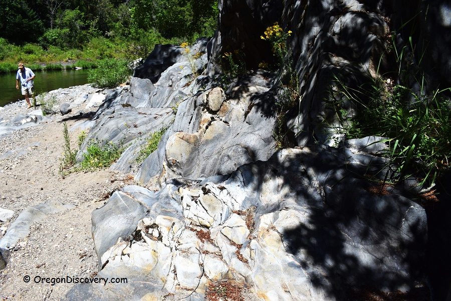
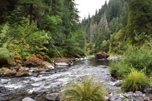
The South Umpqua River is home to extensive gravel bars, particularly in the lower and middle sections between Days Creek and Tiller.
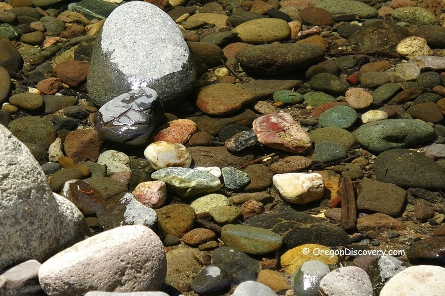
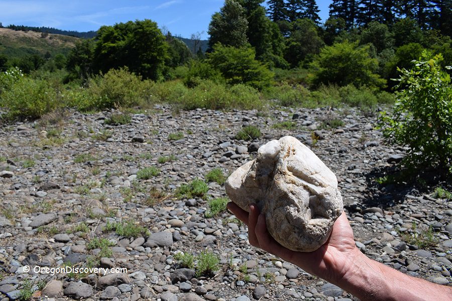
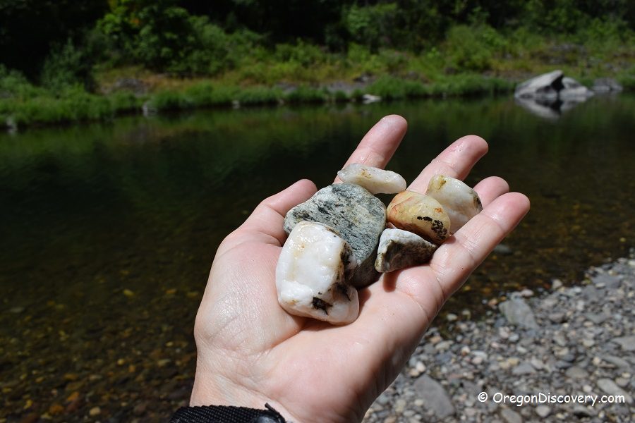
These areas are easy to access and offer excellent rockhounding. Sugary quartz, clear agate, and jasper are abundant here, with occasional finds of carnelian, petrified wood, quartz crystals, and sparkly schist.
Typically, agate appears clear to slightly reddish-tinted, sometimes containing quartz crystal centers that create beautiful geode-like specimens. Some agate geodes found here measure up to 5 inches in length. Large pieces of red, brown, and brecciated jasper are scattered throughout the river gravels, along with tons of sparkling white quartz cobbles.
The real prize for patient collectors is deep red carnelian, which appears rarely but rewards those who search thoroughly. Low-grade petrified wood in brown and gray tones also hides among the river rocks.
Several excellent spots along the South Umpqua River provide legal access to productive gravel bars. The lower river section managed by BLM offers three reliable collecting sites along Oregon Route 227. The upper river section near Tiller and beyond provides additional opportunities on U.S National Forest land.
Best season for collecting: Late summer through early fall offers optimal conditions. Low water levels reveal the largest gravel accumulations and make wading safer. Timing your visit for August or September typically yields the best results.
Middle South Umpqua River (Days Creek–Tiller)
Three BLM-managed sites along Oregon Route 227 provide excellent access to the South Umpqua's gravel bars in the lower or mid-river sections.
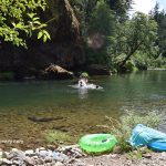
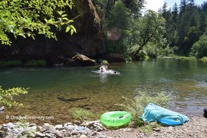
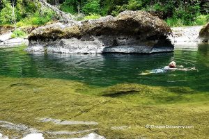
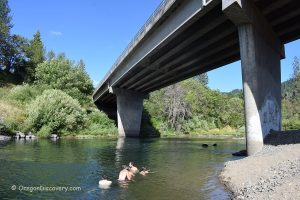
Site 1: Bridge at Days Creek (at milepost 10) serves as the first major collecting spot, located approximately 7 miles east of Canyonville. The bridge crosses the South Umpqua River with visible gravel accumulations below. A narrow parking area sits on the northeast side of the bridge, where a trail leads down to the riverbank.
This location features good concentrations of agate and schist among the river cobbles. The site also offers a refreshing swimming hole, making it popular during the summer months.
South Umpqua Bridge at Days Creek - Roadside Rockhounding & Swimming
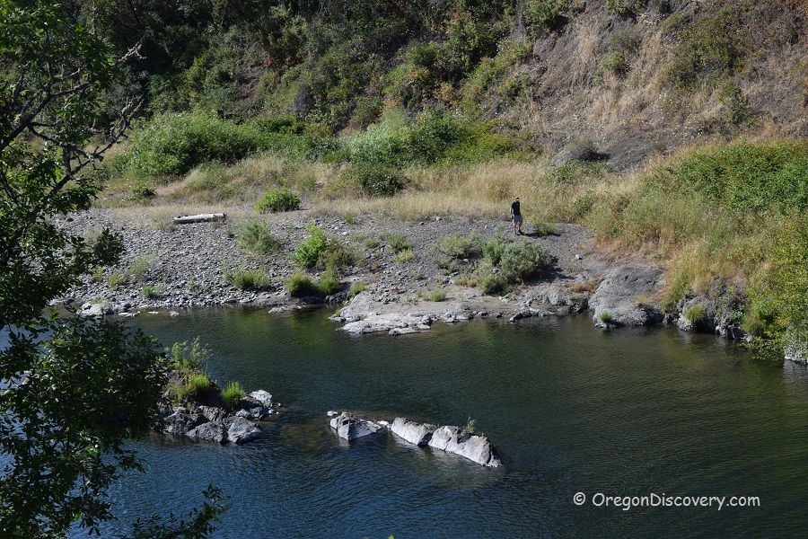
Site 2: Gravel Bar Access lies approximately 6.1 miles east of Days Creek along Route 227 (between mileposts 16 and 17). A dirt 0.1-mile road leads south toward the extended gravel bar and riverbank.
This site features an extensive field of cobbles including large grainy sparkly quartz. Some specimens is large here but smaller size tumbled material is abundant here.
This location allows rock hunters to inspect a substantial amount of material without extensive hiking.
Site 3: Rest Area near Tiller sits 7.5 miles further east along Route 227 at milepost 24.2, just before reaching the small community of Tiller. This wayside on the south side of the road has a vault toilet and picnic tables.
A short steep hike leads down from the parking lot to a nice gravel beach with good accumulations of material. This site combines comfortable amenities, an excellent swimming area, and productive collecting, making it an ideal stop for families.
Upper River Collecting Sites
The upper South Umpqua River offers additional rockhounding opportunities on U.S. National Forest land.
Near Dumont Creek Campground, there are productive gravel bars along the river with easy access. One access point is located approximately 3.6 miles northeast of Tiller. A trail about 0.1 miles west of the campground entrance leads down to a gravel beach with good material accumulations.
We found agate, including carnelian and jasper, as well as a lot of beautiful sugary quartz.
An area at Boulder Creek Campground also features productive gravels nearby along the river corridor. If you are not planning to camp overnight, take the right spur road near the entrance, which leads directly to the riverbank.
Both campground locations offer primitive camping for those who want to extend their rockhounding trips.
Zinc Creek deserves special attention for serious collectors. This tributary holds the elusive deep red carnelian that makes the South Umpqua famous among rock hunters. Material can be found both upstream and downstream from where the road crosses the creek. Move rocks around and splash creek water on dry accumulations to reveal hidden colors and patterns.
Low-grade petrified wood also appears in this area.
📌 Rock collecting is not permitted within campground boundaries. However, excellent gravel bars exist just outside these designated areas along the river, providing legal collecting opportunities.
South Umpqua River Swimming
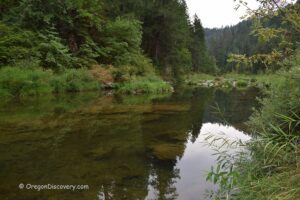
 The South Umpqua River is popular during the warm summer months. Clear mountain water flows through pools ranging from shallow wading areas to deeper swimming spots.
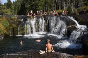
Water temperatures stay cool early in the summer due to forest shade and mountain origins, warming to about 70°F at South Umpqua Falls by late August.
The best swimming is from July through September when flows drop and the weather warms. Always check current conditions before swimming, as spring runoff can create dangerous, fast-moving water and cold temperatures.
South Umpqua River Camping, Lodging & Vacation Rentals
Several primitive campgrounds operated by the Forest Service line the upper South Umpqua River, putting campers right on the water and offering first-come, first-served access for early morning rockhounding adventures.
Dumont Creek Campground offers a secluded camping directly on the South Umpqua River. This primitive campground provides basic amenities.
Boulder Creek Campground is a quiet spot along the river with easy access to nearby collecting areas.
Ash Flat Campground sits 3 miles east of Boulder Creek Campground, offering another camping option for those exploring the region.
If you are looking for more comfortable accommodations, Canyonville has plenty of hotels and rentals to choose from.
South Umpqua River Gravel Bars | Facts
Open: Year-round
Managed by: Bureau of Land Management (BLM) & U.S. National Forest
Rocks & Minerals: Agate, jasper, carnelian, quartz, schist, petrified wood
Tools: Geology pick, gem scoop, collecting bag
Distance from the parking: Vary
Road access: Most sites are accessible by any vehicle; some upper sites benefit from higher clearance
Fees: None
Elevation: 600–1,700 ft (180–500 m)
Adventures Nearby

Directions to South Umpqua River Collecting Sites
From Interstate 5,
- Take Exit 99 at Canyonville and head east on Oregon Route 227.
The road follows the South Umpqua River for approximately 30 miles, passing through Days Creek and Tiller with multiple access points along the way.
Days Creek Bridge (Site 1): N 42°58.391' W1 23°10.244' | 42.9734, -123.1732
Gravel Bar (Site 2): N 42°56.383' W 123°06.538' | 42.9398, -123.1090
Rest Area (Ste 3): N 42°55.942' W 122°59.494' | 42.93237, -122.9916