
Cedar Creek Campground is tucked into the forest along Brice Creek, about 19 miles east of Cottage Grove, Oregon. Surrounded by tall Douglas-fir trees and the sound of rushing water, this small campground feels quiet and peaceful, perfect for a simple camping trip.
There are nine single sites and one double site. Each campsite features a picnic table and fire ring, with nearby vault toilets available. Like many rustic Forest Service campgrounds, there is no drinking water, no hookups, and no dump station. Campers need to bring their own water and supplies. Tent campers will feel right at home, but small RVs or self-contained rigs are also welcome to use the sites.
Shaded by the forest and close to the creek, Cedar Creek Campground gives you a real back-to-nature experience and a good starting point for exploring the Brice Creek area.
Things to Do around Cedar Creek
One of the best things about staying at Cedar Creek is the easy access to outdoor activities.
Hiking
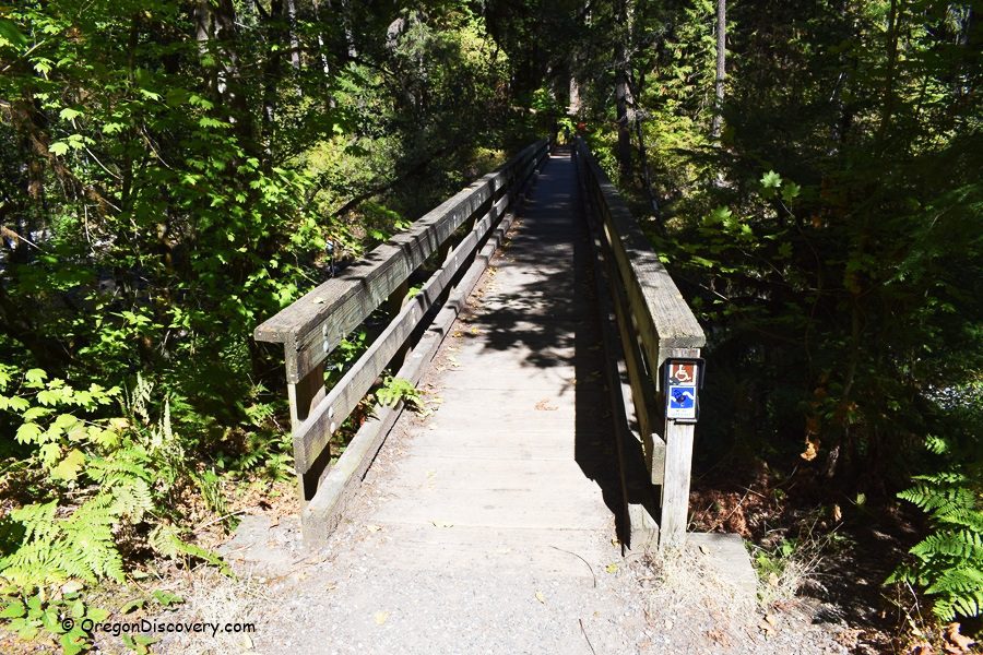
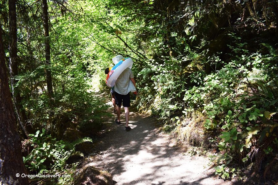
From the campground, a footbridge leads to the Brice Creek Trail. This popular path winds through mossy forest and rocky outcrops, following the creek for miles.
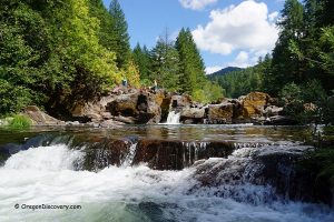
You can take a short hike to Brice Creek Falls or make a more extended trip to Trestle Creek Falls, where two beautiful waterfalls drop through the forest.
Brice Creek Trail – Hiking, Swimming, Camping, & Rockhounding
Swimming
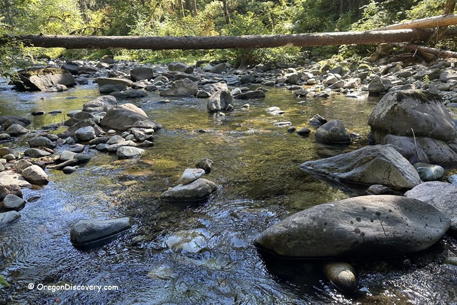
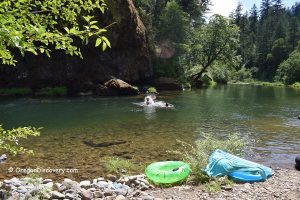
Brice Creek is also known for its swimming holes. Just below the campground’s footbridge is a calm pool that’s great for wading or cooling off on a hot day.
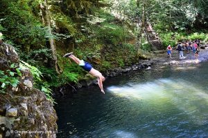
The water is cold, but after a hike, it feels refreshing. A couple of miles farther, Brice Creek Falls has a deep plunge pool and a dramatic waterfall, making it one of the most popular swimming and cliff-jumping spots in the area.
Brice Creek Falls - Waterfalls, Swimming Holes, and Canyon Adventures

When you’re ready to slow down, the forest is full of wildlife. Deer, songbirds, and butterflies are often seen around the campground. Many campers enjoy spending the evening reading by the creek or sitting around a campfire when conditions allow.
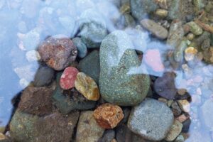
Gold Panning and Rockhounding
The Brice Creek drainage has a rich mining history, and some visitors enjoy trying their hand at gold panning in the creek.
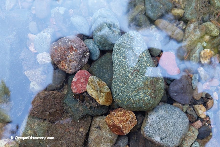
Although you may not find much, it can be a fun way to connect with the past. The gravel bars and creek edges may also contain interesting rocks, such as quartz, jasper, or agates, making the area a good spot for light rockhounding.
Cedar Creek Campground Stay
Cedar Creek Campground is open seasonally, usually from late May through the end of September. A small fee is charged for overnight stays, and payment can be made with cash, check, or a mobile app if you have service before arriving.
Because there are only ten sites, the campground can fill up quickly on weekends, so it’s smart to arrive early.
There is no drinking water available, so please bring your own. Cell service is very limited in this part of the forest, so don’t count on your phone for directions or planning once you’re out there. Campfires are only allowed when conditions are safe, and fire restrictions may be in place during the summer.
Cedar Creek Campground | Facts
Open: Seasonally, from around May 20 through the end of September
Managed by: U.S.Forest Service
Facilities: Picnic tables, fire rings, a vault toilet; No water, no hookups
Activities: Camping, hiking, swimming, rockhounding, and gold panning
Road access: Any vehicle
Day-use fees: None
Elevation: 1,600 ft (490 m)
Cedar Creek Campground is located:
- 24 miles southeast of Cottage Grove
- 45 miles southeast of Eugene
- 150 miles south of Portland.
Adventures Nearby


Directions to Cedar Creek Campground
From I-5,
- Take exit 174 in Cottage Grove and head east toward Dorena Lake
- Drive 4.1 miles on Row River Road
- Continue for 6.6 miles on Government Road/Shoreview Drive
- Merge onto Row River Road, which later becomes Brice Creek Road and follow it for 12.3 miles.