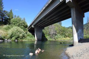
Bridge at Days Creek
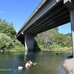 The South Fork of the Umpqua River at the Days Creek bridge is a perfect roadside swimming hole. The beach and swimming area are located under the bridge on the west bank.
You can access the beach by a short trail that starts at the southwest side of the bridge and leads down under the bridge to the riverbank.
South Umpqua Bridge at Days Creek - Roadside Rockhounding & Swimming

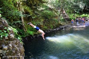
Three C Rocks Campground & Day-Use
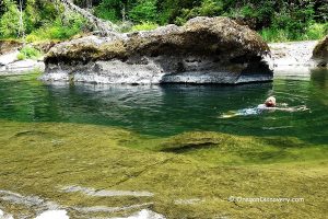
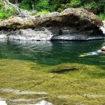 Tucked away in the lush Umpqua National Forest along the South Umpqua River, Three C Rock Campground and Day-Use Area is an excellent destination for camping, picnicking, hiking, and swimming.
A 300-foot-long channel provides a great place to swim, with bright green water so clear you can see underwater ledges and stones along the river bottom.
Dumont Creek Campground
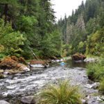
A small, primitive campground sits in a peaceful corner of the Umpqua National Forest, about 12 miles south of Tiller.
It features a rocky beach and shallow river, making it well-suited for wading, splashing, and tubing.
The campground is on a first-come, first-served basis with no reservations accepted.
Dumont Creek Campground - Secluded Retreat on the South Umpqua River
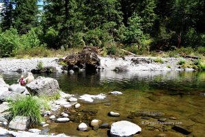
Boulder Creek Campground

The campground is located in the shaded area of of the Umpqua National Forest. The campground gives direct access to the river. The beach area is rocky and pebbly rather than sandy, so bring river shoes.
Here you will find both shallow spots for wading and deeper areas for cooling off on hot days.
If you are not planning to camp overnight, take the right spur road near the entrance, which leads directly to the riverbank.
Boulder Creek Campground - Quiet Retreat along the South Umpqua River
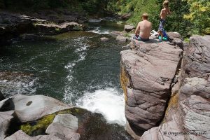
Ash Flat Campground

Ash Flat Campground is a great summer spot along the river, tucked into a mixed conifer forest. With just four campsites, Ash Flat stays quiet and peaceful all season.
A short trail from the campground leads to the river beach.
Upstream, the swimming area has underwater ledges and a small channel between them. Downstream, you’ll find rapids, a large basalt rock, and a swimming hole at the base of the rock.
Ash Flat Campground - Year-Round Escape to the South Umpqua River
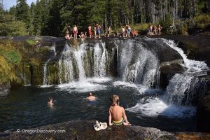
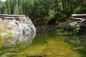
South Umpqua Falls
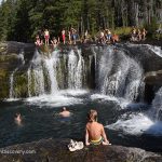 South Umpqua Falls is a scenic destination in the Umpqua National Forest with a waterfall and a unique natural bedrock water slide.
The shallow river above the waterfall has small pools in the bedrock where you can dip on a hot summer day. There are plenty of places for swimming and wading downstream just below the waterfall.
South Umpqua River Rockhounding

The South Umpqua River has extensive gravel bars, especially in the lower and middle sections between Days Creek and Tiller.
These spots are easy to reach and offer excellent rockhounding. Sugary quartz, clear agate, and jasper are common, with occasional finds of carnelian, petrified wood, quartz crystals, and sparkly schist.