
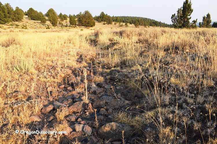
Mud Ridge is located in Oregon’s high desert, about 10 miles east of Hines and Burns. At an elevation of 4,650 feet, the area offers wide, open views and a dry climate most of the year.
The ridge’s name reflects its setting above shallow washes and sagebrush flats. Access roads are rough and rutted in sections, and a high-clearance four-wheel-drive vehicle is recommended from late spring through early fall when the BLM road is open.
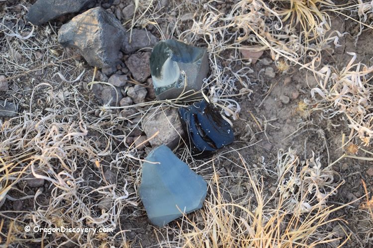
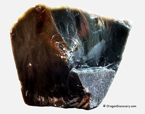
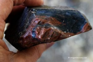
The ridge is a quiet volcanic bench formed from ancient rhyolitic lava that cooled quickly between 5 and 20 million years ago during the Miocene and Pliocene epochs. Rapid cooling prevented large crystal formation, leaving a smooth, glassy texture. Subtle color variations result from trace minerals and oxidation, causing chips to appear jet-black in shade and emerald in sunlight.
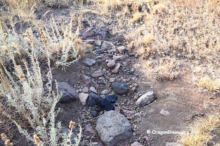
As the rock surface weathers, it exposes glassy seams and float. After light rainfall, the obsidian gleams like black glass, occasionally revealing green or red flashes visible from the road.
Mud Ridge Obsidian Rockhounding
Mud Ridge yields primarily black obsidian, with green, greenish-blue, snowflake, and occasionally rare red pieces mixed in. Float is commonly found along dry washes and gentle hillsides, and a small bucket can be filled with fist-sized pieces after a short walk.
Collecting is often most productive near roadcuts following wind or rain, when fresh shards are exposed and catch the light. Wash lines also hold scattered material, and a geology pick helps loosen half-buried pieces. Holes should be backfilled after excavation to minimize disturbance. Gloves are recommended, as obsidian edges are extremely sharp.
The BLM road extends 2–3 miles through the area, with good collecting potential where the sagebrush thins. The lee sides of low ridges and mouths of side draws often reveal concentrations of obsidian.
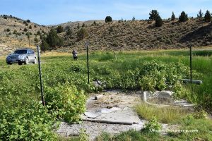
Much of the surrounding terrain consists of private property, but a defined BLM strip at Mud Ridge remains open to casual rock collecting. The BLM section begins about 9 miles north of Highway 20 at a gated entrance.
A sign marks the boundary and notes that the road is closed during winter and early spring due to seasonal conditions.
Verify access details with the BLM Burns District Office before visiting.
Mud Ridge Area: Camping, Lodging, and Vacation Rentals
No camping is allowed at the Mud Ridge site. For services, food, and fuel, Burns and Hines have simple motels and rentals.
Affordable vacation rentals for short and long-term stays near Burns
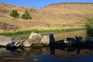
Crystal Crane Hot Springs sits about 25 miles east of Burns and offers soaking and overnight stays. If you're roaming farther, Alvord Hot Springs on the edge of the Alvord Desert also has paid soaking and lodging.
Mud Ridge at Hines | Facts
Best time: Late spring through early fall; avoid winter/early spring closures
Managed by: Bureau of Land Management (BLM)
Rocks & Minerals: Obsidian (black is the most common; green, greenish-blue, snowflake, and red are present)
Tools: Geology pick, gloves, eye protection; small bucket
Amenities: None
Activities: Rockhounding, photography, wildlife viewing
Road access: High-clearance 4WD recommended; seasonal closures possible
Day-use fees: None
Elevation: 4,650 ft (1,420 m)
Mud Ridge is located:
- 10 miles east of Hines
- 130 miles east of Bend
- 280 miles southeast of Portland.
Adventures Nearby


Driving directions to Mud Ridge
From Highway 20 in Burns,
- Take North Foley Drive and travel west for 1.3 miles to Radar Base Road
- Turn left onto Radar Base Road and continue for 2.6 miles to the BLM gate on Skull Creek Road.
From Highway 20 in Hines,
- Turn west onto Hines Lodging Road (National Forest Road 47) at the southern end of Hines
- Travel 4.5 miles to a gravel road on the right
- Turn right and after 0.1 miles bear left onto Radar Road
- Continue for about 3.3 miles to the gate.
From the gate,
- Travel on Skull Creek Road 1.7 miles west. Then turn right and continue 1.1 miles.
This is a BLM-managed land, where you can begin your search and explore along the road for the next 3 miles.
GPS (The BLM gate): N 43°36.491' W 119°06.449' | 43.608183, -119.107483