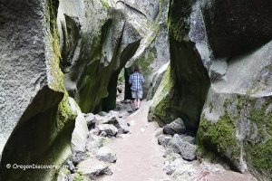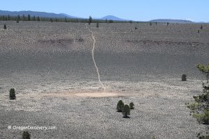
• Fort Rock State Natural Area is a unique geological marvel in the high desert
• The rocky wall served as the gathering place for Native Americans
![]()
![]()
![]()
National Natural Landmark, Fort Rock State Natural Area is a unique geological wonder located in the high desert of Central Oregon, 39 miles southeast of La Pine and just one mile north of Fort Rock Ghost Town.
Comprising 40 tuff rings that rise dramatically from an ancient Ice Age lakebed within the Brothers Fault Zone, Fort Rock's rugged rock walls soar approximately 320 feet above the basin and span 4,460 feet in diameter. The distinctive geometry of these formations, resembling defensive fortifications, led to the area's name.
The creation of Fort Rock dates back to an explosive event caused by basalt magma encountering the lake's bottom. This eruption ejected volcanic ash, mud, and molten lava into the air, ultimately settling around the volcanic vent and forming the iconic shape of Fort Rock. As the lake later dried up, it left behind the scenic natural area we see today.
Previously estimated to be as old as 1.8 million years, recent discoveries have provided a more accurate age range of 50,000 to 100,000 years, placing Fort Rock much closer to our modern times than initially assumed.
In 1938, University of Oregon archaeologist Luther Cressman unearthed a treasure trove of human artifacts dating back 9,000 to 13,000 years. These artifacts, including weapons, tools, baskets, and sage-bark sandals, shed light on the area's rich cultural history, where the semicircular rocky wall served as a gathering place for local tribes.
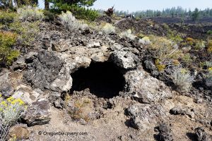
Adjacent to Fort Rock is the water-formed cave known as Fort Rock Cave, adding to the area's archaeological significance.

Visitors to Fort Rock State Natural Area can enjoy a picnic area at the foot of the formation, complete with flush restrooms for convenience. The natural area is open for day use from 8 am to 8 pm.
Please note that during raptor nesting seasons, remote-controlled drones and similar flying devices are not permitted in the area to ensure the protection of nesting birds.
Fort Rock State Natural Area: Places to Stay
No camping is allowed in the park.
The closest cities offering various types of accommodation are situated northeast of the Fort Rock. La Pine is 39 miles away and Bend is located 69 miles away. Both cities provide a range of lodging options for visitors to the area. Whether you're seeking hotels, motels, vacation rentals, or camping facilities, both La Pine and Bend offer convenient options to suit different preferences and budgets.
Affordable vacation rentals for short and long term stay in La Pine
Fort Rock State Natural Area | Facts
Open: Year-round from down to dusk
Managed by: Oregon State Parks
Amenities: Picnic areas, flush restrooms, interpretive information
Distance from the parking: Short
Road access: Any passenger vehicle
Day-use fees: Free
Activities: Hiking, nature viewing, picnicking
Dogs: Must be on a leash
Elevation: 4,400 ft (1,341 m)
Fort Rock is located:
- 39 miles southeast of La Pine
- 69 miles southeast of Bend
- 207 miles southeast of Salem.
Adventures Nearby
Directions to Fort Rock State Natural Area
From La Pine,
- Drive 2 miles south on US-97 to OR-31
- Turn left onto OR-31 and follow 29.2 miles to County Road 5-10
- Turn left onto County Road 5-10 and continue 6.4 miles to Cabin Lake Road
- Turn left onto Cabin Lake Road and follow 1 mile to County Rd 5-11A
- Turn left and after 0.6 miles turn right and go 0.2 miles to the destination.

