

![]()
![]()
![]()
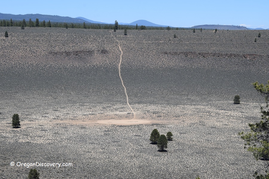
Hole-In-The-Ground is a crater created by a volcanic steam explosion, also known as a maar.
Some people previously believed this natural wonder was the result of a meteoroid impact, but that is incorrect. Like Fort Rock, the formation has a volcanic origin.
The site is located in Central Oregon, about 7 miles from Fort Rock. The crater is roughly 300 feet deep and about a mile wide. It is mostly an open basin with occasional trees scattered throughout.
A 2-mile out-and-back trail circles the rim of the crater, while two additional half-mile trails lead down to the crater floor.
Hole-In-The-Ground is accessible year-round, unless temporarily closed due to snow conditions.
Hole-In-The-Ground | Facts
Open: Year-round
Managed by: Bureau of Land Management (BLM)
Location: Fort Rock Basin
Amenities: None
Activities: Hiking, nature viewing, photography
Trail Distance: 2 miles (3.2 km)
Hike difficulty level: Moderate
Elevation gain: 400 ft (122 m)
Road access: High-clearance vehicle is recommended, the road can be inaccessible in winter
Day-use fees: None
Elevation: 4,600 ft (1,402 m)
Hole-In-The-Ground is located:
- 58 miles southeast of Bend
- 134 miles east of Eugene
- 239 miles southeast of Portland.
Adventures Nearby


Directions to Hole-In-The-Ground
From La Pine,
- Drive 2 miles south on Highway US-97 to Highway OR-31
- Turn left onto Highway 31 and travel 25 miles to the Forest Road NF-3125 between mileposts 25 and 26
- Turn left onto NF-3125, go 0.8 miles then slight left to stay on NF-3125 for 0.3 miles
- Turn right onto NF-200 and continue 0.2 miles/
- Bear left for NF-3130 and continue for 1.3 miles to NF-200.