• Myrtle Grove Campground is nestled in myrtlewood forest along the South Fork Coquille River
Myrtle Grove Campground is a hidden, riverside gem on the South Fork Coquille River, managed by the Rogue River-Siskiyou National Forest. Just 8.4 miles south of the small town of Powers, this primitive campground is a top choice for those seeking peaceful camping, scenic swimming, and outdoor recreation.
Set under a shady canopy of myrtle, maple, and Douglas fir, the campground offers five first-come, first-served tent sites along the river’s edge.
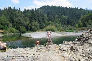
The forest here is lush and green, with rhododendrons, tan oaks, and a wild, vibrant understory. Boulders and rock formations scatter the riverbanks, creating inviting places to swim, relax, and explore.
Myrtlewood is highly prized for its beautiful grain and color, making it one of America’s most valuable hardwoods for artisan crafts like bowls, guitars, and furniture.
During the Great Depression, the city of North Bend even minted its own currency from Myrtlewood disks, Myrtlewood Dollars, which still have collector value today.
While the dried leaves have a culinary history, Myrtlewood contains compounds that can be harmful, so it’s best admired for its beauty and history rather than as a food ingredient.
Unique Oregon Myrtlewood
Oregon Myrtlewood (Umbellularia californica), also called California Bay Laurel, is a unique evergreen tree native only to southern Oregon and northern California.
These trees are unique for the area, with some giants reaching heights of up to 128 feet and over 6 feet in diameter. Their aromatic leaves, more pungent than regular bay leaves, were traditionally used by Native Americans as a medicine and as a natural pest control.

Swimming
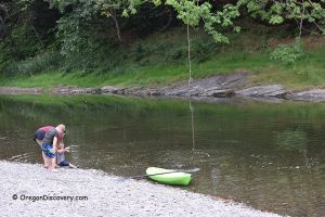
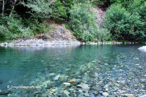
Looking for a classic Oregon swimming hole? Myrtle Grove offers one of the prettiest, with a clear, cool pool nestled between two river bends. The water is usually crisp, around 60–65°F on hot summer days, just what you want after a hike or a long drive.
The swimming area is framed by smooth boulders, shaded by tall trees, and has both shallow spots and deeper pools for wading, floating, or a quick plunge. Water levels can change with the season, but most of the year, you’ll find plenty of places to dip your toes or just stretch out on sun-warmed rocks.
You’ll love how quiet it feels. No crowds, no noise. Just the steady sound of the river and the breeze in the trees. Bring a towel, pack a picnic, and spend the afternoon by the water.

Hiking
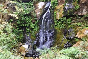
Myrtle Grove is a great base for exploring southern Oregon’s forest trails. Just 3 miles north on Forest Road 33, you’ll find the shared trailhead for Elk Creek Falls and Big Tree Trail.
These short hikes take you to:
- Elk Creek Falls: A beautiful, secluded waterfall in a deep green canyon.
- Big Tree: One of the largest Port Orford cedars in the region - an ancient giant that’s worth seeing!
Looking for more adventure? The nearby Coquille River Falls Trail is just over 10 miles away, with a two-tiered waterfall and lush forest. The area offers plenty of backcountry roads and trails for wildlife spotting, birdwatching, and peaceful wandering.
Rockhounding
If you like rockhounding, Myrtle Grove is a fun spot to search for quartz, red and green jasper, and petrified wood along the riverbanks.
The mix of gravel bars, boulders, and exposed rock makes every walk along the shore an adventure. Bring a bucket or a good pair of pockets because there’s always a chance you’ll find something cool!

Myrtle Grove Camping
This is a true primitive campground - simple and natural. There are 5 tent-only campsites, all set under big shade trees in the narrow river canyon.
Each site comes with a picnic table and fire grill, and you’ll find a vault toilet on site. There’s no drinking water, no hookups, and no reservations.
Everything is first-come, first-served and free; just show up and pick a spot.
Pets are welcome if they’re leashed. Seasonal garbage bins are available from Memorial Day through October, but you’ll want to pack out what you pack in for the rest of the year.

Myrtle Grove Campground | Facts
Open: Year-round
Managed by: U.S. Forest Service
Amenities: Vault toilet, picnic tables, fire rings, seasonal garbage bins (Memorial Day–October), no drinking water (bring your own)
Activities: Camping, swimming, picnicking, hiking, and rockhounding
Distance from the parking: Short
Road access: Any vehicle
Day-use fees: None
Elevation: 600 ft (182 m)
Island Campground is located:
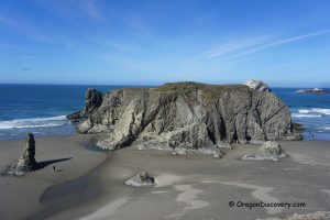
- 64 miles southeast of Bandon
- 89 miles southwest of Roseburg
- 160 miles southwest of Eugene.
Adventures Nearby


Directions to Myrtle Grove Campground
- Take OR 42 east toward Myrtle Point
- At Myrtle Point, turn right onto Powers Highway (OR 542), which becomes County Road 90
- Continue 18 miles south to Powers
- From Powers, continue south on Forest Road 33 for 8.4 miles
- The campground entrance is on the right (watch for the sign; the turn is steep with a rough transition from pavement to gravel).
You May Also Like