

• Orchard Park is popular for kayaking, fishing, swimming, and diving opportunities
![]()
![]()
![]()
![]()
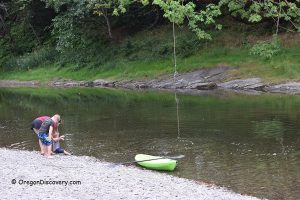
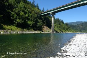
Orchard Park is a beautiful destination on the bank of the South Fork Coquille River, just two miles south of Powers. Here, the river bends gently around gravel bars and a striking cliff on the north bank.
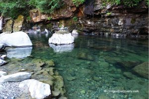
At the base of this rocky monolith, the water runs deep, making it a popular spot for local divers. A platform with a diving board and stairs provides easy access for swimmers.
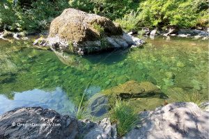
The current is slow inside the bend, and the water warms up nicely during the peak of summer. The shoreline is a mix of pebbles, gravel, and sandy patches, with numerous shallow areas ideal for children.

Along with swimming and diving, this stretch of river is excellent for kayaking, tubing, and paddleboarding.
This is a day-use only site—no camping is allowed. The parking area is located off Powers South Road. From the lot, a short trail begins to the right of the picnic pavilion and leads to a stairway descending to the monolith and gravel beach.
Picnic tables and a bench located near the parking area offer panoramic views of the river from the park's highest point.
The South Fork Coquille River is also a fantastic fishing destination year-round, supporting wild and hatchery steelhead, chinook and coho salmon, sea-run cutthroat trout, and bass. Always check current fishing regulations to confirm whether a particular area is open to angling.

Orchard Park Camping
This is a day-use only site—no camping is allowed.

Orchard Park | Facts
Open: Year-round for day-use
Managed by: City of Powers
Amenities: A vault toilet, picnic tables and a picnic pavilion
Activities: Swimming, diving, fishing, and picnicking
Distance from the parking: Short
Road access: Any vehicle
Day-use fees: None
Orchard Park is located:
- 33 miles southeast of Bandon
- 75 miles southwest of Roseburg
- 140 miles southwest of Eugene.
Adventures Nearby


Directions to Orchard Park
From Highway 101 in Coos Bay,
- Take OR 42/OR 542/Powers Highways and travel 49 miles south to the destination on the right.
GPS: N 42°51.618' W 124°02.887' | 42.8603, -124.04811