
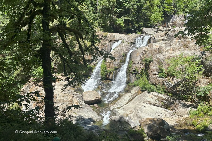
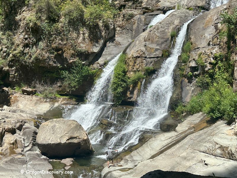
• Coquille River Falls drops a total of 115 feet through a lush, old-growth forest canyon
Coquille River Falls is a stunning, remote waterfall in Coos County about 11 miles southeast of the small town of Powers. This dramatic two-tier waterfall is tucked away in the Rogue River–Siskiyou National Forest, surrounded by mossy cliffs, ancient Douglas-fir, and Port Orford cedar trees.
The falls drop in two scenic tiers:
- The Upper Falls plunges 50 feet (15 m)
- The Lower Falls drops 65 feet (20 m).
Total height: 115 feet (35 m)
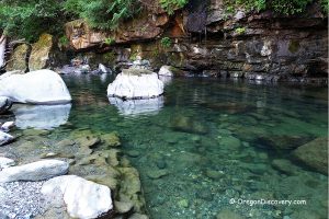
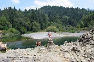
The waterfall is located at the confluence of the South Fork Coquille River, Sru Creek, and Drowned Out Creek. Both tiers crash through a rugged, rocky canyon, making this one of the most impressive and wild Oregon waterfalls you can visit.
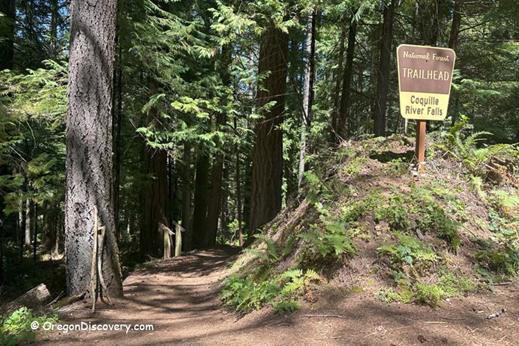
Coquille River Falls Trail
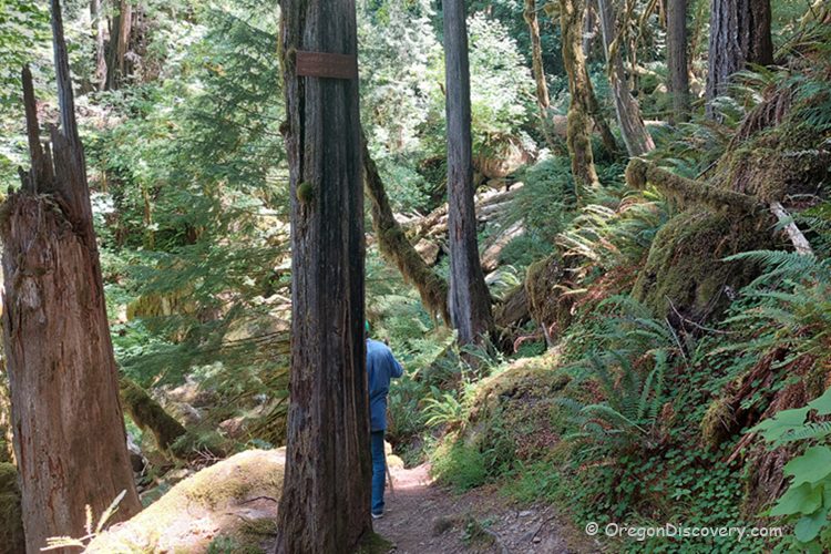
A rugged trail descends through a canyon lined with soaring firs and ancient cedars, leading adventurers to a striking overlook of the impressive Coquille River Falls. This hike to the hidden waterfall offers a brief yet unforgettable adventure into the lush heart of Oregon’s wilderness.
The Coquille River Falls Trail is rated moderate to difficult, dropping about 500 feet from the trailhead down to the river. Expect a challenging descent into the canyon and a steep climb back out.
From the trailhead, follow the dirt path downhill for 0.6 miles (1 km) until you reach a fork marked by a sign on a tree pointing to the Lower and Upper Falls.
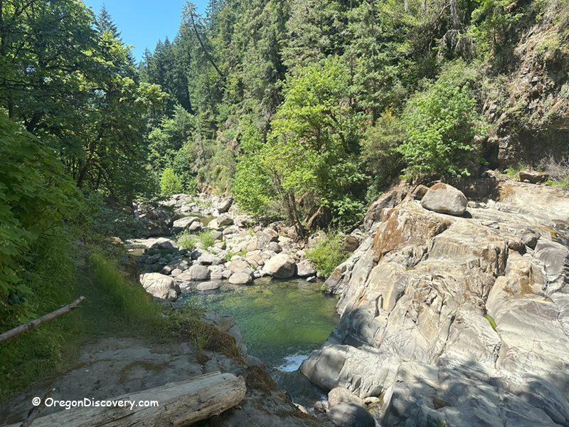
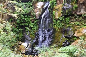
Left fork: Leads to the Lower Falls viewpoint (recommended). This section is about 0.1 miles (0.16 km) one way, well-defined, and features a few steep switchbacks.
Right fork: Leads toward the Upper Falls. This section is rough, unmaintained, and intended for experienced hikers only. The rocks are slippery, especially after rain or during high water.
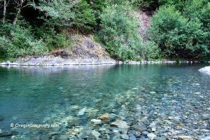
Tip: The Lower Falls viewpoint offers the best and safest spot for photos and relaxation. The view is at its best in spring and early summer, when the water flow is at its strongest.
Coquille River Falls Geology and Natural Area
Coquille River Falls is located within a 500-acre Federal Research Natural Area established in 1945.
The old-growth forest here is dominated by Douglas-fir and Port Orford cedar, which make up 22% of the trees in this area. The waterfall's canyon is carved from sedimentary bedrock from the Tyee Formation, dating back to the Eocene era.
This wild area is home to deer, songbirds, and even river otters. The name "Coquille" comes from the Chinook Jargon word "Scoquel," after the lamprey eels once plentiful in the river.
Coquille River Falls Trail – Hiking Details
The Coquille River Falls Trail is a short but challenging forest hike:
- Trail length: 0.6 miles one way (1.2 miles round trip)
- Elevation change: 500 feet down (and back up)
- Trail type: Narrow, dirt path with steep, sometimes slippery switchbacks
- Best time to visit: Spring and early summer for strong water flow and lush scenery
- Dogs: Allowed on leash.
There are no restrooms or facilities at the trailhead, so plan ahead.
A Brief History
Local Native tribes and early fur traders named Coquille River Falls and the river. The area's name may come from "Scoquel," the Chinook Jargon word for lamprey eels.
The falls are the centerpiece of a federally protected research area, which has preserved rare forest types and wildlife habitats since 1945.
Coquille River Falls Camping, Lodging, & Vacation Rentals
There is no camping right at Coquille River Falls, but there are two great options nearby.
Island Campground is just 8 miles away on the South Fork Coquille River, and Sru Lake Campground is about 11 miles from the falls, nestled by a quiet mountain lake. Both campgrounds offer tent camping, picnic tables, and fire rings. Camping is first-come, first-served.
The closest hotels are in Bandon, about 50 miles west. Bandon is a charming coastal town known for its beaches, sea stacks, and peaceful atmosphere.
Coquille River Falls | Facts
Open: Year-round
Managed by: U.S. Forest Service
Amenities: No restrooms or picnic tables at trailhead; vault toilets and picnic tables available at nearby campgrounds
Activities: Hiking, nature viewing, photography, birdwatching
Distance from the parking: 0.6 miles (one way)
Road access: Most passenger vehicles via well-maintained forest roads
Day-use fees: Free
Elevation: 1,000 -1,500 ft (305- 460 m)
Coquille River Falls is located:
- 11 miles southeast of Powers
- 50 miles east of Bandon
- 90 miles southwest of Roseburg.
Adventures Nearby


Directions to Coquille River Falls
- Head east on Highway 42S toward Coquille for 17 miles
- In Coquille, turn right onto OR-42 East and continue for 18 miles to the town of Powers Junction
- At Powers Junction, turn right onto Powers Highway (OR-542) and drive south for 18 miles to the town of Powers
- From Powers, continue south on Forest Road 33 for 10.5 miles past Elk Creek Falls
- Turn left (east) onto Forest Service Road 3348, just after crossing the river
- Continue for 1.5 miles to the trailhead parking area, which is well-marked on the left.