Patjens Lakes


The natural beauty, Patjens Lakes trail is located close to Mt. Hoodoo and about 1.5 hours from the city of Salem.

The hike began along the Big Lake, where boats and wakeboarders cruised the crystal blue water. A large portion of the trail was burned in 2011 in the Shadow Lake fire.Patjens Lake

Our group trekked past beautiful lakes, through miles of bushwhacking, and toward a stunning unnamed lake. Along the way, we treated ourselves to the sweetest wild strawberries I have ever tasted. The forest was full of wild huckleberry, it was the first time I tried these delicious treats.

Colorful butterflies and gorgeous wildflowers paved our way. We found a lot of animal scat, so best to not hike here alone! At the climax of our hike, we came to the breathtaking secret lake. The lake had a single well-maintained campsite. There was a prepared stack of firewood, with a giant set of antlers on top for décor. We walked around the entire lake, although we startled millions of tiny frogs.

After a delicious picnic and a refreshing swim, we trudged back up the mountain through the forest, and toward the fire-scorched ghost of a forest. The white skeletons of trees contrasted with the fresh new beginning forest. Young trees and wildflowers were scattered among the tall white forest snags. Looking around, we saw The Three Sisters, Mt. Washington, Mt. Jefferson, Three-Fingered Jack Mt., and many more beautiful peaks.

We hiked a total of 11 miles and ended up on the opposite side of where we started. What welcomed us back was a view of the sapphire-colored lake with streaks of white.


Patjens Lake

Patjens Lakes

Patjens Lake

Patjens Lakes

Patjens Lakes

Patjens Lakes

Patjens Lake

Patjens Lakes

Patjens Lake

Patjens Lake

Patjens Lakes

Patjens Lake

Patjens Lakes Hike | Facts

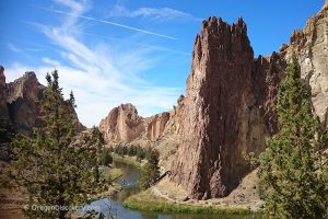
Location: Willamette National Forest • Cascades • Oregon • USA

Trail Type: Loop
Trail #: 3395
Distance: 6.2 miles (10 km)
Difficulty Level: Moderate to Difficult

Max Elevation: 4,400 ft (1,340 m)
Elevation Gain: 700 ft (213 m)

Dogs: Allowed
Activities: Day hiking, backpacking
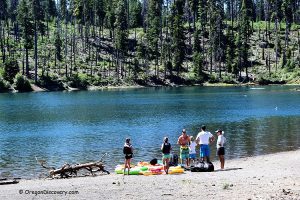
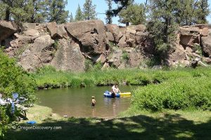
Other Activities: Horse Riding, Camping, Boating, Fishing


Adventures Nearby

Directions to Patjens Lakes Loop

From McKenzie Bridge,

  • Follow east on Highway 126 roughly about 24 miles to Highway 20
  • Drive east on Highway 20 near 7 miles and turn right onto Forest Road 2690 (Hoodoo turnoff)
  • Continue about 4 miles to Patjens Lakes Trailhead on your right, located at the west end of Big Lake.

USDA

GPS (Trailhead): N 44°22.502' W 121°52.927' | 44.37503, -121.882


Leave a Reply

Your email address will not be published. Required fields are marked *

This site uses Akismet to reduce spam. Learn how your comment data is processed.