

• Cape Blanco Lighthouse is the oldest, windiest, and westernmost light station
Cape Blanco Lighthouse is the most western, most southern, and oldest lighthouse still in use in Oregon. It sits about 4 miles north of Port Orford.
Cape Blanco is the westernmost point in Oregon and the second westernmost point in the United States, after Cape Alava in Washington
Jutting 1.5 miles out into the Pacific Ocean, the headland is often exposed to strong winds. Most of the time, the wind blows about 20 miles per hour (mph), but during the winter storms, it can reach 100 mph. During the Columbus Day Storm in October 1962, the gale brought deadly winds up to 180 mph.

Cape Blanco Lighthouse History
Constructed in 1870, the lighthouse is 59 feet high and towers 245 feet above sea level. In clear weather, the beam can be visible as far as 23 nautical miles out, warning ships away from dangerous reefs. In 1980, it became fully automated. You can enjoy the lighthouse tour, which takes you all the way to the lantern room. The tour lasts around 20 minutes and requires climbing 63 spiraling steps to the top.
Cape Blanco and its surrounding area feature over 400 years of recorded history, starting from Captain Martin D’Aguilar of Spain visiting the cape in 1603 and naming it Blanco (“white” in Spanish).
The lighthouse grounds are part of Cape Blanco State Park, established in 1971 after the purchase of land from Joseph N. Hughes. Hughes‘s family owned a 2,000-acre dairy farm that bordered the lighthouse property and extended to the Sixes River.

Victorian Hughes House and Cape Blanco State Park
Built in 1898, the Victorian-style Hughes House stands not far from the light station, overlooking the mouth of the Sixes River.
Both historic Hughes House and the Cape Blanco Lighthouse were placed on the National Register of Historic Places.
Cape Blanco State Park has 150 acres for horseback riding and more than 8 miles of hiking trails that lead to beaches.
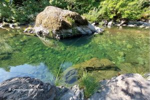
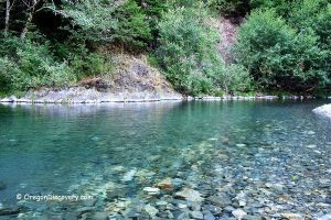
Cape Blanco Beach is south of the cape and is known for the tall Needle Rock. You can reach the beach by walking a trail from the parking area. Other trails lead to Sixes River Beach, which stretches north from Cape Blanco to the river.
Take one or all of the possible routes and enjoy the beauty of the Oregon Coast!

Cape Blanco State Park Campground & Lodging
The campground has 52 electrical sites with water, 4 standard cabins, a horse camp, a group camp, and hiker/biker camps. There are flush toilets, hot showers, and firewood for sale. Six sites and one of the cabins are accessible.
Lodging is available in Port Orford or Gold Beach.
Cape Blanco Lighthouse | Facts
Tower Height: 59 feet (18 m)
Focal Height: 245 feet (75 m)
Built: 1870
Operation: Active
Location: Cape Blanco State Park
Open: From April through October, Tuesday through Sunday, 10 am to 3:30 pm
Cape Blanco Lighthouse is located:
- 9 miles north of Port Orford
- 106 miles southwest of Roseburg
- 170 miles southwest of Eugene.
Adventures Nearby


Directions to Cape Blanco Lighthouse
From Port Orford,
- Travel 4 miles north on Highway 101 to Cape Blanco Road between mileposts 296 and 297
- Turn left (west) onto Cape Blanco Road and continue 5 miles to the destination.
The last 0.25-mile portion of the road to the light station is open for pedestrian traffic only.