Cape Meares Viewpoint & Lighthouse

• Cape Meares features the shortest lighthouse and unusually-shaped Octopus Tree
• The cape and surrounding rocks are home to one of the largest nesting seabird colonies

Historical Landmarks OregonHiking OregonWildlife Viewingmushrooms OregpnPhotographing

Cape Meares State Scenic Viewpoint is a Pacific Coast headland and one of the three capes along the breathtaking 35-mile Three Capes Scenic Route.

The other two points along the route - Cape Lookout State Park and Cape Kiwanda Natural Area - are also well worth visiting.

The 100-acre Cape Meares State Park, managed by the Oregon Parks and Recreation Department, is surrounded by the 140-acre Cape Meares National Wildlife Refuge, managed by the U.S. Fish & Wildlife Service.

The cape was named after Captain John Meares, a British explorer and fur trader who sailed along the Northwest Coast in 1788.


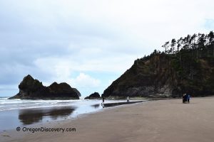
The cape rises about 200 feet above the ocean and offers spectacular views of crashing waves along steep bluffs and rocky cliffs. These cliffs are home to one of North America’s largest nesting seabird colonies.

The most common species is the common murre. Other frequently seen birds include pigeon guillemots, tufted puffins, peregrine falcons, and pelagic and Brandt’s cormorants. The best time for seabird viewing is between April and July.

Cape Meares also offers excellent whale-watching opportunities. Gray whales can often be seen migrating south from December to January and returning north from March to April.


Cape Meares State Park, Oregon Coast
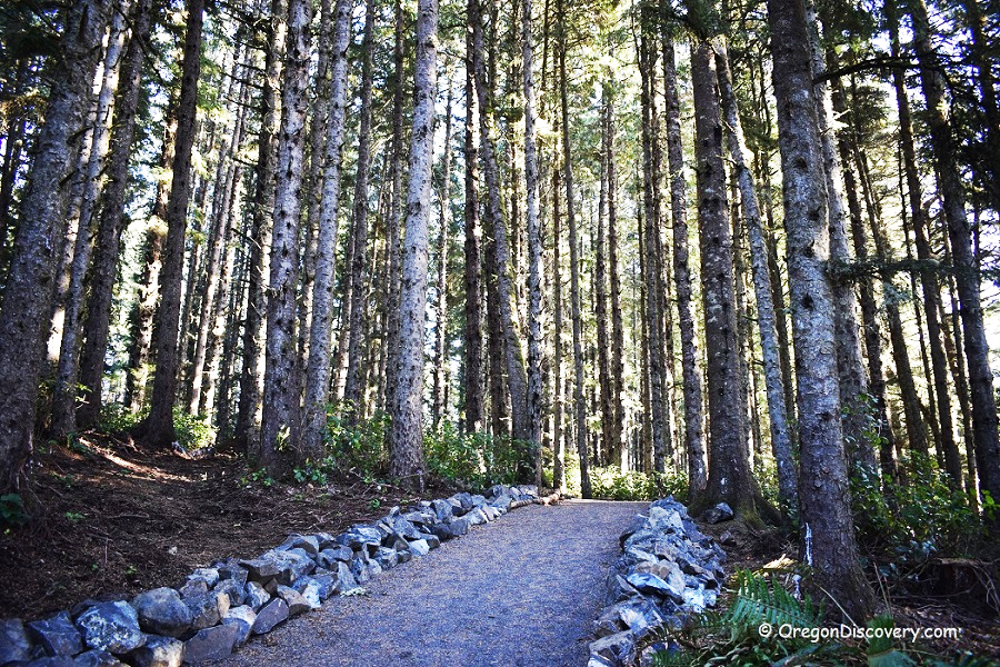
Cape Meares State Park Trail

Hiking Trails at Cape Meares State Park

Cape Meares offers a network of short but scenic hiking trails that wind through coastal forest, cliffs, and viewpoints overlooking the Pacific Ocean. The park’s trails total about three miles and are generally easy to moderate, making them accessible for most visitors.

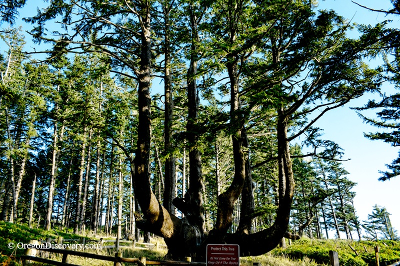
One of the most popular routes is the trail to the Octopus Tree, an unusual Sitka spruce with multiple massive trunks radiating outward from a wide base.

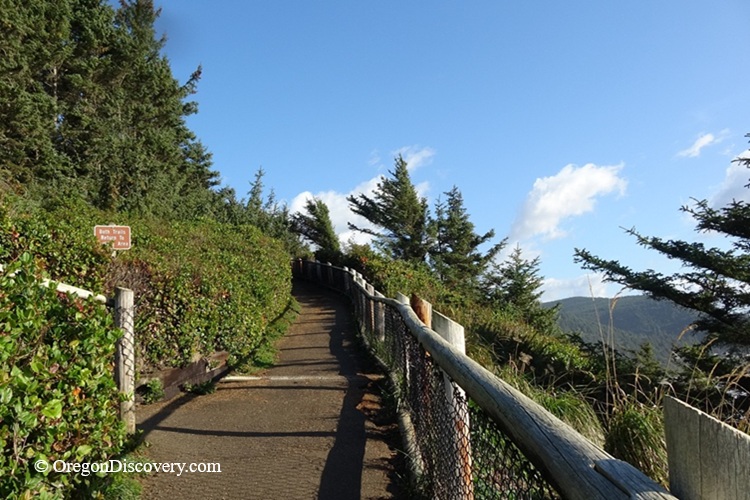
Another highlight is the paved lighthouse trail, which leads to Cape Meares Lighthouse and provides sweeping views of the coastline along the way.

From the headland, several viewpoints offer dramatic overlooks of the ocean, including cliffs, offshore rocks, and seasonal seabird nesting areas. In spring and summer, hikers may also spot nesting seabirds along the cliffs below.

The trails are well-marked and shaded in many sections, but conditions can be damp and muddy after rain, so sturdy footwear is recommended.


Cape Meares State Park - Octopus Tree Trail, Oregon Coast
Octopus Tree Trail

Cape Meares Lighthouse

Cape Meares LighthouseCape Meares Lighthouse is the shortest lighthouse on the Oregon Coast, constructed in 1890 on the basalt outcropping. Standing 217 feet above sea level, the 38-foot lighthouse served as Tillamook Bay’s primary light station until 1963.

A 0.2-mile paved trail leads from the parking area to the lighthouse. The path winds through coastal vegetation and offers sweeping ocean views, along with interpretive signs about local history and wildlife.

Cape Meares Lighthouse - The Shortest Light Station on the Oregon Coast


Octopus Tree

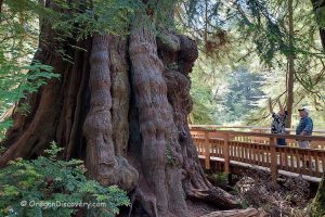
Another trail leads to the large unusually-shaped Sitka spruce, known as Octopus Tree.

The age of the Octopus Tree is estimated to be 250 to 300 years. Being 105-foot tall with a 50-fot base without a central trunk, the tree resembles an octopus with giant tentacles heading toward the sky.

The Octopus Tree is designated as an Oregon Heritage Tree in April 2009 and it is believed to carry big ceremonial significance for the local native population back in the days.


Octopus Tree, Cape Meares State Park, Oregon Coast
Octopus Tree


Cape Meares | Facts

Open: Year-round from 7 am to 7 pm
Managed by: Oregon State Parks & U.S. Fish & Wildlife Service

Amenities: Flush restroom and picnic area
Activities: Hiking, nature viewing, and photography

Distance from the trailhead: Short
Hike difficulty level: Easy

Road access: Any passenger vehicle
Day-use fees: None
Dogs: Must be on a leash

Cape Meares is located:

  • 12 miles northwest of Tillamook
  • 84 miles west of Portland
  • 84 miles northwest of Salem.


Video

Adventures Nearby


Directions to Cape Meares

From Tillamook,

  • Take Highway OR-131 and travel 9 miles west to Cape Meares Loop
  • Turn right onto Cape Meares Loop and follow 1.2 miles
  • Continue onto Bayshore Drive for 1.4 miles to the park entrance on the left.

Cape Meares Park Directions


Leave a Reply

Your email address will not be published. Required fields are marked *

This site uses Akismet to reduce spam. Learn how your comment data is processed.