

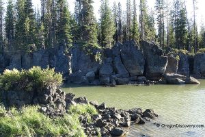
• Davis Lake was created by lava flows that formed a natural dam and blocked Odell Creek
• The lake the most well-known for excellent fly fishing
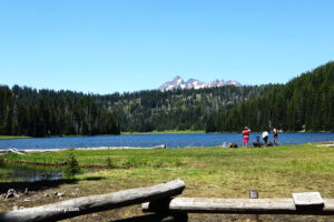
Davis Lake is a high-elevation lake located southwest of Bend in the Deschutes National Forest, along the scenic Cascade Lakes Highway.
The lake is named after “Button” Davis, a Prineville-area stockman who grazed his cattle near the lake in the 19th century.
Davis Lake was formed around 6,000 years ago due to volcanic activity. Lava flows from a nearby eruption created a natural dam, blocking Odell Creek and forming the lake.
The lake’s size varies seasonally, ranging from about 1,000 to 3,906 acres—largest during the winter months. Its main water sources are Odell Creek and Ranger Creek. During summer, inflow from these creeks is not enough to offset the lake’s drainage through its porous volcanic bottom. Davis Lake is relatively shallow, with an average depth of 9 feet and a maximum depth of 22 feet.
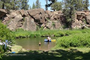
Due to abundant shoreline vegetation and a muddy bottom, Davis Lake is not ideal for swimming. For a refreshing summer dip, consider nearby North Twin and South Twin Lakes, Elk Lake, Cultus Lake, Wickiup, or Crane Prairie Reservoirs.

Fishing
Davis Lake is best known for fly fishing, especially for trophy-sized rainbow trout.
It’s also considered one of Oregon’s top bass lakes. Largemouth bass, introduced illegally in 1995, now outnumber trout. The lake is also home to native piscivorous trout and whitefish. Only fly fishing with artificial flies is permitted. Be sure to check current ODFW regulations before fishing.
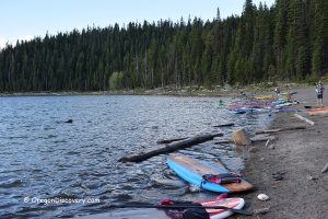
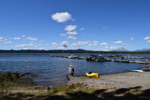
Both motorized and non-motorized boats are allowed, though speeds are limited to 10 mph. West Davis Campground provides primitive boat access, while Lava Flow Campground has a developed boat ramp.ramp.

Davis Lake Camping and Lodging
East Davis Lake Campground is located near the point where Odell Creek flows into the lake. Lava Flow Campground, situated on the lake’s northwest shore, may be closed seasonally to protect nesting eagles. All campgrounds offer basic amenities, including toilets, fire pits, and picnic tables.
Reservations can be done online through Recreation.gov or by calling toll free 1-877-444-6777
For more comfortable accommodations, consider staying at one of the Cascade Lakes resorts or in a hotel in nearby Bend.
Affordable vacation rentals for short and long term stay at Cascade Lakes Highway

Cascade Lakes Scenic Byway - Mapped
Davis Lake | Facts
Open: Late spring through fall (Cascade Lakes Highway closes in winter)
Managed by: U.S. Forest Service
Amenities: Restrooms, picnic sites, boat ramps
Activities: Boating, fishing, hiking, and nature-viewing
Distance from the parking: Short
Road access: Any passenger vehicle
Day-use fees: Yes or Interagency Senior/Access/Military Pass
Elevation: 4,200 ft (1,280 m)
Davis Lake is located:
- 55 miles west of Bend
- 93 miles east of Eugene
- 197 miles southeast of Portland.
Body of water: Natural lake
Surface area: From 1,000 to 3,906 acres
Shoreline: 8 miles (13 km)
Maximum depth: 22 ft (7 m)
Adventures Nearby


Directions to Lava Flow Campground
From Bend,
- Take Highway 97 and travel 17 miles south to Vandevert Road
- Turn right onto Vandevert Road and drive 1 mile to S Century Drive
- Turn left onto S Century Drive and continue 1.1 miles
- Turn right to stay on S Century Drive and follow 22.8 miles to Cascade Lakes Highway 46
- Turn left onto Cascade Lakes Highway and go 2.1 miles
- Turn right, then again right onto NF-855 and continue 1 miles
- Turn left to stay on NF-855 and continue 0.9 miles to the destination.
GPS (East Davis Lake Campground): N 43°35.208' W 121°51.396'| 43.5868, -121.8566
GPS (Lava Flow Campground): N 43°37.389' W 121°49.284'| 43.62315, -121.8214