

• Drift Creek Falls Trail offers a hike to the impressive 75-foot waterfall
• The pedestrian suspension bridge above the canyon is the longest in Oregon and Washington
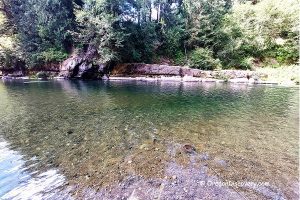
Drift Creek Falls Trail descends through the Coast Range Forest to the picturesque Drift Creek Falls and the 240-foot long suspension bridge.
The well-designed trail #1378 with gentle changes in grade over the entire route is 1.25 miles to the bridge. While hiking along the trail, you will enjoy a beautiful second-growth coastal woodland with Douglas firs, Sitka spruce, western hemlock, sword ferns, salmonberries, huckleberries, vine maples, and salal bushes. There are a variety of wildflowers and mushrooms on the route too.

After a mile, the trail passes the creek over a footbridge and soon you are able to hear waterfall sounds. The remaining quarter-mile path runs along the creek and, eventually, you will arrive at the largest pedestrian suspension bridge in Oregon and Washington. There is an alternate 3-mile trail known as Northern Loop that starts and ends at the Drift Creek Trail.
Extending 100 feet above the canyon floor, the bridge anchored in the rock on one side by ties and cables and firmly cemented on the opposite side.
Built in 1997, the bridge is dedicated to Scott Paul who died in a fatal construction accident in 1993. Crossing the bridge is itself an exciting experience as it provides a spectacular aerial view of the 75-foot Drift Creek Falls, the misty canyon, and beautiful cascading Drift Creek.


From the bridge, the trail continues the next 0.25 miles downhill to the base of the waterfall. From the bridge, the trail continues the next 0.25 miles downhill to the waterfall's base.
This last piece of the trail is steep, muddy, and slippery.
VERY slippery!
How do I know? My hiking partner took a slide down on her rear. Thankfully, she was OK, but that was VERY DAGEROUS!
So running shoes is a bad choice for the waterfall.
Check another option (and some other cool gear, too) here.

Drift Creek Falls | Facts
Open: Year-round from dawn until dusk
Managed by: US Forest Service
Location: Siuslaw National Forest
Amenities: Vault toilet at the parking area, no drinking water
Activities: Hiking, fishing, mushroom picking, nature viewing, photography
Accommodations: No camping or overnight parking
Distance from the parking: 1.5 miles (2.4 km)
Trail type: Out & Back (Trail #1378)
Hike difficulty level: Easy to Moderate
Elevation gain: 380 ft (116 m)
Road access: Any passenger vehicle
Day-use fees: Yes or Interagency Senior/Access/Military Pass
Dogs: Must be on a leash
Elevation: 911 ft (278 m)
Drift Creek Falls is located:
- 16 miles east of Lincoln City
- 57 miles west of Salem
- 85 miles southwest of Portland
- 123 miles northwest of Eugene.
Waterfall Facts
Total height: 75 feet (23 m)
Total width: 8 ft (2 m)
Watercourse: Drift Creek
Elevation: 630 feet (192 m)
Number of drops: One
Primary form: Horsetail
Seasonality: 12 months
Video
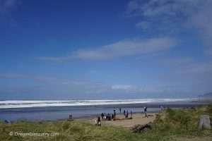
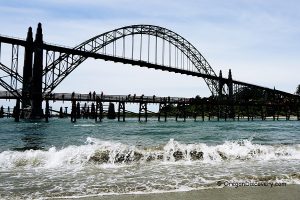
Adventures Nearby


Directions to Drift Creek Falls Trailhead
From Portland and Salem,
- Take Highway 18 toward the Coast and follow for about 15 miles to North Bear Creek Road (milepost 5)
- Turn left onto North Bear Creek Road and drive 9 miles to Drift Creek Falls Trailhead
- At the junction with Schooner Creek Road, bear right
- The paved road occasionally becomes an old logging road with a lot of curves. In many places, the road is gravel and narrow with only room for one car. By the time you arrive at the trailhead, Bear Creek Road becomes Forest Road 17.
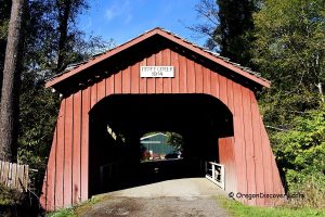
Driving along North Bear Creek Road, allows you to see the oldest in Oregon Drift Creek Covered Bridge.
From Lincoln City,
- From Highway 101, follow to milepost 119, the south side of Lincoln City, and turn east onto South Drift Creek Road
- Turn right to stay on the same road and turn left in 0.4 miles onto South Drift Creek Camp Road
- Follow 0.9 miles on South Drift Creek Camp Road to Forest Road 17
- Turn left onto Forest Road 17 and continue 9.4 miles to the Drift Creek Trailhead parking area.
- At the junction with Forest Roads 1929 and 1730 keep left.
GPS (waterfall): N 44°55.992' W 123°51.042' | 44.9332, -123.8507
GPS (trailhead): N 44°56.130' W 123°51.342' | 44.9355,-123.8557