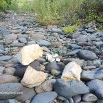
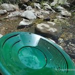
Southern Oregon has plenty of opportunities for recreational rock and mineral collecting. The ledges, river and lake gravels produce a wide variety of minerals including gem-quality specimens. Due to most of the sites mentioned below are located along the river and creek banks, the best rockhounding time is during the summer and early fall months when the water level is low and more materials are exposed. Before accessing the collecting area, contact pertinent agencies the most up-to-date information and regulations.
North Fork and South Fork of the Umpqua River
Minerals may be found on the river gravel beds along the banks of the North and South Forks of the Umpqua River. There are small pullouts at North Fork Umpqua River along Highway OR 138 from the town of Glide, but a river access can be steep and slippery.
For the South Fork of the Umpqua River, take Tiller Trail Highway, running east of Canyonville. Find pullouts with the riverbank access. Check the river gravel beds near I-5 under the bridge in the town of Myrtle Creek.
Rocks & Minerals: Agate, jasper, quartz, carnelian, petrified wood
Locations : North Fork Umpqua River - Swiftwater Park; South Fork Umpqua River - Myrtle Creek, Bridge at Days Creek , Bridge at Tiller Trail Highway, Rest Area.
Days Creek Bridge - South Umpqua River
 This site is a perfect roadside swimming hole and a great gravel bed to search quartz, agate, jasper, pyrite, and schist.
Illinois River
From Grant Pass, travel onto US 199 south for about 23 miles to 8 Dollar Road/NF 4201. Turn right and drive about 2.8 miles to the bridge, past the bridge and go 0.2 miles to the parking area.
The Illinois River is the area where the rare mineral Josephinite, named after Josephine County, is found. Josephinite is also known as Awaruite, a composition of nickel and iron. Also, look for agates and jaspers.
Rocks & Minerals: Agate, Jasper, Josephinite
Althouse Creek
From Cave Junction, take OR 46 east and drive 1.8 miles to Holland Loop Road, turn right and continue 5.3 miles to Althouse Road, turn right and then turn left to stay on Althouse Road, turn left onto Althouse Creek Road. Turn right onto Browntown Road/Forest Service Road 4703.
This place is known for rhodonite - a pink to brownish manganese inosilicate that can be cut and polished. Also, Oregon Jade, red jasper, serpentine, and gold can be found along Althouse Creek. The best time for rockhounding is summer and fall when the water level is low. There are some private and public lands along the creek's bank. Be careful not to trespass.
Rocks & Minerals: Rhodonite, serpentine, Oregon Jade, and jasper
Southern Oregon Coast
The beach and the creek bottom are composed of gravel and rocks of various sizes and colors.
White quartz and jasper are scattered throughout the gravels of the river.
Collecting of small amounts of rocks and minerals for personal use is allowed.
Gravels contain quartz, agate, jasper, and petrified wood that wash down from its tributaries in the Coast Range.
Gravel bars of the river are great locations to search quartz, agate, and jasper.
The beach is a highly productive site. Besides agates, brecciated jaspers, quartz, petrified wood, sea glass, and nephrite jade can be found.
DISCLAIMER
The Oregon Rockhounding Map provides information about some of the many rockhounding sites of the state of Oregon. Information is subject to change at any time, and Oregon Discovery team cannot guarantee that is either current or correct. Be aware that there are some mine claims and private lands near the public collecting areas. Determining the land status and minerals' collection rules at the site is your primary responsibility.
Currently, this map is incomplete but new rockhounding sites and related details will be added in the future.
Marli B. Miller. Roadside Geology of Oregon. 2014. Mountain Press Publishing Company Missoula, Montana. William A. Kappele.
Rockhounding Oregon: A Guide to the State's Best Rockhounding Sites (Rockhounding Series). 2014. A Falcon Guide. William A. Kappele.


