
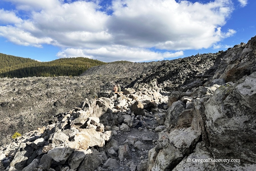
The Big Obsidian Flow covers one square mile of shiny black obsidian and pale pumice


The Big Obsidian Flow is Oregon's youngest major lava flow, located inside the caldera of Newberry Volcano in the Deschutes National Forest, about 40 minutes south of Bend, near Paulina Lake and Paulina Falls.
What makes it special? You can walk right across the top of it. This shiny black volcanic glass formed during an eruption about 1,300 years ago, which is extremely young in geologic time.
The flow covers about one square mile and sits at an elevation of around 6,400 feet. Visiting here feels like stepping into the heart of an ancient volcano, where fire and eruptions shaped the landscape thousands of years ago.
Even on a quiet day, the black obsidian sparkles in the sunlight, creating a striking contrast with the surrounding pine forests and nearby lakes.
The site is open from late May through mid-November, with June through October offering the best conditions for visiting.
🔵 No motorized vehicles or e-bikes are allowed on the trail.
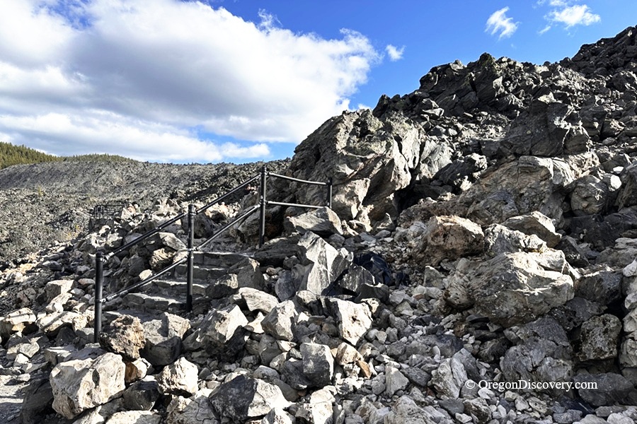
Big Obsidian Flow Geology & History
About 1,300 years ago, molten rhyolite lava erupted from Newberry Volcano and cooled quickly, forming the natural volcanic glass known as obsidian.
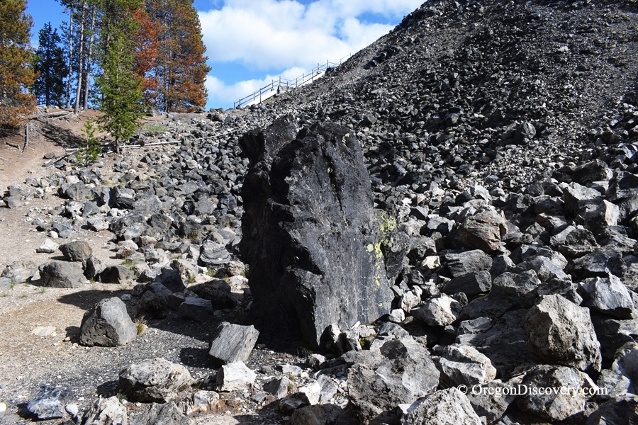
Two main types of volcanic rock cover the flow: glossy black obsidian and lighter, softer pumice. Together, they create the unusual landscape spread across nearly one square mile.
The area is also important for scientists studying volcanic activity, including how obsidian and other volcanic rocks form.
Long before modern research, Native peoples valued this sharp volcanic glass for creating tools, blades, and projectile points.
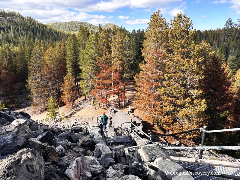
Big Obsidian Flow Hike
A short paved trail leads from the parking area to a lower viewpoint with a panoramic view of the dark, rugged lava field.
For a closer experience, climb the stairs and follow the 1-mile loop trail across the top of the flow. The route gains about 200 feet in elevation and is easy to moderate, but the surface is uneven and covered with sharp obsidian fragments and volcanic gravel.
Seven interpretive panels along the trail explain the eruption, local plants and wildlife, and the importance of obsidian to people who used this resource for thousands of years. Benches along the way provide places to rest and enjoy the unusual scenery.
Keep in mind that there is almost no shade on the trail. Bring plenty of water, especially during summer, and consider starting early to avoid the hottest part of the day.
🟡 Because the trail crosses sharp volcanic glass, sturdy shoes are recommended. Sandals are a poor choice, and dogs are best left at home.
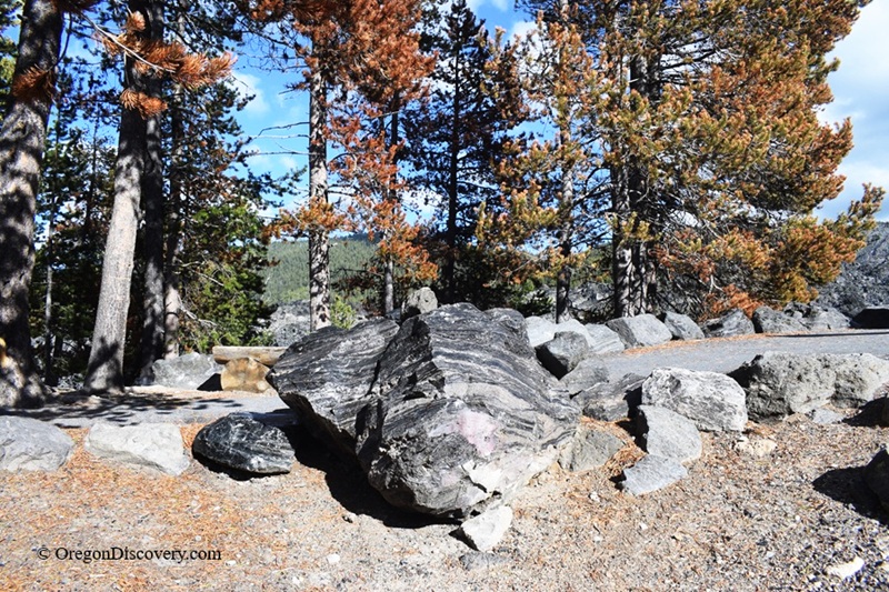
Camping & Lodging near Big Obsidian Flow
Several Forest Service campgrounds are located inside the Newberry Caldera, offering a convenient base for exploring Big Obsidian Flow and other volcanic attractions nearby.
Campgrounds around Paulina Lake and East Lake provide easy access to the area's lakes, trails, and scenic viewpoints.
If you prefer more comfortable accommodations, Bend offers a wide range of hotels, restaurants, and services.
Big Obsidian Flow | Facts
Open: Late May to mid-November
Managed by: U.S. Forest Service
Amenities: Amphitheater, picnic tables, restrooms, interpretive panels
Activities: Hiking, walking, viewpoint, photographing
Distance from the parking: Short, one-mile round-trip loop with about 200 feet of elevation gain to the high point
Road access: Any passenger vehicle during the open season
Day-use fees: Yes, or Interagency Senior/Access/Military Pass
Elevation: 6,400 ft (1,950 m)
The Big Obsidian Flow is located:
- 21 miles east of La Pine
- 29 miles south of Bend
- 95 miles east of Eugene.
Adventures Nearby



Directions to Big Obsidian Flow
From La Pine,
- Drive north on U.S. Highway 97
- Turn east onto Paulina-East Lake Road (Forest Road 21)
- Follow the road for about 21 miles into the Newberry Caldera
- Watch for the Big Obsidian Flow Trailhead sign and turn onto the access road
- Park in the lot near the trailhead.