
• Cape Arago Lighthouse is a decommissioned beacon on a rocky island near Charleston
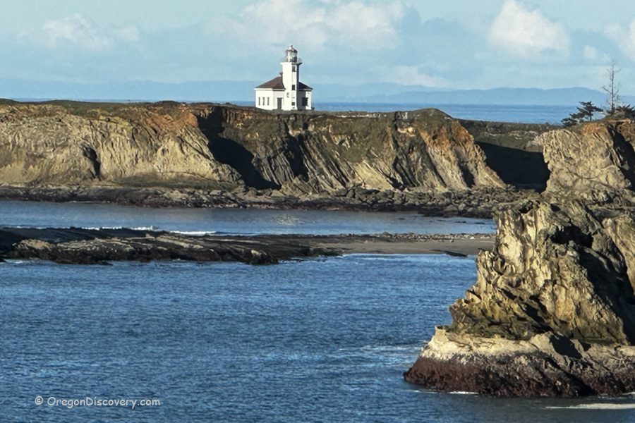
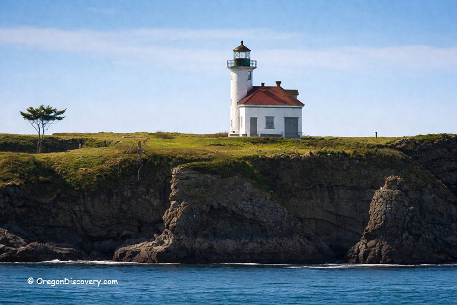
Cape Arago Lighthouse is a historic decommissioned lighthouse standing on a small rocky island near Charleston, Oregon, about 2.6 miles north of Cape Arago on the Southern Oregon Coast. Formerly known as Cape Gregory Lighthouse, it remains one of the most photographed and storied lighthouses near Coos Bay.
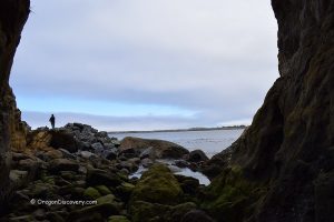
Visitors cannot approach the lighthouse itself. The site is fenced off and closed to the public, and the wooden bridge that once connected the island to the mainland was destroyed by the sea during the winter of 2012–2013. Even so, the views from shore are spectacular, and the history behind this place runs deep.
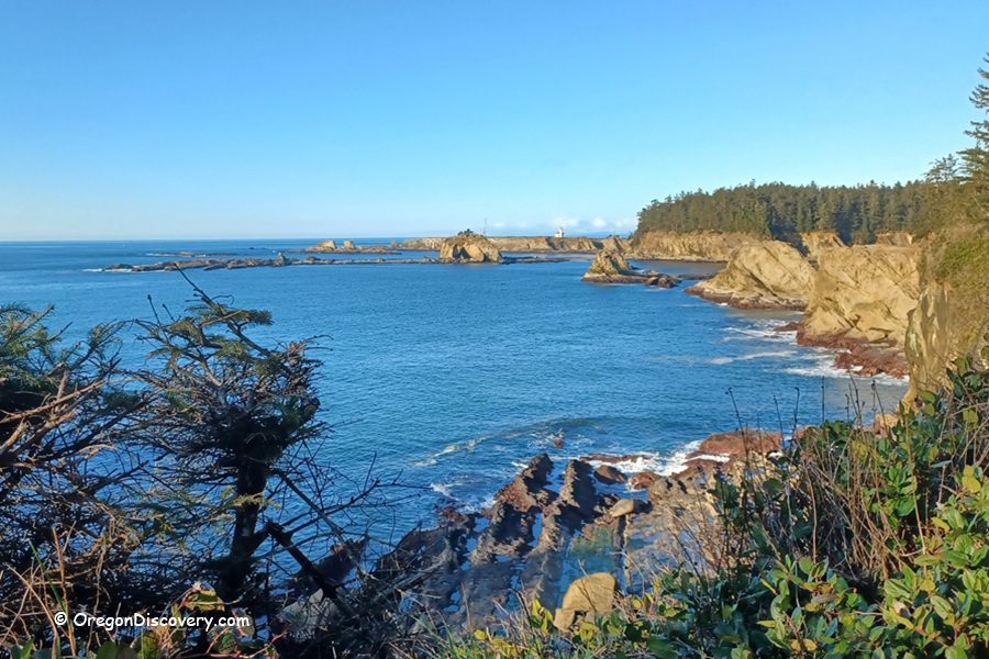
The lighthouse is visible from Yoakam Beach, Lighthouse Beach, and the Lighthouse Lookout.
In 1909, a second lighthouse was constructed. Designed by lighthouse architect Carl Leick, the wooden tower stood 100 feet tall and was positioned higher on the island, producing a much more powerful light. Its design was similar to Mukilteo Light in Washington.
Despite the improvements, erosion continued to threaten the structure.
In 1934, the third and final lighthouse was built. This time, the builders used reinforced concrete to withstand the harsh coastal environment better. The new tower reused the fourth-order Fresnel lens from the second lighthouse and shared a similar design with Point Robinson Light in Washington.
Around this time, the original 1866 tower, which had stood unused for years, was demolished. The second lighthouse was stripped of its lantern and briefly used as an office before it, too, was eventually removed.
The lighthouse was automated in 1966. In 1993, the historic Fresnel lens was replaced with a modern optic, and the lighthouse was added to the National Register of Historic Places.
The beacon continued guiding ships into Coos Bay for another twelve years before it was officially decommissioned on January 1, 2006.
Today, only the 1934 concrete tower remains standing. All other buildings on the island have been removed.
Where to See Cape Arago Lighthouse
Although visitors cannot set foot on the island, several coastal locations offer excellent views of the lighthouse.
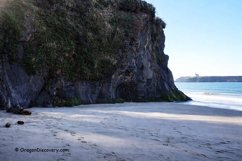
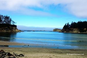
Lighthouse Beach is a secluded stretch of sand tucked between Sunset Bay and Shore Acres. It offers one of the closest mainland views of the lighthouse sitting on its rocky island.
Yoakam Beach also provides excellent vantage point. This quiet and uncrowded beach offers wide views of the lighthouse, the surrounding cliffs, and the open Pacific Ocean.
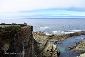
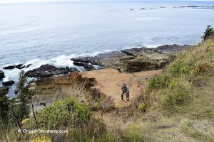
Lighthouse Lookout is a designated viewpoint sits along Cape Arago Highway. On clear days, the view from here is spectacular.
If you're planning to visit Lighthouse Beach or Yoakam Beach, check the tide charts before you go. Low tide gives you more room to walk and better angles for photos. Bring binoculars or a zoom lens because they make a big difference since the lighthouse is across the water on its own island.
Video
Cape Arago Lighthouse History
The story of Cape Arago Lighthouse begins in the mid-1800s, when Coos Bay became one of Oregon's busiest shipping ports. Ships carrying lumber, coal, and other cargo needed a reliable navigational light to guide them safely into the harbor. In 1864, Congress approved funding for a lighthouse at this location.
The first tower was lit in 1866. It was a modest 25-foot octagonal structure with a skeleton base that housed a fourth-order Fresnel lens. The tower stood on the western edge of the island and was connected to the keeper's residence by a 1,300-foot wooden walkway — nearly a quarter mile of boardwalk stretching across exposed rock and crashing surf.
Because the station was completely exposed to Pacific storms, crews spent decades repairing and rebuilding damaged structures. During this time, the station also received a fog signal and a new boathouse to help keepers access the island safely.
By the early 1900s, sailors were demanding a stronger light, and erosion was gradually eroding the island beneath the original tower.
Cape Arago Lighthouse Campground & Lodging
The campground at Sunset Bay has 29 full-hookup sites, 34 tent sites, and 8 yurts. There are flush toilets, hot showers, and firewood for sale.
The campground is open year-round and accepts reservations.
Lodging is also available in Charleston, Coos Bay, and North Bend.
Affordable vacation rentals for short and long-term stays at Charleston and North Bend
Cape Arago Lighthouse | Facts
Tower Height: 44 feet (13 m)
Focal Height: 100 feet (30 m) above sea level
First Lit: 1866 (first tower), 1909 (second tower), 1934 (third tower)
Automated: 1966
Decommissioned: January 1, 2006
Operation: Inactive
Location: Rocky island near Charleston, Oregon, 2.6 miles north of Cape Arago
Open: Closed, viewable from Lighthouse Beach, Yoakam Beach, and Lighthouse Viewpoint
Cape Arago Lighthouse is located:
- 12 miles southwest of Coos Bay
- 15 miles southwest of North Bend
- 87 miles west of Roseburg.
Adventures Nearby


Directions to Cape Arago Lighthouse Lookout
From North Bend,
- Take 540/South Empire Blvd and head southwest for about 12 miles along Cape Arago Highway to Lighthouse Lookout.