
• Cape Meares Beach & Bayocean Peninsula is scenic beach and a buried ghost town site
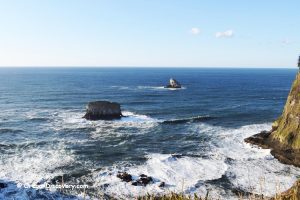
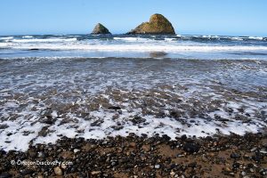
Cape Meares Beach and Bayocean Peninsula sit about 8 miles northwest of Tillamook on the northern Oregon Coast. The peninsula is a narrow sand spit that wraps around Tillamook Bay. It features an open Pacific beach on the west, quiet estuary mudflats on the east, and forested dunes running through the middle.
Here, you can walk for miles and barely see another person. Beachcombing is excellent after winter storms. The bay-side mudflats draw hundreds of shorebirds in spring and fall. And beneath the dunes lies the buried history of Bay Ocean Park, a ghost town gradually eroded by the Pacific over several decades.
Access to the spit is available from both Cape Meares Beach and Bayocean Peninsula Park.
Free parking near Cape Meares Beach provides direct beach access, while Bayocean Peninsula Park (day-use fee required) serves as the main trailhead for exploring the spit.
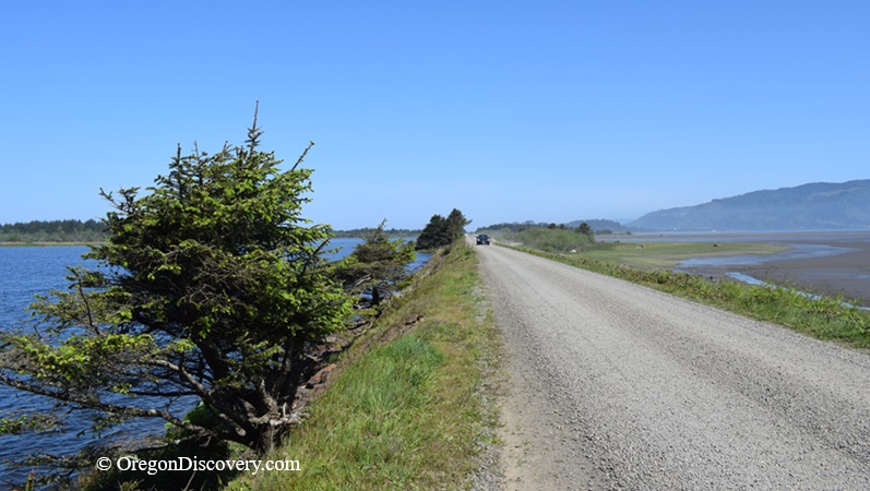
Beyond the park, visitors continue on foot, bicycle, or horseback. The Bayocean Dyke Road can become muddy, and the beach includes stretches of soft sand.
Things to Do at Cape Meares Beach and Bayocean Peninsula
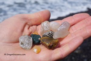
Cape Meares Beach Beachcombing
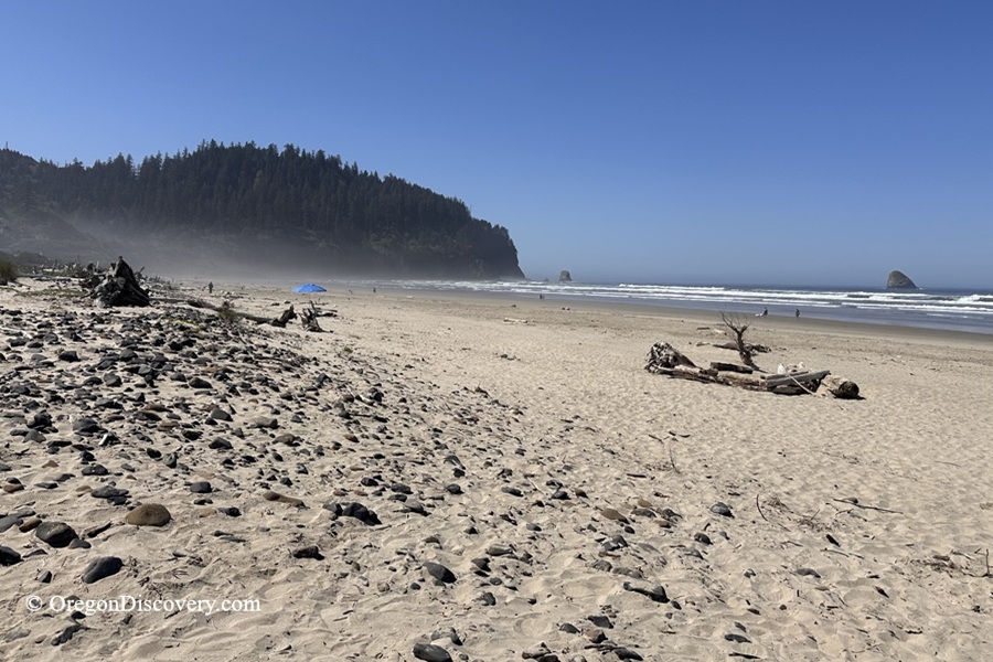
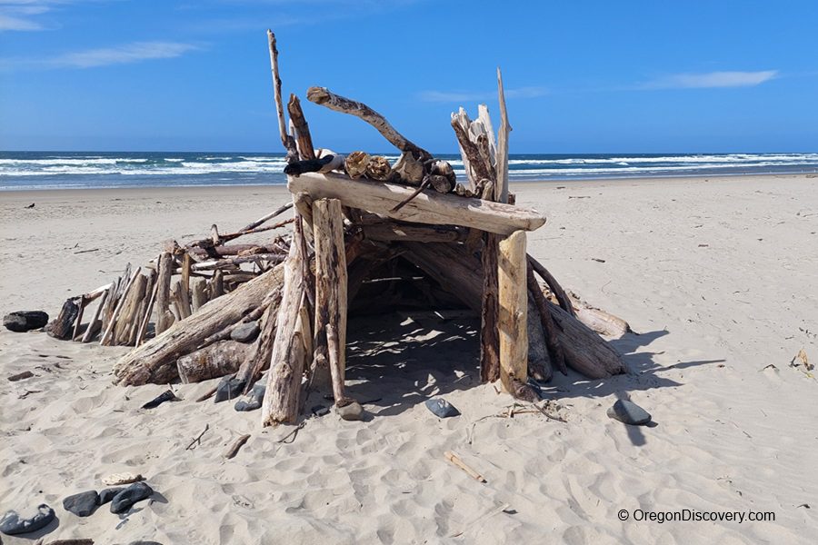
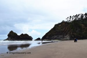
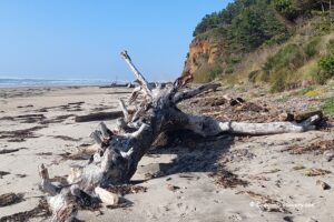
The long stretch of beach between Cape Meares and the south jetty is one of the best beachcombing areas on the Tillamook Coast. Winter storms push driftwood, shells, and polished stones onto the sand. Few people walk this stretch, so finds remain undisturbed longer than on busier beaches.
Bayocean Peninsula Sand Spit Hike
The Bayocean Dike Road runs over 3 miles north along the bay to Kincheloe Point near the Tillamook Bay south jetty. The ocean-side beach covers roughly the same distance.
A full loop with road north of Bayocene Peninsula Park, than returning south via the beach runs about 7 miles round trip.
The terrain is flat, but soft sand slows you down, so allow extra time.
🌊 Safety: Avoid Hiking Near the North End Shoreline at High Tide Conditions
The Bayocean Peninsula is a narrow sand spit, and the beach conditions change with the tide and surf.
Near the north end at the Tillamook Bay south jetty, beach width can vary, and sections may become constrained at higher tides.
Planning beach travel around low tide is recommended.
Cape Meares Fishing and Clamming
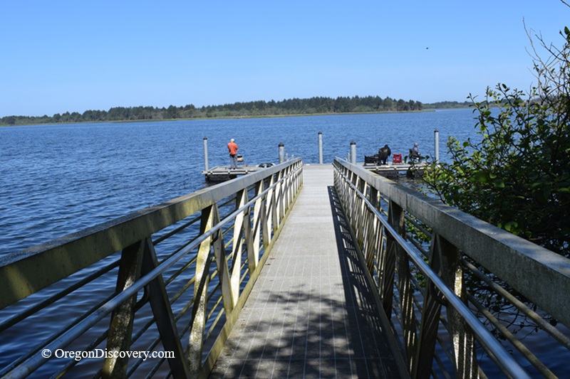
Cape Meares Lake is regularly stocked with rainbow trout by the Oregon Department of Fish and Wildlife.
Stocking typically takes place in spring from March through June, with additional stocking events in early fall, including occasional larger “trophy” trout.
The lake also has a public fishing dock located near the intersection of Bayocean Road and the Bayocean Dike Road, offering easier access to deeper water and improved fishing opportunities.
The south jetty is a productive fishing area for perch, rockfish, lingcod, and occasional salmon, but conditions can be dangerous due to slippery rocks and heavy surf.
On the bay side, experienced diggers harvest gaper clams, butter clams, and cockles in the mudflats. Always carry a valid Oregon shellfish license and check the biotoxin hotline before digging.
Bayocean Ghost Town
Ever walked over a buried town? In 1906, developer T.B. Potter began building Bay Ocean Park here, the so-called "Atlantic City of the West."
By 1914, 600 lots were sold. A natatorium with a heated pool was built and hotels were planned. But the ocean began to slowly erase the shoreline. The natatorium collapsed by 1936, homes fell into the surf, and by the late 1950s the entire town had vanished. Today, sand and dunes cover almost every remaining trace of the town.
Birdwatching
The bay-side mudflats are outstanding for shorebirds. During a moderately low tide in spring or fall, exposed flats attract sandpipers, plovers, dunlins, great blue herons, and bald eagles. Bring binoculars, since the flat terrain makes it easy to scan from the trail.
Camping, Lodging & Vacation Rentals at Cape Meares Beach
No camping is allowed on the beach, but you can stay in Oceanside and Tillamook.
Affordable vacation rentals for short and long term stay in Oceanside
Affordable vacation rentals for short and long term stay in Tillamook
Cape Meares Beach and Bayocean Peninsula | Facts
Open: Year-round (day-use)
Managed by: Oregon State Parks & Tillamook County
Amenities: None
Activities: Hiking, beachcombing, birdwatching, fishing, clamming, and photography
Distance from the parking (Cape Meares Beach): Short
Road access: Any vehicle
Day-use fees: Cape Meares Beach - free; Bayocean Peninsula Park - fee is requred
Cape Meares Beach is located:
- 8 miles northwest of Tillamook
- 25 miles south of Cannon Beach
- 74 miles west of Portland.
Adventures Nearby


Directions to Cape Meares Beach
From Highway 101 in Tillamook,
- Turn west on 3rd Street toward Netarts (State Route 131)
- Drive 1.7 miles to Bayocean Road
- Turn right and follow it for about 5 miles.
For Cape Meares Beach, continue straight for about 0.7 miles.
For Bayocean Peninsula Park, turn right onto a lower access road and drive about 0.9 miles to the parking area.