
• Lighthouse Beach is an uncrowded shoreline with views of Cape Arago Lighthouse
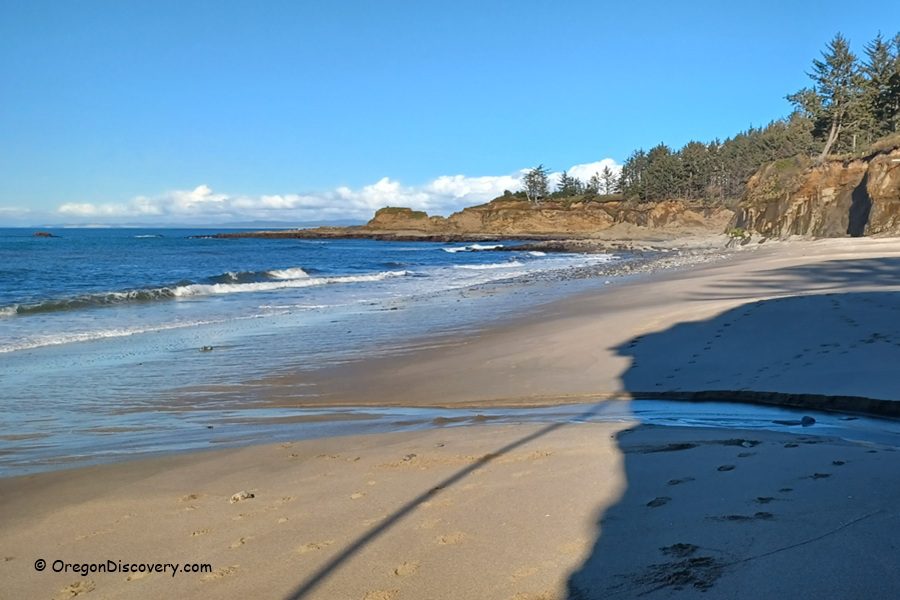
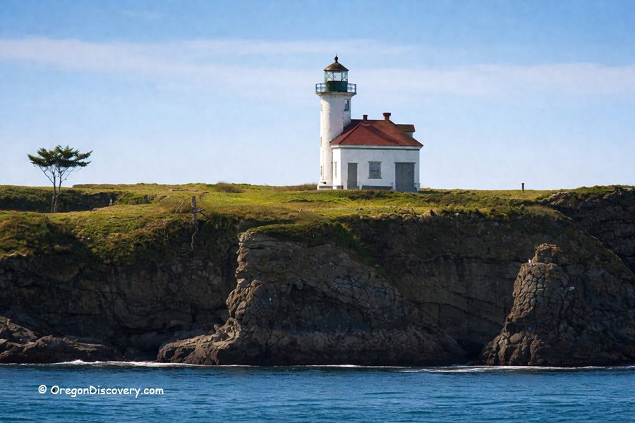
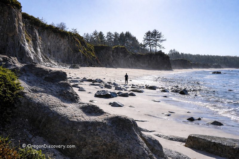
Lighthouse Beach is a hidden coastal gem on the southern Oregon Coast, about 11 miles southwest of Coos Bay near the fishing village of Charleston. It sits between Yoakam Beach to the east and Sunset Bay State Park to the west, stretching roughly half a mile along the shore, with Cape Arago Lighthouse perched on Chief's Island about a quarter mile offshore.
What sets it apart from other beaches near Coos Bay is how quiet it remains. While Bastendorff Beach and Sunset Bay draw steady crowds, Lighthouse Beach remains nearly deserted most of the time.
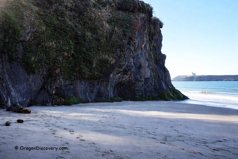
The beach faces west into the full force of Pacific Ocean swells, with coastal cliffs framing both sides and Sitka spruce clinging to the bluffs above.
How to Get to Lighthouse Beach
Getting here takes effort. Property owners have restricted direct public access along the old trail, creating an ongoing dispute that local surfers and community members continue to fight. The most reliable route is walking from Yoakam Beach during a very low tide, carefully crossing a wave-cut rock platform that separates the two beaches.
To reach Yoakam Beach, look for a small "Day Use Only" sign at a narrow pullout along Cape Arago Highway, 0.3 miles west of the Bastendorff Beach entrance road. Parking is very limited.
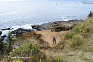
A 300-yard trail leads through coastal forest to a viewpoint, then a steep path with rough rock steps descends to the beach. The trail gets muddy and slippery in wet weather and isn't ideal for limited mobility. Wear sturdy footwear, always check tide conditions before heading down, and give yourself plenty of time to get back because getting caught on a rising tide is dangerous.
Things to Do at Lighthouse Beach
Surfing
Lighthouse Beach has quietly earned a reputation among Oregon Coast surfers. Under ideal conditions, the beach produces a big, clean, curling break that attracts advanced-level surfers. The seclusion is a huge draw. You can ride waves here without the crowds that pack more well-known surf spots.
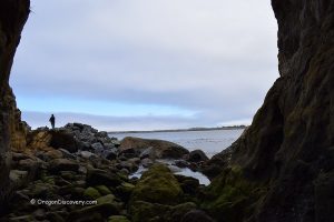
Tide Pool Exploring
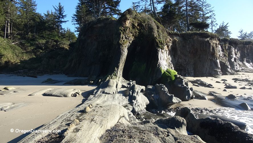
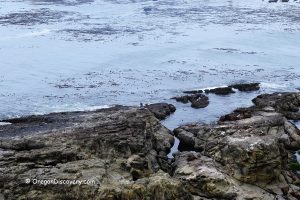
At very low tides, you can walk toward Chief's Island at the western end of Lighthouse Beach and explore colorful tide pools tucked among the rocks. Sea stars, anemones, small crabs, and other marine creatures fill these pools.
The best time to visit is during a minus tide, when the water pulls back far enough to expose rocky shelves that stay hidden the rest of the time. Always check a tide chart before heading out.
Kayaking
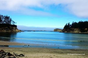
Experienced kayakers occasionally paddle to Lighthouse Beach by launching from Sunset Bay State Park and following the scenic route around Qochyax Island and Gregory Point.
On calm days, it's a beautiful paddle with views of sea cliffs and coastal rock formations.
However, these are rocky waters that can turn rough quickly. Only veteran paddlers with solid open-ocean experience should attempt this route.
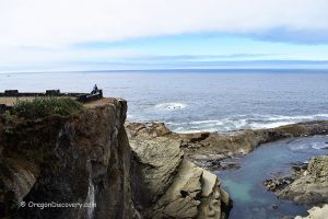
Cape Arago Lighthouse Views
You can't visit Lighthouse Beach without taking in the views of the Cape Arago Lighthouse. The lighthouse sits on Chief's Island, roughly a quarter mile from the shore, and it dominates the view from the western end of the beach. During very low tides, you can walk closer to the island for an even more dramatic perspective.
If you want an additional vantage point, the Lighthouse Viewpoint along Cape Arago Highway, about 1.7 miles from Yoakam Point, provides a scenic overlook.
Camping, Lodging & Vacation Rentals at Lighthouse Beach
There is no camping at Lighthouse Beach or at nearby Yoakam Point. The nearest campgrounds are at Bastendorff Beach County Park and Sunset Bay State Park, both just a short drive away.
For lodging and vacation rentals, the fishing village of Charleston is the closest option and sits roughly 3 miles to the northeast. North Bend and Coos Bay offer many more choices, from budget motels to vacation homes.
Affordable vacation rentals for short and long-term stays at Charleston and North Bend
Lighthouse Beach | Facts
Open: Year-round for day-use
Managed by: Oregon State Parks
Amenities: None
Activities: Surfing, surf fishing, tide pool exploring, kayaking, birdwatching, beachcombing
Distance from the parking: Short
Road access: Any vehicle
Day-use fees: None
Happy Camp Beach is located:
- 11 miles southwest of Coos Bay
- 50 miles north of Port Orford
- 82 miles northwest of Roseburg.
Adventures Nearby


Directions to Lighthouse Beach (via Yoakam Beach)
From North Bend,
- Take 540/South Empire Blvd and head southwest for about 7 miles along Cape Arago Highway
- Look for the small "Day Use Only" sign at the pullout, 0.3 miles west of the Bastendorff Beach entrance road.
Park at the pullout, hike the 300-yard trail to the beach, and cross to Lighthouse Beach at low tide.