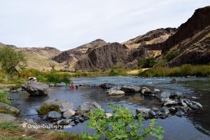
• Leslie Gulch is a stunning rugged canyon with unique rock formations
• The area has hiking trails of various lengths and difficulty
A part of the Owyhee Canyonlands, Leslie Gulch is known for its dramatic volcanic formations and diverse ecosystems within the rugged landscapes of southeastern Oregon.
A primary way to explore the area is Leslie Gulch Road leading to trailheads of various hiking trails, Slocum Creek Campground, and Leslie Gulch Recreation Area with a boat ramp on the bank of Owyhee Reservoir.
Named after Hiram E. Leslie, a local rancher who tragically died after being struck by lightning in 1882, Leslie Gulch is steeped in both natural beauty and historical intrigue.
Nature and Geology
The area is distinguished by its striking rock formations, featuring towering cliffs and honeycombed rock faces that have been sculpted from volcanic ash over millions of years.
The predominant geological material in the area is tuff formed by the consolidation of volcanic ash, which shapes much of the landscape.
This unique geology supports a unique soil composition, creating a home for rare plant species. Some of these are found only in this area.

Leslie Gulch Hiking
Leslie Gulch has several hiking trails of varying lengths and difficulties:
The Juniper Gulch Trail is a 3.3-mile round-trip hike through varied terrain, including narrow sandy washes and overhanging cliffs. The elevation gain here is about 1,046 feet.
Timber Gulch Trail is a 1.2-mile, easy round-trip hike that leads into a natural amphitheater surrounded by pinnacle cliffs.
Upper Leslie Gulch Trail is a 4.1-mile out-and-back route with an elevation gain of 400 feet, offering panoramic views of the canyon.
Dago Gulch Trail is an easy 1.6-mile trail with caves and overhangs.
Rockhounding
Leslie Gulch is an Area of Critical Environmental Concern, so rockhounding is prohibited. The closest place to collect rocks is at Owyhee Reservoir. Follow BLM guidelines for rock collecting.
Owyhee Canyonlands have more places for rockhounding, including Succor Creek State Natural Area, Haystack Butte, Negro Rock, and Twin Springs.

Fishing and Boating
The Owyhee Reservoir, adjacent to Leslie Gulch, is a popular spot for fishing and boating. Anglers can catch crappie, rainbow trout, largemouth bass, smallmouth bass, yellow perch, and brown bullhead.
Leslie Gulch has a boat launch.
Swimming and Kayaking
The Owyhee Lake is a fantastic place for various water activities, including swimming and kayaking. However, be mindful of the speed and the presence of fishing boats.
Wildlife Watching
The Leslie Gulch supports a diverse array of wildlife. It is home to one of the nation's largest herds of California bighorn sheep. You can also see mule deer, Rocky Mountain elk, coyotes, and bobcats here.
Bird watchers can enjoy sightings of chukar, California quail, northern flickers, white-throated swifts, and various raptors.
Know Before You Go
Leslie Gulch is an Area of Critical Environmental Concern; therefore, collecting rocks, vegetation, or firewood here is strictly prohibited.
The roads can be rough, so ensure your vehicle is roadworthy. High-clearance vehicles are recommended. Large recreational vehicles are not recommended. Wet roads or winter conditions can make the road impassable. Also, the area is prone to flash floods, so pay extra attention to the reservoir.

Leslie Gulch Camping, Lodging, & Vacation Rentals
The only spot to camp at the gulch, Slocum Creek Campground has nine campsites, some of which offer accessible amenities. It provides basic amenities, including pit toilets and picnic tables, but lacks potable water. This is a first-come, first-served campground.
The closest lodging is available in Homedale, Idaho.
Affordable vacation rentals for short and long-term stays in Homedale
Leslie Gulch | Facts
Open: Year-round
Managed by: Bureau of Land Management
Amenities: Vault toilets, picnic tables, campground, boat launch
Activities: Hiking, nature viewing, photography, picnicking, boating, fishing, swimming, kayaking, camping
Distance from the parking: Varies
Road access: Any vehicle
Day-use fees: None
Elevation: 2800 ft (853 m) at the lake
Leslie Gulch is located:
- 79 miles southwest of Boise
- 176 miles southeast of Burns
- 306 miles southeast of Bend.
Adventures Nearby
Directions to Leslie Gulch
From Jordan Valley,
- Take US-95 North/Bassett Street for 18.2 miles
- Turn left onto Succor Creek Road and follow it for 3 miles
- Slight right to stay on Succor Creek Road and follow it for 5.5 miles
- Turn right to stay on Succor Creek Road and follow it for 1.5 miles
- Turn left onto Leslie Gulch Road and follow it for 14 miles.
Phone: 541-473-3144

