
• Enjoy recreational gold panning along Quartzville Creek’s 12-mile Wild and Scenic River corridor
Quartzville Creek in Linn County is one of Oregon's most popular public gold panning destinations. The creek flows through ancient volcanic terrain about 50 miles east of Sweet Home along the Quartzville Back Country Byway.
Ancient volcanoes formed this region millions of years ago. Lava flows, volcanic ash, and underground magma built the surrounding mountains. Gradually, rain, snow, and rivers broke down those volcanic rocks and carried the pieces into the creek. Most rocks here are igneous, formed from cooled lava or volcanic material.
Miners named this creek in the late 1800s during Oregon's gold rush. Early prospectors found gold and spotted white quartz veins in the surrounding hills.
Because quartz often occurs near gold deposits, the mining community became known as "Quartzville." Small mining camps once operated here, and traces of that history remain today.
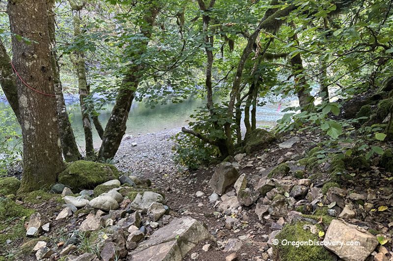
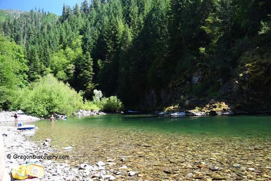
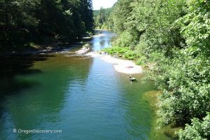
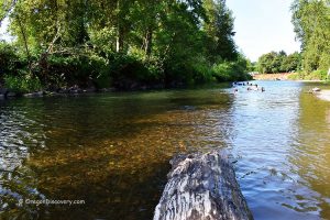
Several pullouts and recreation sites along the road provide easy access to the river.
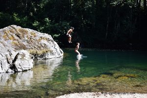
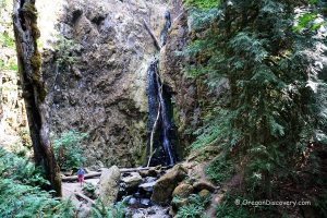
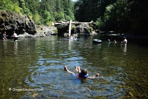
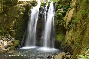
In summer, you can visit Yellowbottom Recreation Site, a popular swimming area, though gold panning is not allowed there.
Quartzville Creek Gold Panning and Rockhounding
Recreational Gold Panning
The 12-mile stretch of the creek, from Green Peter Reservoir to the edge of Willamette National Forest, is designated as a Wild and Scenic River.
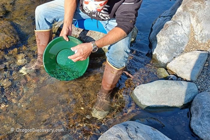
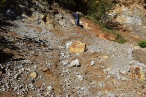
Along this corridor, BLM lands allow recreational gold panning without a mining claim. Some small amounts of placer gold can still be found in the creek gravel.
Over millions of years, gold from mineralized veins in the volcanic rocks was released by weathering and washed into the stream. Flowing water naturally sorted the heavier gold into cracks, bedrock pockets, and gravel bars. The best material concentrates behind large boulders and along the inside of bends, where the current slows.
In this area, panners can find fine gold, tiny flakes, and occasional small nuggets in shallow sand and gravel bars. A gold pan and small sluice handle work best, while classifiers or screens help remove larger rocks before washing.
Rockhounding
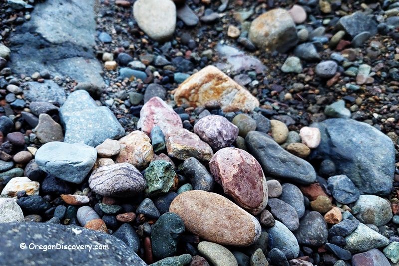
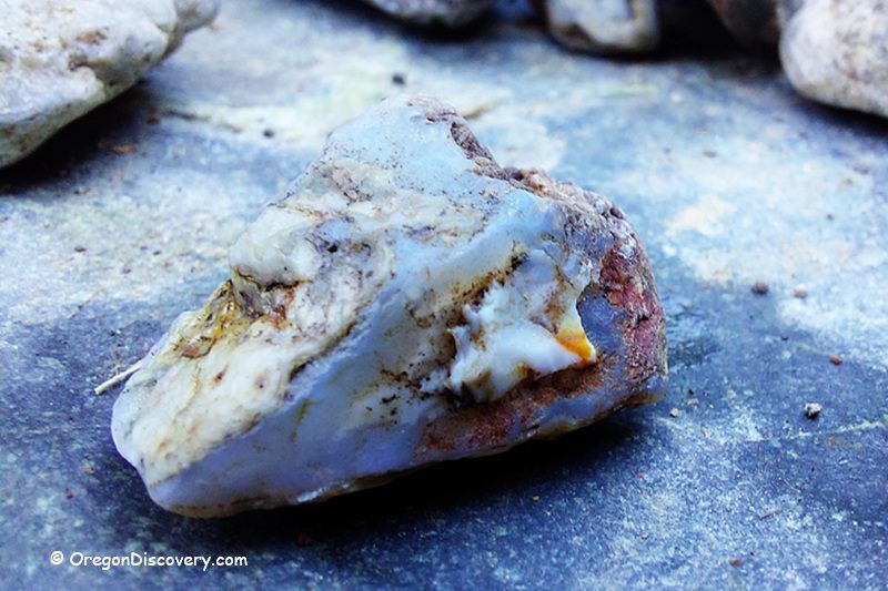
Quartzville Creek's gravels contain a variety of volcanic rock types from the Western Cascades such as as andesite and basalt along with silica‑rich rhyolite and tuff, and quartz is a common mineral in the gravels, with occasional native gold reported in nearby localities.
Dark andesite and basalt are common, reflecting iron and magnesium-rich minerals. Flow-banded rhyolite appears in pink to purple colors from higher silica content and staining. Altered basalt often shows green tones from chlorite or epidote minerals.
Pebble gravels contain chalcedony, agate, jasper in red, yellow, and brown shades, clear to milky quartz, calcite, and breccia. These colors and textures reflect the region's volcanic origins and the sorting and smoothing action of the creek. Most specimens appear as small surface rocks or river-tumbled stones.
Collectors must follow surface-only limits and posted rules.
Best season: Late summer through early fall offers the lowest water levels and safest wading conditions. By August, gravel bars fully expose, and water temperatures warm for comfortable prospecting.
Several pullouts and recreation sites along the road provide easy access to the creek.
Quartzville Creek Camping, Lodging & Vacation Rentals
Dispersed camping is available along the Quartzville Back Country Byway for tents and trailers. Sites are first-come, first-served with no facilities. These primitive spots offer beautiful views of the creek.
Bring your own water and pack out all trash.
Quartzville Group Camp is managed by Linn County and requires reservations. This site accommodates groups, tents, and trailers, with basic amenities such as fire rings and picnic tables.
Yellowbottom Recreation Site provides camping with easy creek access. It's popular for swimming, fishing, and enjoying the surrounding forest. Gold panning is not allowed here.
Old Miners Meadow Group Use Area is a group site along the river with vault toilets, picnic tables, and campfire rings. It's ideal for larger groups seeking a scenic river setting. Reservations for Old Miners and Yellowbottom are required via recreation.gov.
For more comfortable accommodations, you can stay at the town of Sweet Home.
Quartzville Creek Prospecting | Facts
Best time: Late summer through early fall
Managed by: Bureau of Land Management (BLM)
Rocks & Minerals: Fine gold, flakes, occasional small nuggets, quartz, calcite, chalcedony, agate, jasper, andesite, basalt, rhyolite, breccia
Tools: Gold pan, sluice, classifier, snuffer bottle
Distance from the parking: Short
Road access: Any vehicle
Fees: None
Elevation: 1,200 ft (366 m)
Adventures Nearby
Directions to Quartzville Creek
From Interstate 5,
- Take Exit 233 at Albany and head east on US-20 toward Sweet Home
- Continue approximately 40 miles to Sweet Home, then turn north onto Quartzville Road
- Follow the Quartzville Back Country Byway east along the creek to reach access points.
Site 1: N 44°32.953' W 122°25.497' | 44.54935, -122.42492
Site 2: N 44°33.438' W 122°25.003' | 44.55746, -122.41663
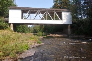
Site 3 (Boulder Creek Bridge): N 44°33.918' W 122°24.578' | 44.56542, -122.40964