
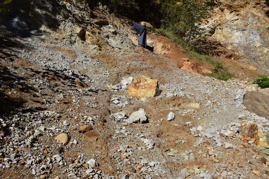
• Boulder Creek Pyrite is exposed in a colorful road cut near Quartzville Creek
Boulder Creek sits about 30 miles east of Sweet Home in the Quartzville Creek recreation area. The site is known for exposed pyrite, also known as "fool's gold," along a colorful, rust-stained road cut in the Willamette National Forest. On sunny days, the crystals catch the light and sparkle, making the site easy to spot from the road.
Pyrite formed long ago from hydrothermal activity in the Cascade Range. Hot mineral-rich water carrying iron and sulfur moved through cracks in volcanic rocks such as basalt and andesite.
As it cooled, pyrite (iron sulfide) began to form, often together with quartz in small cracks and veins.
Over time, the surrounding volcanic rock was chemically altered and broke down into softer, clay-rich material.
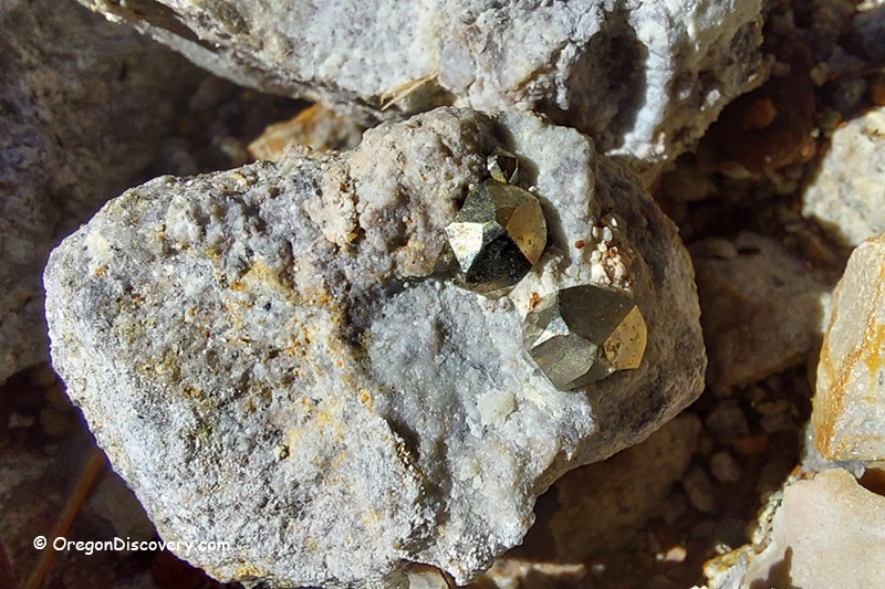
The harder pyrite crystals resisted weathering. As a result, pyrite can now be found in crumbly, gray or rust-colored rock along the road cut.
Boulder Creek Rockhounding
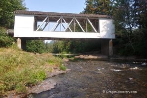
The collecting site is located about 1.6 miles from the Boulder Bridge, which crosses Quartzville Creek.
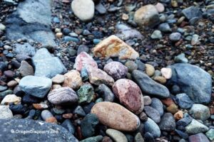
The pyrite crystals occur as well-formed 12-sided shapes, mostly ranging from ¼ to ½ inch across. Some larger matrix pieces contain clusters of crystals that reach several inches in size. The best specimens are those where multiple crystals remain attached to the host rock.
The most productive areas are the softer, more weathered parts of the road cut. Rain helps break down the clay-rich material, exposing crystals hidden in the hillside.
In many sections, the rock is soft enough to break by hand, although a small geology pick is still useful. A bucket and spray bottle are also helpful tools.
🔵 Collect with caution. Watch for loose and unstable rocks above you. Also, in dry conditions, the clay can create fine dust, so eye protection and a dust mask are recommended.
Quartzville Creek Recreation Area
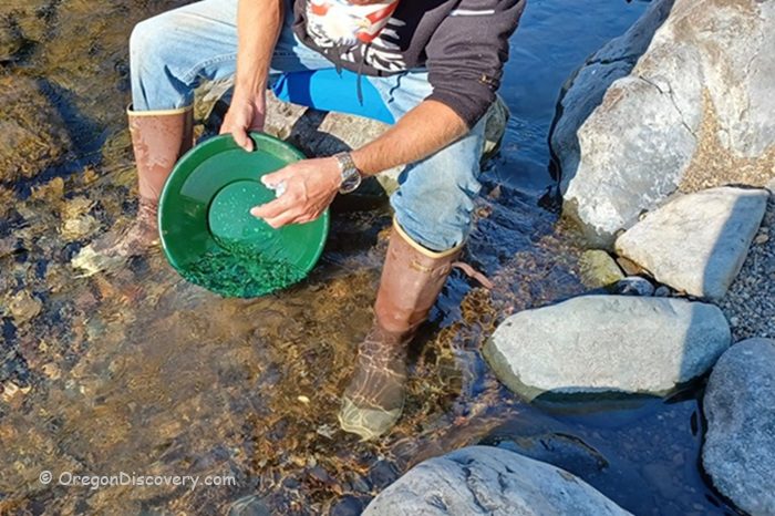
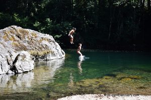
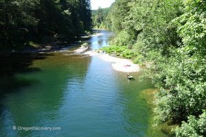
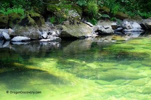
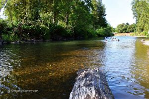
The Quartzville Creek corridor is one of Oregon's most popular recreation areas. In addition to rockhounding, you can enjoy recreational gold panning along BLM-managed sections of the creek, swimming at Yellowbottom Recreation Site, fishing for native trout, and hiking in the Willamette National Forest.
The Quartzville Back Country Byway is a scenic 50-mile drive through old-growth forest past mountain streams and volcanic peaks. Nearby, Foster Lake and Green Peter Reservoir offer boating, camping, and other outdoor recreation.
Several pullouts and developed recreation sites along the road provide easy access to the creek and surrounding forest.
Boulder Creek Camping, Lodging & Vacation Rentals
Dispersed camping for tents and trailers is available along the Quartzville Back Country Byway. All sites are first-come, first-served with no facilities.
Make sure to bring your own water and pack out all trash.
Quartzville Group Camp (managed by Linn County) requires reservations. This site accommodates tents, groups, and trailers, with basic amenities such as fire rings and picnic tables.
Yellowbottom Recreation Site provides camping with easy access to the creek. It's popular for fishing, swimming, and enjoying the surrounding forest. Gold panning is not allowed here.
Old Miners Meadow Group Use Area is a group site along the river with picnic tables, vault toilets, and campfire rings. It's ideal for larger groups wanting a scenic river setting. Reservations for Yellowbottom and Old Miners are required via recreation.gov.
For more comfortable accommodations, you can stay in Sweet Home, about 30 miles west.
Boulder Creek Pyrite Rockhounding | Facts
Best time: Late spring through early fall
Managed by: U.S. Forest Service - Willamette National Forest
Rocks & Minerals: Pyrite
Tools: Geology pick, bucket, old towel, spray bottle
Distance from the parking: Short
Road access: Any vehicle
Day-use fees: None
Elevation: 1,930 ft (590 m)
Adventures Nearby
Directions to Boulder Creek
- Head east on US 20 for approximately 5.5 miles
- Turn left (north) onto Quartzville Road
- Follow Quartzville Road for about 20.3 miles, passing Foster Lake and Green Peter Reservoir
- Cross the bridge on your left and take the left fork up Boulder Creek Road
- Continue uphill for approximately 1.6 miles.