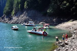
Fishing
The creek supports populations of smallmouth bass, crappie, yellow perch, cutthroat trout, and rainbow trout. Small runs of Chinook salmon and steelhead are also present, but the creek is closed to salmon and steelhead angling. Trout fishing is open from late May through October on a catch-and-release basis only. Warmwater gamefish may be taken during trout season, with no catch limit.
Whitewater Kayaking
Thomas Creek is known among whitewater kayakers. The upper 5-mile section is rated Class III to IV, while the 9.5-mile lower section ranges from Class II to III depending on flow volume.
Rockhounding
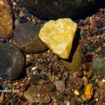
The creek is popular among rock collectors for its agate, jasper, petrified wood, and fossils. Be aware that most creek banks are privately owned and marked with “No Trespassing” signs. Only a few areas lie on public land.
The best time for rockhounding along Thomas Creek is during low water levels, when gravel deposits are exposed and the stream can be easily forded.
Thomas Creek Rockhounding - Oregon's Creek for Agates and Covered Bridges
Larwood Covered Bridge
 Located right by the Larwood Wayside Park at the junction of the Roaring River and Crabtree Creek, Larwood Covered Bridge over Crabtree Creek is one of the six covered bridges within a short distance from Scio and Stayton.
According to "Ripley's Believe It or Not", it's the only place in the world, where a river empties into a creek.
Larwood Covered Bridge: Where the Roaring River Meets Crabtree Creek

Hoffman Covered Bridge
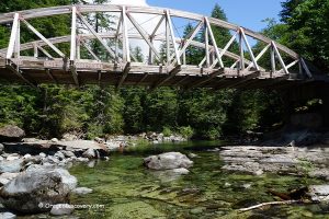
 Hoffman Covered Bridge a historic wooden structure over the Crabtree Creek. Built with only hand tools, the 90-foot bridge is accentuated by two Gothic-style windows on each side, an exposed roof truss design, and a trapezoidal-shaped portal.
Swimming under the bridge is relaxing and enjoyable.
Hoffman Covered Bridge: A Historical Landmark on Crabtree Creek
Gilkey Covered Bridge
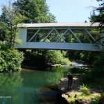
 Built in 1939 over Thomas Creek, Gilkey Covered Bridge is a part of the scenic Covered Bridges Tour Route near Scio and Stayton. The bridge was named after the town of Gilkey, which started as a railroad station in 1880.
In addition to historic value, Gilkey Covered Bridge is a great spot for swimming, rockhounding, and fishing.
Gilkey Covered Bridge – History and Recreation on Thomas Creek
Hannah Covered Bridge
 Built in 1936, Hannah Covered Bridge, also known as Thomas Creek Bridge, spans the Thomas Creek that begins in the Willamette National Forest and flows 35 miles west to the South Santiam River.
The site offers swimming, fishing, and rockhounding opportunities.
Hannah Covered Bridge – A Historic Landmark on the Covered Bridge Tour
Broken Dam at Jordan Bridge
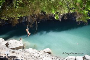
 One of the most scenic swimming spots on Thomas Creek is located at Jordan Bridge near Highway 226. Previously, the creek was spanned by Jordan Covered Bridge, constructed in 1937.
Though the site is undeveloped, it attracts water enthusiasts who enjoy sunbathing, swimming, and rock jumping during the hot summer months.
Broken Dam – Swimming and Fishing at Jordan Bridge on Thomas Creek