

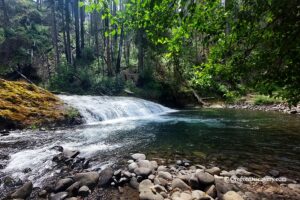
• A narrow and deep stretch of the creek with interesting rock formations
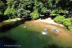
The beautiful swimming hole is just a few hundred feet from Broken Bowl Campground, nestled in a narrow creek channel defined by bedrock, unique rock formations, and smooth river stones. Downstream, you will find a gravel beach, underwater ledges, and a small pebble island with creek rapids flowing around it.
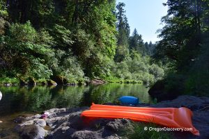
This area has no amenities. Please respect the site and pack out all trash.
Beyond the swimming hole, outdoor enthusiasts can explore the 13.7-mile Fall Creek National Recreation Trail. This scenic route winds through the Fall Creek corridor, offering stunning views, stream crossings, and plenty of inviting spots for swimming, fishing, and picnicking.
Broken Bowl Campground
Known for its quiet, friendly environment, Broken Bowl Campground offers 16 campsites (including 10 tents only) and features flush toilets, drinking water, and picnic tables.
Dolly Varden Campground is just 0.25 miles west of Broken Bowl. It has 5 tent sites, a vault toilet, and picnic tables.
Reservation for both campgrounds is recommended in advance at www.recreation.gov.
Fall Creek – Broken Bowl | Facts
Open: May - September from sunrise to sunset
Managed by: US Forest Service
Amenities: None
Activities: Swimming, hiking, fishing
Distance from the parking: Short
Road access: Any passenger vehicle
Day-use fees: None
Elevation: 1,000 ft (305 m)
Broken Bowl Swimming Spot is located:
- 31.4 miles east of Eugene
- 93 miles southeast of Salem
- 140 miles southeast of Portland.
Swimming hole rating: 3 out of 5
Body of Water: River
Water quality: Transparent
Current: Light to moderate
Depth: Deep and shallow
Beach: Bedrock and rock formation
Water T° (summer): Cool
Adventures Nearby


Directions to Broken Bowl
From I-5,
- Take Exit 194 A in Eugene for Highway 126 East
- Follow on Highway 126 for 6.6 miles to Bob Straub Parkway
- Go 7.6 miles straight onto Bob Straub Parkway, then Highway 222 South and Jasper/Jasper Lowell Roads to Place Road
- Turn left onto Place Road/Big Fall Creek Road and continue 4.5 miles
- Bear left after passing Winberry Creek Road and follow for about 11 miles to the destination on the right.