
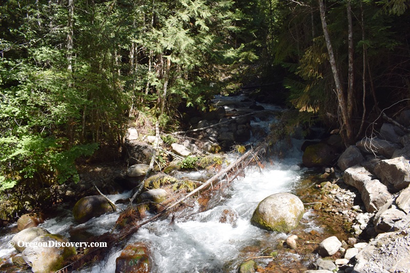
• The North Santiam River transports Cascade volcanic rocks, depositing them in gravel bars
The North Santiam River originates near Mount Jefferson in the western slopes of the Cascades and flows west through forested canyons. It joins the South Santiam River at Jefferson, forming the Santiam River, and eventually flows toward the Willamette River.
As it travels downstream, the river cuts through layers of volcanic rock formed millions of years ago. The geology plays a major role in what you can find along its banks.
Basalt flows, ancient lava deposits, and silica-rich fluids once moved through cracks in cooling rock, forming minerals like agate, jasper, and quartz.
In some areas, buried wood from ancient forests gradually replaced silica, forming petrified wood.
As erosion continues, these materials are released from the surrounding rock and carried downstream by the river, naturally tumbling and polishing them along the way.
This constant movement is what makes the North Santiam River a rewarding place to search. New material is always being exposed, especially after seasonal floods.
North Santiam River Rockhounding
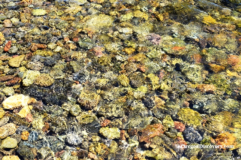
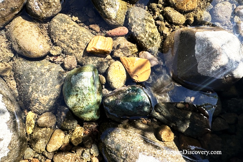
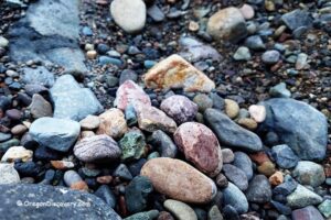
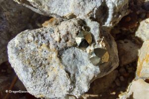
The most common materials found along the North Santiam River include basalt, quartz, agate, jasper, and petrified wood.
Agate tends to show clear and yellow colors with soft banding.
Jasper is common and appears red, brown, yellow, and occasionally greenish hues.
Petrified wood, usually in muted earth tones like black, brown, and dark reddish shades, often with subtle wood grain still visible.
Water levels play a key role in rockhounding here. As the river rises and falls, gravel bars are rearranged, exposing fresh material.
The most productive areas are where the river slows down and drops material.
North Santiam River Gravel Bars & Access Areas
Along the river corridor, there are a few great places with extended gravel bars and easy access to the river.
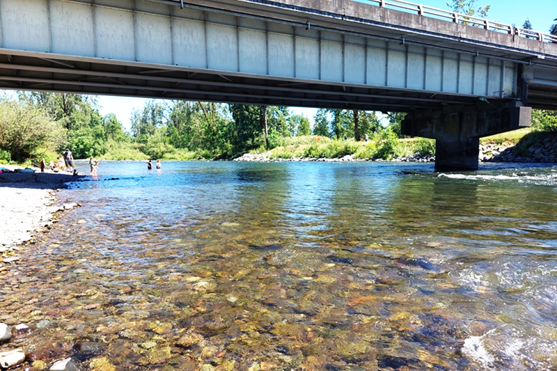
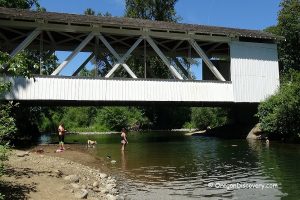
Stayton Bridge
Closer to Stayton, the river enters the valley, becoming more braided and slower-moving. It allows broader gravel deposits, easier walking, bank access, and smaller, well-rounded stones.
Fishermen’s Bend Site between Mehama and Mill City
Fisherman Bend is a public recreation access point where the river widens and slows. Gravel bars are exposed well during low water levels, which makes it easier to walk along the shoreline compared to canyon sections.
Upstream of Detroit Lake, access becomes more limited due to steep canyon terrain and forest, but there are still a few entry points:
- Breitenbush River in Detroit Canyon Zone
- Marion Creek Area
North Santiam River Outdoor Activities
The North Santiam River is not a destination where large or rare mineral finds are guaranteed, though occasional discoveries are still possible along its gravel bars and riverbanks.
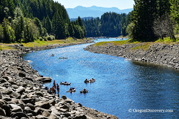
The area is valued for its easy access, forested landscapes, and wide range of outdoor recreation opportunities. Visitors come here for hiking, fishing, river exploration, photography, and seasonal water activities, all set within the scenic western slopes of the Cascade Range.
The surrounding region adds even more to the experience.
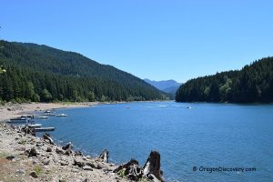
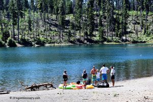
Detroit Lake is a popular spot for boating, swimming, and camping, while Lower Breitenbush Hot Springs and Breitenbush Hot Springs offer a more relaxing natural retreat.
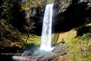
Nearby Silver Falls State Park is known for its impressive waterfalls and well-maintained trail system.
The Little North Santiam River is also popular for its scenic natural beauty and refreshing swimming holes .
Together, these destinations make the North Santiam River is a great area to explore.
North Santiam River Camping and Lodging
There are several campgrounds along the North Santiam River and the Detroit Lake area.
Detroit Lake State Park is the largest campground, offering 107 full-hookup sites, 68 electric/water sites, and 96 tent sites. The park also provides boat ramps, a fishing dock, swimming areas, a playground, and basketball and volleyball courts. Reservations are required.
Cove Creek Campground offers 60 campsites, including 55 single sites and 5 double sites. It can accommodate trailers up to 30 feet in length. Reservations are required.
South Shore Campground, located on the southeast side of Detroit Lake, features 25 single sites and 5 double tent sites, along with access to boating, fishing, and hiking opportunities.
Detroit Lake & Big Cliff Lake Recreation Area
For additional lodging options, the city of Salem is within driving distance and offers a wide range of hotels and accommodations.
North Santiam River Rockhounding | Facts
Open: From late spring trough early fall
Managed by: Bureau of Land Management (BLM) & U.S. Forest Service
Rocks & Minerals: Jasper, agate, petrified wood, quartz
Tools: Geology pick, sand dipper beach scoop
Distance from the parking: Varies
Road access: Any vehicle
Fees: None
Elevation: 400 - 2,000 ft (120 - 600 m)
Adventures Nearby


Directions to North Santiam River Stayton Bridge Collecting Site
From Interstate 5,
- Take exit 253 in Salem and head east on OR-22 (North Santiam Highway) toward Detroit Lake
- Drive 11.5 miles and take exit 13 toward Stayton/Sublimity, then turn right onto Cascade Highway
- Continue south on Cascade Highway for 1.6 miles to the parking area near the river.
GPS (Stayton Bridge): N 44°47.587' W 122°47.655' | 44.793, -122.794
For additional locations, return to OR-22 and continue east, as the highway follows the North Santiam River through much of the canyon.
GPS (Fishermen's Bend Recreation Site): N 44°45.363' W 122°30.797' | 44.756, -122.513