

• Thomas Creek combines mineral hunting with covered bridges and swimming holes
Thomas Creek begins on the western slopes of the Cascade Range in the Willamette National Forest. It flows about 35 miles west before joining the South Santiam River east of Scio, between Salem and Albany.
The creek drains a landscape shaped by repeated volcanic eruptions.
Lava flows, ash, and broken volcanic rock cover the region.
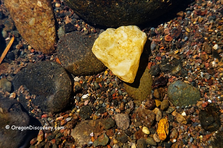
Silica-rich groundwater once moved through cavities and fractures in these rocks. Over millions of years, it formed agate, jasper, chalcedony, and quartz inside the cavities.
Later, erosion broke down the volcanic rocks, releasing these harder minerals. Rain, frost, and flowing water carried them into the creek, where they tumbled smoothly in the gravel beds.
This natural process is what makes Thomas Creek rockhounding so rewarding. Each winter flood reshuffles the gravel bars and exposes fresh material.
Thomas Creek Rockhounding
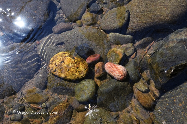
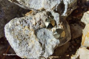
The most common materials along Thomas Creek include agate, jasper, petrified wood, and calcite.
Agates here are mostly clear, though gray, blue, and light carnelian shades also occur. Some pieces measure 2 to 3 inches across.
Jasper appears in bright red, yellow, brown, green, and multicolored patterns.
Petrified wood from the Oligocene epoch (about 23 to 34 million years ago) shows up in brown and black tones, often with visible grain.
Water levels greatly affect collecting conditions here. Low water from late summer through early fall exposes the best gravel bars. So plan your trip between July and October for the best results.
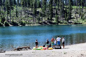
Thomas Creek Access at Thomas Creek Drive
A heads-up before you go: most creek banks are privately owned and marked with "No Trespassing" signs. Only a few areas are on public land, but most are County Parks.
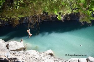
This spot at Thomas Creek Drive is the last public access point, sitting at 450 ft elevation on BLM land.
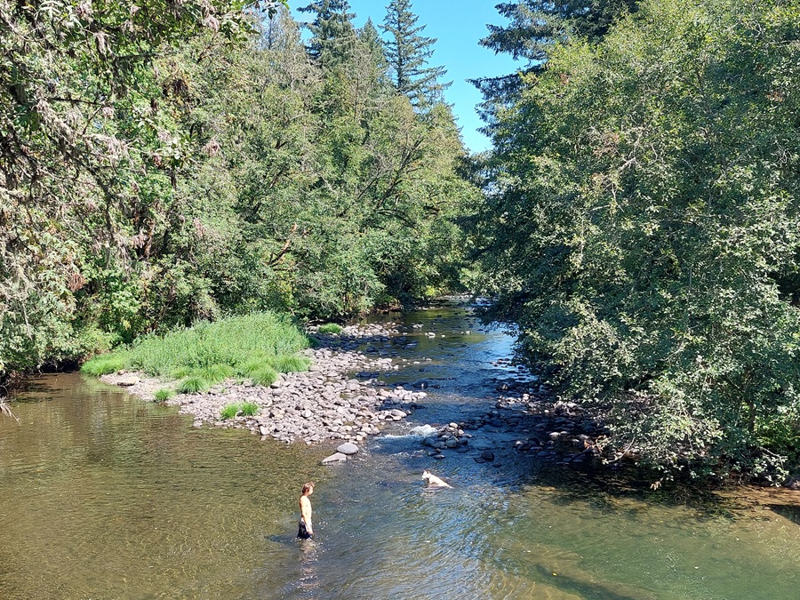
It's a popular swimming destination with a rope swing, a pebble bottom, and a small shady beach.
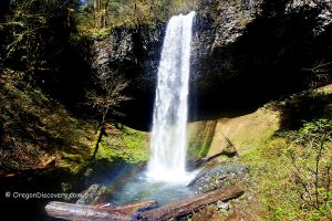
Thomas Creek Outdoor Activities
Thomas Creek is more than just a rockhounding spot.
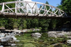
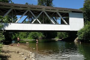
The area is famous for its historic covered bridges, with three of the six bridges on the popular self-guided Covered Bridge Tour crossing Thomas Creek: Gilkey, Shimanek, and Hannah.
In summer, the creek warms to a comfy 70–75°F, making it perfect for swimming, even for kids.
Anglers come for smallmouth bass, crappie, yellow perch, cutthroat trout, and rainbow trout. Trout fishing runs from late May through October on a catch-and-release basis. The creek is closed to salmon and steelhead angling.
Whitewater kayakers love this creek, too. The upper 5-mile section runs Class III to IV, while the 9.5-mile lower section ranges from Class II to III depending on flow.
Thomas Creek Camping and Lodging
Silver Falls State Park is the closest full-service camping, 27 miles north of the creek.
The park has 47 RV sites with full hookups, 50 tent sites, 14 cabins, and group camping areas. Amenities include restrooms, drinking water, picnic tables, and fire pits.
For RV travelers, several private RV parks operate near Scio and Stayton, just a short drive from the rockhounding sites.
For hotel lodging, the city of Salem, 25 miles west, offers a wide range of options. Albany is also within easy reach for nightly stays.
Thomas Creek Rockhounding | Facts
Open: From late spring trough early fall
Managed by: Bureau of Land Management (BLM) - Salem District
Rocks & Minerals: Agate, jasper, petrified wood, calcite, quartz
Tools: Geology pick, collecting bag, sturdy boots or waders
Distance from the parking: Varies
Road access: Any vehicle
Fees: None
Elevation: 450 ft (137 m)
Adventures Nearby


Directions to Thomas Creek Site
From Interstate 5,
- Take exit 253 in Salem and head east on OR-22 (North Santiam Highway) toward Detroit Lake
- Drive about 23 miles to Mehama, then turn right onto OR-226
- Follow OR-226 about 6.8 miles through Lyons, where the road turns sharply west out of town
- Continue another 5.5 miles to Thomas Creek Drive and turn left (east)
- Follow Thomas Creek Drive for 4.5 miles until the pavement ends at the locked gate
- Park along the road and follow the trail down to the creek.