

• Molalla River Day-Use Site 2 is a secluded scenic river spot
• Large rock ledges serve as platforms to sunbath or jump into a deep pool
![]()
![]()
![]()
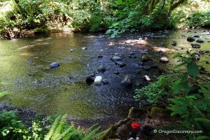
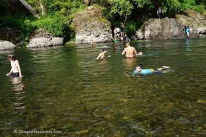
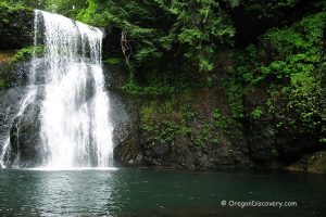
Molalla River Day-Use Site 2 is a designated recreation site along the Molalla River Recreation Corridor, located 2.5 miles south of the Glen Avon Bridge. This is a great place to cool down on a hot summer day. The scenic secluded location is accessible by a flat trail from the turnout of South Molalla Forest Road.
The large rock ledges serve as platforms for relaxing, sunbathing, and jumping into the deep clean green water. There is a shallow area downstream as well. Typically, the water is cool even at the peak of the summer heat (67°F in August).
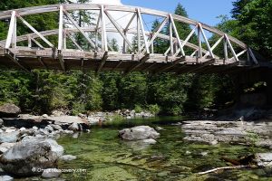
The Molalla River Trail System combines 25 miles of trails with various difficulty levels designated for mountain bikers, equestrians, and hikers.
Camping, open fires, and shooting are prohibited. Camping, picnic sites, restrooms, and drinking water are available in campgrounds and recreation areas nearby.
There is no garbage service at this site. Pack all your trash before leaving and carry it out.
No restroom at this site but there is a vault toilet 300 yards away at Ivor Davies Wayside.

Other Molalla River Recreation Corridor Sites


Molalla River Campgrounds & Lodging Nearby
Camping is not permitted at this site. However, camping, picnic facilities, restrooms, and drinking water are available at the nearby Three Bears and Cedar Grove Campgrounds.
Both campgrounds offer tent sites equipped with metal fire rings, barbecue grills, and picnic tables. Reservations can be made in advance through Recreation.gov. Alternatively, campsites are available on a first-come, first-served basis, though payment must still be processed via a mobile app. Please note that there is no cell reception in the Molalla River Recreation Area, so plan accordingly.
The campgrounds operate seasonally, from May through October.
Molalla River Day-Use Site 2 | Facts
Open: Year-round
Managed by: Bureau of Land management (BLM)
Amenities: None
Activities: Swimming, fishing, hiking
Distance from the parking: Short
Road access: Any passenger vehicle
Day-use fees: None
Elevation: 680 ft (207 m)
Molalla River Day-Use Site 2 is located:
- 10 miles southeast of Molalla
- 37 miles east of Salem
- 45 miles southeast of Portland.
Adventures Nearby


Directions to Day-Use Site 2
From I-5,
- Take exit-271 and then turn left onto OR-214 toward Woodburn
- Head 16 miles east along OR-214 then OR-211 to Mathias Road in Molalla
- Bear right onto Mathias Road and follow 0.2 miles to S Feyrer Park Road
- Turn left onto S Feyrer Park Road and continue for 1.7 miles to S Dickey Prairie Road
- Turn right onto S Dickey Prairie Road and drive 5.3 miles to Glen Avon Bridge
- Cross the bridge and bear left, continue on S Molalla Forest Road for about 3 miles to the destination on the left.