
Lower Proxy Falls combines a spectacular waterfall with ancient forest, volcanic lava, and a glacially carved landscape


Lower Proxy Falls is one of Oregon's most impressive waterfalls, hidden in the forest near McKenzie Pass.
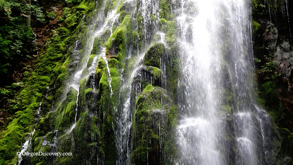
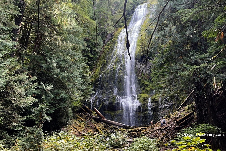
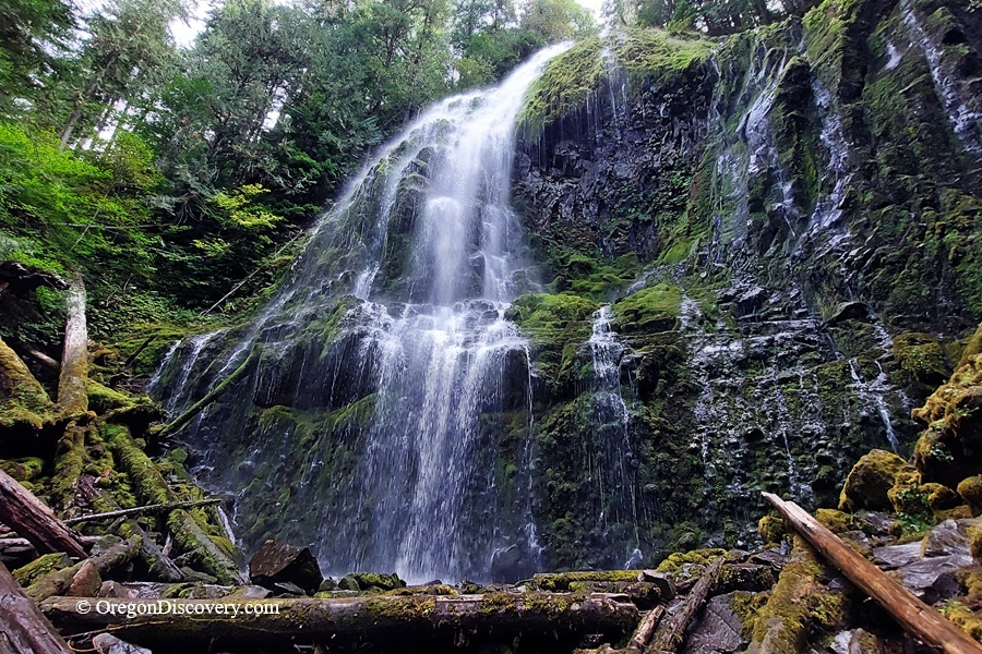
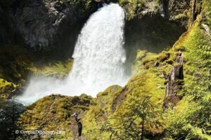
Proxy Creek plunges about 226 feet over a moss-covered basalt cliff before continuing through the rugged volcanic landscape below. The waterfall is surrounded by old-growth forest, lava flows, and cliffs.
The official name is Proxy Falls, but it is often called Lower Proxy Falls to distinguish it from nearby Upper Proxy Falls.
What makes this waterfall especially interesting is not only its height. It is located at the edge of a glacially carved hanging valley, where Proxy Creek drops from the smaller valley into the deeper valley below.
The landscape around the falls also shows the influence of ancient glaciers and much younger volcanic activity. It is a beautiful place to see how glaciers, volcanoes, and running water have shaped the Oregon Cascades.
A Waterfall Shaped by Glaciers
Proxy Falls is a good example of how glaciers can help create waterfalls.
Thousands of years ago, glaciers carved a deep valley through the Cascade landscape. The smaller valley containing Proxy Creek was left hanging above the main valley.
Today, Proxy Creek flows through this hanging valley before reaching the edge and plunging over the cliff.
The waterfall drops about 226 feet (69 meters), making it one of the highest waterfalls in Oregon.
Lower Proxy and Upper Proxy Falls
Lower Proxy Falls behaves differently from Upper Proxy Falls.
At Upper Proxy Falls, the water disappears into the volcanic rock at the base of the waterfall.
At Lower Proxy Falls, Proxy Creek continues flowing downstream after the waterfall, following the edge of the Collier Cone lava flow before reaching the Sims Butte lava flow. There, much of the creek's water sinks into the porous volcanic rock.
During periods of low runoff, much of the stream channel below Lower Proxy Falls can even become dry.
This is one of the unusual features of the Proxy Falls area: the two nearby waterfalls have different surface-water patterns even though they are surrounded by a combination of volcanic rock and glacially carved terrain.
The Collier Cone Lava Flow
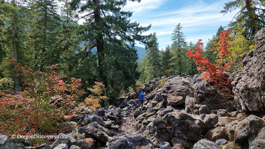
The trail to Proxy Falls crosses the Collier Cone lava flow, a relatively young volcanic feature estimated to be about 1,600 years old.
A lush forest now grows across the volcanic landscape, while rocky lava formations remain beneath the trees.
The lava is also important to the area's water system. Its permeable structure allows water to move underground in some areas rather than remain in surface streams. In the Proxy Falls area, water enters underground passages within the lava flows and can later reappear at springs.
For hikers interested in geology, the walk to Proxy Falls offers an opportunity to see how volcanic rock and water interact with the landscape.
Lower Proxy Falls Hiking
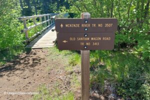
Lower Proxy Falls is reached by Proxy Falls Trail #3532, which begins at Oregon Highway 242 (McKenzie Highway).
The main loop is about 1.6 miles round trip. Short side trails lead to the viewpoints for both Lower and Upper Proxy Falls; each adds about 0.4 miles round trip. The trail passes through dense conifer forest and across rugged volcanic terrain.
Depending on which direction you take around the loop, Lower Proxy Falls can be reached after about two-thirds of a mile if you go left from the trailhead, or about one mile if you go right. The left route is shorter and generally easier, while the right route is longer and can feel more rugged.
The trail is relatively easy overall, but don't expect a completely smooth walk. Parts of the route cross uneven lava rock, and some sections can be rocky and slippery.
The viewpoint offers a beautiful vista of the falls through the forest. From there, a rougher route leads closer to the base.
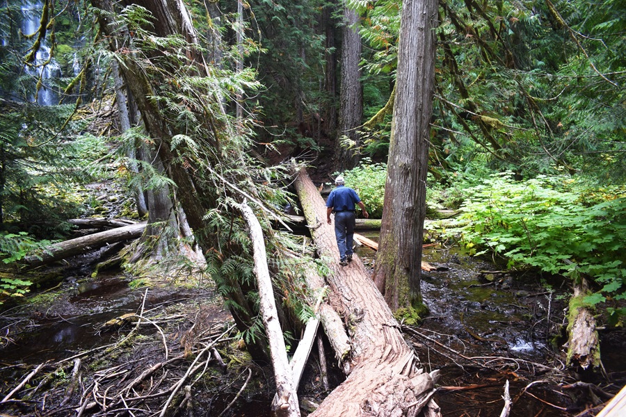
The scramble to the base is not part of the easy main trail.
The route can be steep, uneven, and slippery, especially when wet.
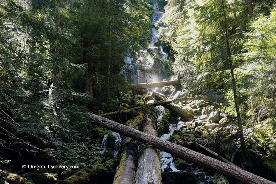
Reaching the base requires descending to the creek, which can be crossed on a large fallen log when conditions allow. The crossing can be slippery, so use extra caution and avoid crossing if conditions are unsafe.
Sturdy shoes are recommended, and hikers should use extra caution around the rocks and waterfall.
At the base, the waterfall looks much larger than it does from the main viewpoint. The roughly 225-foot drop rises above the forest floor, and spray from the falls can make the rocks very wet.
Cell service can also be limited in this area. Download your map and directions before leaving.
Proxy Falls Trail: Two Waterfalls, Lava, and Forest in Oregon
The Best Time to Visit Proxy Falls
The best time to visit is during the warmer months when Oregon Route 242 (McKenzie Highway) is open to vehicles.
🔵 McKenzie Highway 242 is closed to vehicles during the winter because of snow, making access to the Proxy Falls trailhead seasonal.
Water flow can also change throughout the year. Spring and early summer often bring stronger runoff, while the waterfall may have less water later in the season.
Always check current road conditions before driving to the trailhead.
The trailhead can be busy, especially on summer weekends, so arriving earlier in the day may make parking easier.
Lower Proxy Falls
Camping & Lodging near Proxy Falls
Alder Springs Campground is the closest camping option to the Proxy Falls trailhead, about 2 miles east along Highway 242. It has 6 tent-only sites, all first-come, first-served.
Amenities include picnic tables, fire rings, and a vault toilet, but there is no drinking water. Bring your own, plus firewood.
Prefer more comfortable options?
Clear Lake Resort is another nearby lodging option, located about 2 miles from the Proxy Falls trail area. It offers cabins and other accommodations near beautiful Clear Lake.
Belknap Hot Springs Resort is 9 miles away and offers lodge rooms plus hot mineral pools. Hike in the morning, soak in the afternoon.
Other lodging options are available in Bend or Eugene.
Lower Proxy Falls | Facts
Open: Seasonally, roughly late June through mid-November
Managed by: U.S. Forest Service, Willamette National Forest, McKenzie River Ranger District
Amenities: A vault toilet across the highway, picnic tables
Activities: Waterfall viewing, hiking, photography, snowshoeing in winter
Distance from the parking: About 1.6-2.4 miles for the full loop and side trails
Road access: Any passenger vehicle
Day-use fees: Yes, or a Northwest Forest Pass or America the Beautiful Pass
Elevation: 3,000 ft (914 m)
Proxy Falls is located:
- 48 miles east of Eugene
- 50 miles southwest of Bend
- 158 miles southeast of Portland.
Adventures Nearby


Directions to Proxy Falls Trailhead
From I-5,
- Take exit 194A in Eugene for Highway 126 East toward Springfield
- Drive east for about 60 miles to Highway 242
- Turn right onto Highway 242 (Old McKenzie Highway), near Belknap Hot Springs
- Follow Highway 242 for 9 miles to the sign for the Proxy Falls Trailhead.
- The trailhead is on the east side of the road.
Cell service can be limited in this area, so save your directions or download and offline map before you leave.