
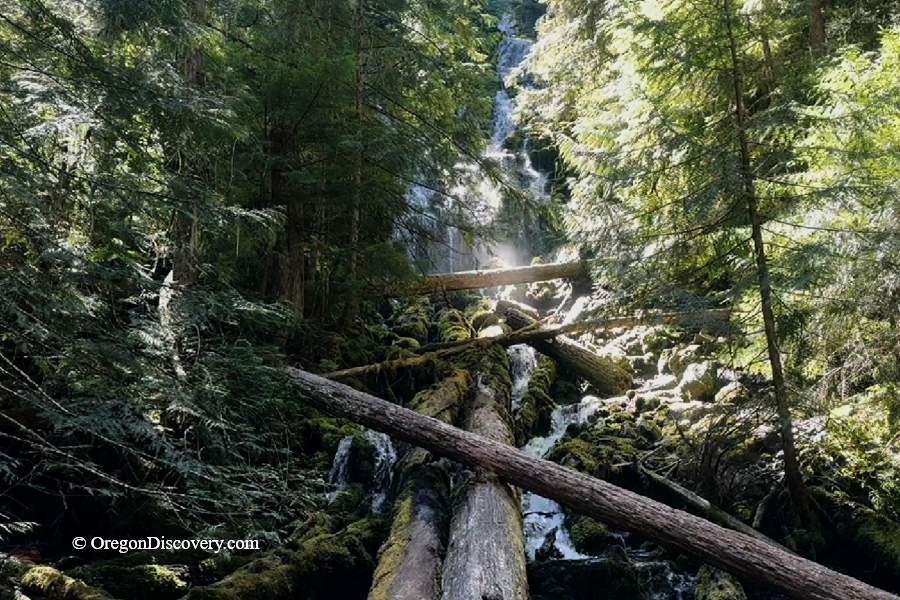
Upper Proxy Falls is a unique waterfall with water disappearing into volcanic ground


Upper Proxy Falls is one of those Oregon waterfalls that seems to defy the usual rules of flowing water.
Near McKenzie Pass, water cascades about 126 feet down the mountainside and flows into a quiet pool at its base.
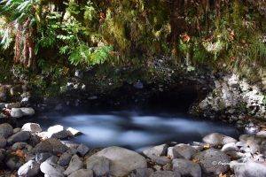
But there is no visible stream flowing away from the pool. Instead, the water seems to vanish into the porous volcanic rock and continues beneath the surface.
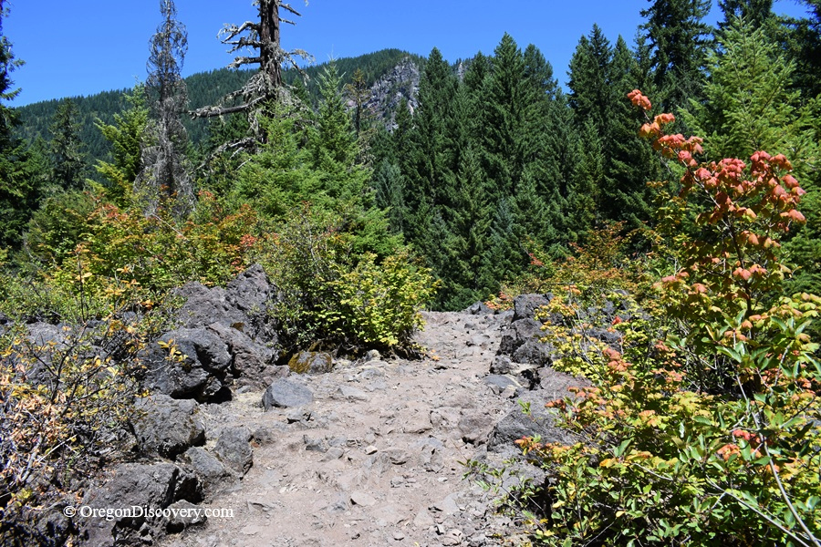
Glaciers and volcanoes shaped this landscape, and the trail crosses the approximately 1,600-year-old Collier Cone lava flow. The young lava is highly porous, allowing water to move underground and helping shape the unusual behavior of Upper Proxy Falls.
Upper Proxy Falls is a fascinating example of how Oregon's volcanic geology shapes its waterfalls.
The water's journey doesn't end there. It eventually re-emerges in springs that contribute to the larger Lost Creek drainage system, which also includes Proxy Creek and Lower Proxy Falls.
Why Does Upper Proxy Falls Disappear?
Unlike most waterfalls, the water at Upper Proxy Falls does not continue flowing across the surface after reaching the bottom. It disappears into the porous volcanic rock.
The waterfall drops onto a relatively young lava flow from Collier Cone. The lava is full of cracks, openings, and spaces that allow water to move underground. Instead of forming a visible stream, much of the water from Upper Proxy Falls sinks into the lava flow and continues through the volcanic rock.
This is one of the most unusual features of Proxy Falls. Upper Proxy Falls disappears almost as quickly as it appears.
Lower Proxy Falls is different. Its water continues downstream as Proxy Creek before much of it eventually sinks into the volcanic rock farther away.
Proxy Falls Hiking
The trailhead is accessed from McKenzie Highway (OR 242), which is seasonally closed during the winter because of snow. The road typically reopens in late spring or early summer.
Before you go, check current road conditions at TripCheck.com.
The trailhead is located on the east side of the road.
The Proxy Falls Trail is about a 1.6-mile loop. If you hike the full loop, you can see both Upper and Lower Proxy Falls.
If you want an easier and shorter hike to see just Upper Proxy Falls, take the trail on the left and return the same way. This out-and-back route is about 1.2 miles.
The trail begins fairly flat, crossing a rugged volcanic landscape. As you get closer to the waterfall, it becomes steeper and rockier. Along the way, the landscape combines volcanic lava fields with beautiful old-growth forest.
The trail on the right is more strenuous, with steeper and rockier sections, but it provides a different way to experience the volcanic landscape and forest.
Proxy Falls Trail: Two Waterfalls, Lava, and Forest in Oregon
Upper Proxy Falls
Camping & Lodging near Proxy Falls
Alder Springs Campground is the closest camping option to the Proxy Falls trailhead, about 2 miles east along Highway 242. It has 6 tent-only sites, all first-come, first-served.
Amenities include picnic tables, fire rings, and a vault toilet, but there is no drinking water. Bring your own, plus firewood. The Linton Lake Trailhead is directly across the road.
Limberlost Campground sits about a mile up Highway 242 from the Highway 126 junction, roughly 8 miles west of the Proxy Falls trailhead. It has 12 sites along Lost Creek, shaded by huge fir and cedar trees.
Some sites can be reserved through Recreation.gov.
Want more choices?
Clear Lake Resort is another nearby lodging option, located about 2 miles from the Proxy Falls trail area. It offers cabins and other accommodations near beautiful Clear Lake.
Belknap Hot Springs Resort is 9 miles away and offers lodge rooms plus hot mineral pools. Hike in the morning, soak in the afternoon.
Other lodging options are available in Bend or Eugene.
Affordable vacation rentals for short and long-term stays at Eugene
Upper Proxy Falls | Facts
Open: Seasonally, roughly late June through mid-November; Highway 242 closes for snow
Managed by: U.S. Forest Service, Willamette National Forest, McKenzie River Ranger District
Amenities: A vault toilet across the highway, and picnic tables
Activities: Waterfall viewing, hiking, photography, snowshoeing in winter
Distance from the parking: About 1.6-1.7 miles for the full loop
Road access: Any passenger vehicle
Day-use fees: Yes, or a Northwest Forest Pass or America the Beautiful Pass
Elevation: 3,200 ft (975 m)
Lower Proxy Falls is located:
- 48 miles east of Eugene
- 50 miles southwest of Bend
- 158 miles southeast of Portland.
Adventures Nearby


Directions to Proxy Falls Trailhead
From I-5,
- Take exit 194A in Eugene for Highway 126 East toward Springfield
- Drive east for about 60 miles to Highway 242
- Turn right onto Highway 242 (Old McKenzie Highway), near Belknap Hot Springs
- Follow Highway 242 for 9 miles to the sign for the Proxy Falls Trailhead.
- The trailhead is on the east side of the road.
Cell service can be limited in this area, so save your directions or download and offline map before you leave.