
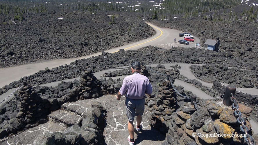
Dee Wright Observatory is a stone shelter in the heart vast lava field


The Dee Wright Observatory sits at the summit of McKenzie Pass on Oregon Highway 242, 15 miles west of Sisters, inside the Willamette National Forest. It stands at 5,187 feet, near the boundary between the Willamette and Deschutes National Forests.
What makes it special? The whole shelter is built from the black lava rock on which it stands, in the middle of a 65-square-mile expanse of lava fields.
No trees. No soil. Just miles of sharp black rock and a little stone castle in the middle of it. In 1964, NASA conducted training exercises here with astronauts preparing for lunar exploration. Standing there, you can see why NASA chose this landscape for lunar training.
Highway 242 is part of the McKenzie Pass-Santiam Pass National Scenic Byway, and the drive alone is worth the gas.
🔵 Highway 242 closes to cars every winter, usually November through late June.
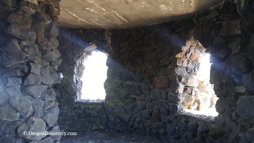
Views from the Dee Wright Observatory
Inside the shelter, stone-framed viewing openings are positioned to frame the surrounding peaks. Look through them, and the mountains appear centered like a photo.
Then climb the stairs to the roof. A bronze peak finder identifies the surrounding buttes and mountains and gives their elevations.
On a clear day, you can pick out Mount Hood, about 78 miles north, plus Mount Jefferson, Mount Washington, Black Butte, Black Crater, Belknap Crater, Little Belknap, Scott Mountain, and the Three Sisters.
Look for Collier Glacier on North Sister, one of Oregon's largest glaciers.
Interpretive panels along the walkway share stories from early travelers and explain the geology.
The observatory also sits between the Mount Washington Wilderness and Three Sisters Wilderness, putting you right next to some of Oregon's wildest country.
Because light pollution is very low up here, stargazing can be excellent.
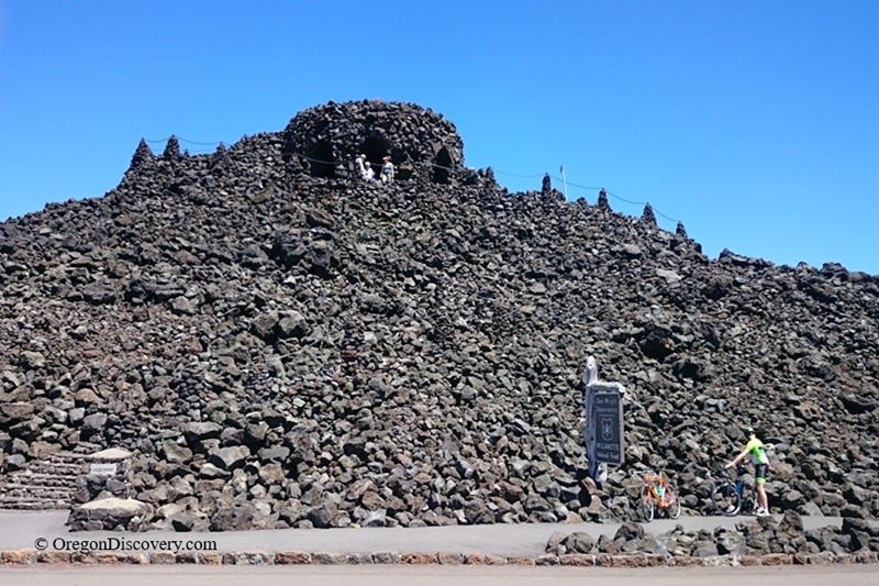
Dee Wright Observatory Geology & History
The observatory stands on a young lava flow from Yapoah Cone, one of the volcanic cones near North Sister. The rough, jagged basalt here is called A'a lava (pronounced "ah-ah"). Touch it once, and the name makes sense.
The route below you has changed a lot. It began as an Indian trail, later became a wagon road through the lava beds, and eventually developed into the highway we know today.
William N. Parke designed the observatory, and the Civilian Conservation Corps built it in 1935, during the Great Depression. Camp F-23 of Company 927 did the work out of Camp Belknap near Clear Lake.
So who was Dee Wright? He was a longtime Forest Service packer who later served as a CCC crew foreman. He died in 1934, and the observatory was named for him after his death.
The McKenzie Highway Historic District was added to the National Register of Historic Places in 2011.
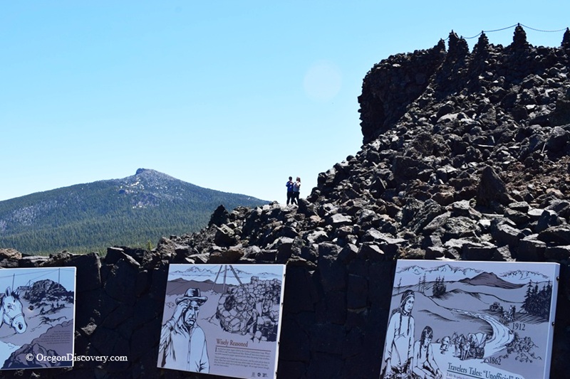
Lava River National Recreation Trail
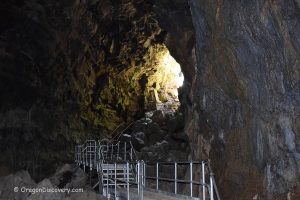
The short loop starts right at the observatory and takes about 30 minutes. You walk between walls of cooled lava while signs explain how the volcanic landscape formed.
Even in this harsh rock, you may spot small trees, lichens, and wildlife. You may also see Pacific Crest Trail hikers passing through.
A paved accessible section leads from the parking area through the lava field to the observatory's lower level. The roof is accessible only by stairs.
Grades on the Lava River Trail range from 0–8%, with some drop-offs. The trail is rated “most difficult” for wheelchair users, and the rear hiker loop is not barrier-free.
🟡 Stay on the trails. A'a lava is extremely sharp and can easily damage shoes or cause cuts. There is virtually no shade, so bring plenty of water and sunscreen.
Camping & Lodging near Dee Wright Observatory
Alder Springs Campground is one of the closest camping option to the observatory, about 8 miles west along Highway 242. It has 6 tent-only sites, all first-come, first-served.
Amenities include picnic tables, fire rings, and a vault toilet, but there is no drinking water. Bring your own, plus firewood. The Linton Lake Trailhead is directly across the road.
Limberlost Campground sits about a mile up Highway 242 from the Highway 126 junction, roughly 18 miles west of the observatory. It has 12 sites along Lost Creek, shaded by huge fir and cedar trees.
Some sites can be reserved through Recreation.gov.
On the east side, Cold Springs Campground is about 11 miles from the pass and 4 miles west of Sisters, with 23 sites and vault toilets but no drinking water.
Want more choices?
Clear Lake Resort offers rustic cabins on one of Oregon's clearest lakes, roughly 25 miles from the observatory by way of Highways 242 and 126.
Belknap Hot Springs Resort is about 20 miles west and offers lodge rooms plus hot mineral pools. Drive the pass in the morning, soak in the afternoon.
Other lodging options are available in Bend or Eugene.
Affordable vacation rentals for short and long-term stays at Eugene
Dee Wright Observatory | Facts
Open: Late June to early November (snow dependent)
Managed by: U.S. Forest Service, Willamette National Forest
Amenities: Parking, accessible restrooms, garbage service, interpretive panels
Activities: Sightseeing, hiking, photographing, stargazing, cycling
Distance from the parking: Short to the observatory; half-mile paved loop on the Lava River Trail
Road access: Any passenger vehicle. No trailers or long RVs, the switchbacks are too tight
Day-use fees: None
Elevation: 5,187 ft (1,580 m) at the observatory; McKenzie Pass summit 5,325 ft (1,623 m)
The Dee Wright Observatory is located:
- 15 miles west of Sisters
- 38 miles northwest of Bend
- 80 miles east of Eugene.
Adventures Nearby

Directions to Dee Wright Observatory
From Sisters,
- Drive west on Highway 242 for 15 miles
- Watch for the stone tower on your right
- Park in the lot at the summit.
The observatory is visible from the road, and parking sits right beside it.
Phone: (800) 832-1355